

Open in App
Get this route on your phone instantly.
Starting at the car park, head east along the single track roadway ( A896 ) for about 3 miles, then turn right onto the Coulin Lodge track.
Once past Loch Clair keep on the left as the road turns right towards Coulin Lodge. Stay left on the forest track as it turns uphill away from the Loch. Follow this track uphill above Loch Coulin, and turn right for a downhill past the houses at Torran Cuilinn and Coulin.
At Coulin turn left onto the estate track and head south to the bridge. Continue south here along the land rover track to the summit of Coulin Pass before a fast descent on a forestry road down to Achnashellach.
At bottom of the hill, turn right onto the A890 and head for Coulags, some 4 miles along the road.
At Coulags turn right onto the track leading to the cottages. It's signposted here as a Right of Way to Torridon. Just before the road climbs to the cottages, take the singletrack off to the left which takes you past the cottages and onto the rough singletrack heading into Coire Fionnaraich. It starts with a climb which can be quite tough in places, due to the rocks on the path. Make sure the tyres are well pumped up from here onwards, this is real pinch-flat territory
You can either cross the burn on the narrow bridge, or just ride through the burn like a proper MTB'er. There are a few large drainage ditches cut across the path from here to just beyond the bothy. Follow the singletrack past the bothy as it steadily climbs to Loch Coire Fionnaraich.
Once round the loch, the real tough climb begins. You won't cycle much of this, so be prepared to pick the bike up and carry it up to the juction of the paths. It's a long slog, but worth every one of the 140m or so of vertical climb ( sorry - had to put that in there ! ).
Once you get your breath back, cycling the last little bit of ascent to the top of Bealach na Lice is easy enough.
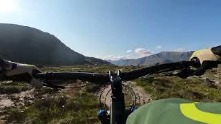
This is where your rewards begin, as a whole new view opens up before you as you start a gentle descent around Loch an Eion, where things just get better and better.
You're about 350m above sea level at this loch, and from here to Annat it's all downhill to sea level. This is one amazing bit of natural singletrack. It has a good grippy hard packed base which gives you lots of confidence. There are rocks to avoid, rocks to jump off if you want, a large bedrock section, all of it fast and all of it fun. Don't forget to stop now and then to take in the stunning views though.
Once you get down to Annat turn right and follow the road back to the starting point. Alternatively, turn left and head along the road for 200m and take the second right to the pub for a refreshment. You deserve it after all.

We hope you've been enjoying Trailforks!
Create a FREE account to view route comments and much more.
| 4 miles |

Service Road Atlas is a free to use, community-driven service for viewing and creating reports on the numerous back-country service roads around B.C. and Alberta.
Save the current map location and zoom level as your default home location whenever this page is loaded.
Save