

Open in App
Get this route on your phone instantly.
Overview
With a doubletrack climb, Tyler’s Traverse is all gain with little pain. Once you start the singletrack descent you’ll find endless berms punctuated with a few rock gardens to keep you on your toes. So much fun that when you hit the bottom you’ll wonder if you have the energy for another lap. Sure, why not?
Route Details
From the trailhead hop onto the Tyler’s Uphill Access Trail for a short quarter mile to its intersection with a forest road; head right to begin the climb. It’s a scenic route but there are several intersections so keep your wits about you. The entire doubletrack climb clocks in just less than five miles before you hit the final singletrack climb. Your overall elevation gain is only 1,500’, making the climb accessible to a range of riders.
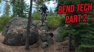
At the top the trail rolls across the top of a plateau, rewarding riders who have saved some legs for sprinting. Because rock is in short supply on Bend’s trails, Tyler’s Traverse seeks them out like a hungry Labrador searching for dropped food at a picnic. You’ll wind around to take advantage of a couple rock-overs that crest atop outcroppings, the pitch-black lava punishing poor line choices. Keep your eyes focused on the good line or, better yet, send your buddies first through the crux so they can scout it for you.
Once past the lava-rock the trail begins to pick up speed, tossing you into large berms and speeding through straightaways. The flow is on and because this is a one-way descending trail you can let go of the brakes and push it as far as the traction allows. The entire trail is seven miles long, though, so pace yourself or your legs will give out because it does feel like the berms are endless. Eventually the trail cuts back hard left and you’re almost back to the trailhead, wearing a grin so wide that even a full-face helmet can’t hide it.
Riding Season
Upper Tyler’s Traverse can be covered in snow until late spring depending on the snowpack but the snow doesn’t return in earnest until late fall. The descent can get dusty in the middle of summer so wear goggles if you’re riding with the pack.

We hope you've been enjoying Trailforks!
Create a FREE account to view all route reviews and much more.

Service Road Atlas is a free to use, community-driven service for viewing and creating reports on the numerous back-country service roads around B.C. and Alberta.
Save the current map location and zoom level as your default home location whenever this page is loaded.
Save OTTA & contributors