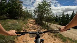
The Wallaby Loop is an officially signposted loop that gives a great introduction to riding at Djuwang Baring/Creswick Trails. The route has no challenging technical features but is fairly steep for a green difficulty trail.
The loop is fully adaptive MTB and ebike friendly.
Starting on Tourist Road, climb to the top of the gravity zone on Yam Daisy. At the top, traverse along the 2-way Guwak Trail to the intersection of Port Phillip Road and Brackenbury Road. Then, join Marsupial and complete a loop through the Wood Coupe riding zone, before connecting back to do Guwak in the other direction and finally descend on Green Apple
Trail Issues on Route
- Closed: 1 trail (newest: Jun 16, 2026)
Local Trail Association
Wombat MTB Club (woodendcycles.com.au)Stats
-
Distance5 miles
-
Altitude min1,490 ft
-
Altitude start1,490 ft
-
Altitude end1,499 ft
-
Climb632 ft
-
Descent-623 ft
-
Grade max-21.2%
-
Grade min19%
-
Distance climb2 miles
-
Distance down2 miles
-
Distance flat2,677 ft
8 Reviews & Comments
We hope you've been enjoying Trailforks!
Create a FREE account to view route comments and much more.
Trails in Route
| 4,888 ft | |||||
| 3,156 ft | |||||
| 2 miles | |||||
| 3,202 ft | |||||
| 3,071 ft |
Details
-
Riding area
-
Primary ActivityMountain Bike
-
Other Activities
- E-Bike
- Adaptive Bike
-
Difficulty ratingGreen
-
Route TypeLoop
-
eBike Allowed
-
Bike typeAM, XC, Adaptive MTB
-
DirectionOne Direction
-
Physical ratingModerate
- Unknown
- Snow Groomed
- Snow Packed
- Snow Covered
- Snow Cover Partial
- Freeze/thaw Cycle
- Icy
- Prevalent Mud
- Wet
- Variable
- Ideal
- Dry
- Very Dry
The colour categories are based on what percentage of riders are riding a trail in its intended direction.
- > 96%
- > 90%
- > 80%
- > 70%
- > 50%
- < 50%
- bi-directional trail
- no data
- < 2 days
- < 1 week
- < 2 weeks
- < 1 month
- < 6 months
- > 6 months
- Downhill Only
- Downhill Primary
- Both Directions
- Uphill Primary
- Uphill Only
- One Direction
- Description
- Photos
- Description & Photos
- Videos
- most popular
- popular
- less popular
- not popular
Service Road Atlas is a free to use, community-driven service for viewing and creating reports on the numerous back-country service roads around B.C. and Alberta.
Save the current map location and zoom level as your default home location whenever this page is loaded.
Save- Singletrack
Photos
Videos
Recent Trail Reports Along Route
- By MacroTiara
& contributors - #65205 - 123 views

