


Open in App
Get this route on your phone instantly.
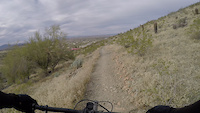
A west end loop that starts at the 19th Ave trailhead on the north side of the park.
Starts on MHT Perimeter for a climb up to some ramadas, then a short break in climbing until you hit Ranger. The sustained climb with some tech mixed in takes you up to National (keep an eye out for the righthand sharp switchback near the top, easy to ride past and end up going east on National further uphill than needed).
National starts out with some narrower exposed trail with only a few short punchy climbs before heading downhill. One notable section is extra spicy (steep, very loose, tight turns), but otherwise a pretty fast and fun descent until it levels out at the bottom. Continue back onto the MHT Perimeter trail for a rollercoaster of shorter ups and downs while traversing the mountains back to the trailhead.
Nice views the whole loop, plus minimal hikers and bikers compared to other parts of the park.

We hope you've been enjoying Trailforks!
Create a FREE account to view all route reviews and much more.
| 3,904 ft | |||||
| 1 mile | |||||
| 1 mile | |||||
| 4,619 ft | |||||
| 2 miles | |||||
| 4 miles |

Service Road Atlas is a free to use, community-driven service for viewing and creating reports on the numerous back-country service roads around B.C. and Alberta.
Save the current map location and zoom level as your default home location whenever this page is loaded.
Save