
6.5 miles
Distance
1,373 ft
Climb
-1,371 ft
Descent
1 mile
High Point
1 ft
Altitude change
5,658 ft
Altitude min
5,658 ft
Altitude start
5,659 ft
Altitude end
-44%
Grade max
52.2%
Grade min
3 miles
Distance climb
3 miles
Distance down
755 ft
Distance flat

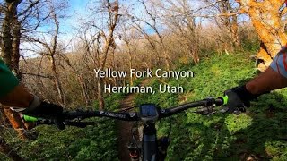
great raw singletrack in yellow fork canyon in herriman

Detailed Description
yellow fork loop is a 6 mile popular intermediate route located near Herriman Utah. This mountain bike only route. This route includes 17 trails. This route climbs 1,373 ft with a max elevation of 7,006 ft then descends -1,371 ft.
Tags
Canyon

Trail Issues on Route

  • Significant Issue / Amber: 2 trails (newest: Mar 27, 2026)
  • Minor Issue / Yellow: 5 trails (newest: Nov 8, 2026)

Local Trail Association

Herriman Hills Trails Alliance (herrimanhills.org)
Please consider joining or donating to the local riding association to support trail development & maintenance.
Donate to earn trail karma!

Stats

  • Distance
    6 miles
  • Avg time
    1 hr 10 min
  • Altitude change
    1 ft
  • Altitude min
    5,658 ft
  • Altitude start
    5,658 ft
  • Altitude end
    5,659 ft
  • Climb
    1,373 ft
  • Descent
    -1,371 ft
  • Grade max
    -44%
  • Grade min
    52.2%
  • Distance climb
    3 miles
  • Distance down
    3 miles
  • Distance flat
    755 ft

33 Reviews & Comments


We hope you've been enjoying Trailforks!

Create a FREE account to view all route reviews and much more.

Details

  • Riding area
  • Primary Activity
    Mountain Bike
  • Difficulty rating
    Blue
  • Activity Logs
    58
Avg: 3.75 (4 votes)
close
Trail transparency
  • Singletrack
  • Unpaved
Yellow Fork Canyon | Herriman, Utah
mtb
Yellow Fork Canyon | Herriman, Utah
9:10 | 1343 | comments: 0 | favs:
Jun 11, 2020
Yellow Fork Canyon | Herriman, Utah
mtb
Yellow Fork Canyon | Herriman, Utah
9:10 | 545 | comments: 0 | favs:
Jun 11, 2020

Recent Trail Reports Along Route

statustraildateconditiondescription
Yellow Fork
Nov 8, 2026 @ 12:01pm (America/Boise)
Nov 8, 2026
While the leaves on the ground help, the trail is too much in the shade and it is wet and slippery though fairly firm. It's not worth how much mud you will pick up on your tires and fling onto your bike. Best to avoid, probably for the season unless we get a long dry and mild streak.
Yellow Fork
Oct 25, 2026 @ 3:59pm (America/Denver)
Oct 25, 2026
Dry to damp with heavy muddy areas in low spots. Easy to ride or walk around these areas though.
Yellow Fork (Lower)
Aug 5, 2026 @ 1:48pm (America/Denver)
Aug 5, 2026
They have recently closed the parallel trail, Yellow Fork, diverting all traffic to Dan's Hill. They have widened Dan's a bit, but with all the traffic, it is chiefly moon dust.
Dans Hill (Upper)
Aug 5, 2026 @ 1:48pm (America/Denver)
Aug 5, 2026
They have recently closed the parallel trail, Yellow Fork, diverting all traffic to Dan's Hill. They have widened Dan's a bit, but with all the traffic, it is chiefly moon dust.
Dans Hill
Aug 5, 2026 @ 1:48pm (America/Denver)
Aug 5, 2026
They have recently closed the parallel trail, Yellow Fork, diverting all traffic to Dan's Hill. They have widened Dan's a bit, but with all the traffic, it is chiefly moon dust.
more reports »
  • By Work2Ride & contributors
  • #4418 - 3,293 views

Hit the Trail

Open in App

Get this route on your phone instantly.

Download Route

Save to wishlist, Garmin & download.