
Norsk (English below):
Hallingdals sørligste pumptrack finner du midt i Flå sentrum – en stor og variert bane på hele 900 m². Her kan du kombinere en stor ytre runde med kreative linjer på indre seksjon, perfekt for å øve på basisferdigheter og leken sykling for både barn, ungdom og voksne.
Pumptracken kompletterer Hallingdal som region med en av Norges høyeste tettheter av pumptracks. I Flå er det også kort vei til mat, butikker og annen service – perfekt for en aktiv stopp på reisen gjennom dalen.
Adkomst:
Pumptracken ligger sentralt i Flå sentrum, med enkel tilgang fra Rv7 og god parkering i nærheten.
English:
The pumptrack in Flå town center covers 900 m² with a large outer loop and several creative inner lines. A great spot for riders of all ages to develop core biking skills and have fun.
This pumptrack adds to Hallingdal’s impressive collection, giving the region one of the highest pumptrack densities in Norway. In Flå, it’s easy to combine a ride with a snack or a stop at local shops and cafés.
Access:
Centrally located in Flå, just off the Rv7 highway, with parking and amenities nearby.
Hallingdals sørligste pumptrack finner du midt i Flå sentrum – en stor og variert bane på hele 900 m². Her kan du kombinere en stor ytre runde med kreative linjer på indre seksjon, perfekt for å øve på basisferdigheter og leken sykling for både barn, ungdom og voksne.
Pumptracken kompletterer Hallingdal som region med en av Norges høyeste tettheter av pumptracks. I Flå er det også kort vei til mat, butikker og annen service – perfekt for en aktiv stopp på reisen gjennom dalen.
Adkomst:
Pumptracken ligger sentralt i Flå sentrum, med enkel tilgang fra Rv7 og god parkering i nærheten.
English:
The pumptrack in Flå town center covers 900 m² with a large outer loop and several creative inner lines. A great spot for riders of all ages to develop core biking skills and have fun.
This pumptrack adds to Hallingdal’s impressive collection, giving the region one of the highest pumptrack densities in Norway. In Flå, it’s easy to combine a ride with a snack or a stop at local shops and cafés.
Access:
Centrally located in Flå, just off the Rv7 highway, with parking and amenities nearby.
Skillpark Features

Reports
no reports have been added for Flå Pump Track yet, add a report.
Reports are used to indicate current condition and inform builders and other users about any issues.
Reports are used to indicate current condition and inform builders and other users about any issues.
close
3D
Trail Conditions
- Unknown
- Snow Groomed
- Snow Packed
- Snow Covered
- Snow Cover Partial
- Freeze/thaw Cycle
- Icy
- Prevalent Mud
- Wet
- Variable
- Ideal
- Dry
- Very Dry
Trail Flow (Ridden Direction)
Trailforks scans users activity logs to determine the most popular direction each trail is ridden. A good flowing trail network will have most trails flowing in a single direction according to their intension.
The colour categories are based on what percentage of users are riding a trail in its intended direction.
The colour categories are based on what percentage of users are riding a trail in its intended direction.
- > 96%
- > 90%
- > 80%
- > 70%
- > 50%
- < 50%
- bi-directional trail
- no data
Trail Last Used
Trailforks scans activity logs to determine the last time a trail was ridden.
- < 2 days
- < 1 week
- < 2 weeks
- < 1 month
- < 6 months
- > 6 months
Trail Ridden Direction
The intended direction a trail should be ridden.
- Downhill Only
- Downhill Primary
- Both Directions
- Uphill Primary
- Uphill Only
- One Direction
Contribute Details
Colors indicate trail is missing specified detail.
- Description
- Photos
- Description & Photos
- Videos
Trail Popularity ?
Trailforks scans activity logs to determine which trails are ridden the most in the last 9 months.
Trails are compared with nearby trails in the same city region with a possible 25 colour shades.
Think of this as a heatmap, more activities = more kinetic energy = warmer colors.
- most popular
- popular
- less popular
- not popular
ATV/ORV/OHV Filter
Max Vehicle Width
inches
US Cell Coverage
Legend

Radar Time
Activity Recordings
Trailforks uses anonymized public activity data.
?
Activity Recordings
Trailforks uses anonymized public activity data.
?
Winter Trails
Warning
A routing network for winter maps does not exist. Selecting trails using the winter trails layer has been disabled.
Missing Trails
Most Popular
Least Popular
Trails are colored based on popularity. The more popular a trail is, the more red. Less popular trails trend towards green.
Jump Magnitude Heatmap
Heatmap of where users jump on trails. Zoom in to see individual jumps, click circles to view jump details.
BC Backroad Status
![map legend]()
Service Road Atlas is a free to use, community-driven service for viewing and creating reports on the numerous back-country service roads around B.C. and Alberta.

Slope Aspect
Direction the slope faces
Trails Deemphasized
Trails are shown in grey.
Only show trails with no bike usage.
Suggested Layers
Based on selected activity type
Save the current map location and zoom level as your default home location whenever this page is loaded.
Save- Norway
- Google map
Photos
Videos
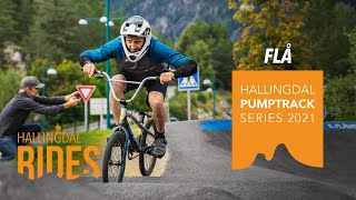
Hallingdal Pumptrack Series 2021 - Flå
0:00 | 261 | comments: 0 | favs:
May 16, 2025
- By larsstorheim
 H Rides & contributors
- #9589 - 401 views
