more stats
4,148 ft
Distance
141 ft
Climb
-109 ft
Descent
00:03:43
Avg time
32 ft
Altitude change
1,846 ft
Altitude min
1,963 ft
Altitude max
1,931 ft
Altitude start
1,963 ft
Altitude end
0.774%
Grade
-18.108%
Grade max
18.286%
Grade min
2,172 ft
Distance climb
1,569 ft
Distance down
371 ft
Distance flat
00:03:43
Avg time

18 Details

  • Activities
    • Mountain Bike
    • Adaptive Bike
    • Winter Fat Bike
  • Riding Area
    The Summit Bechtel Reserve
    Glen Jean, West Virginia
  • Difficulty Rating
  • Local Popularity
    85 in Mountain Biking
  • Global Ranking
    #167847 in Mountain Biking
  • Trail Type
    Machine Groomed
  • Bike Type
    AM, XC, Fat, Adaptive MTB
  • Direction
    One Direction
    Popular Direction Shown
  • Climb Difficulty
    Green
  • Physical Rating
    Easy
  • Dogs Allowed
    Yes
  • Year Opened
    2013
  • Land Owner

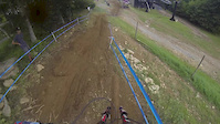
Quick easy connector trail

Access Info

At the moment The Summit is only open to special programs, events and the New River Bicycle Union. See http://www.summitbsa.org/ for more information on Scouting and Youth programs. See http://www.newriverbicycleunion.org for more info on the NRBU club access.

Bike Park

Traditionally Indigenous Territory

Recent Activity on Trail

Past Week
  • 0 rides
  •  
6 Months
  • 0 rides
  •  
All
  • 4 rides
  • Last: Jun 1, 2026
c1c2c3c4
January
February
March
April
May
June
July
August
September
October
November
December
update trails status or condition

18 Trail Reports

statusdatedescription
Mar 24, 2026 @ 5:20pm (America/New_York)
Mar 24, 2026
Apr 25, 2018 @ 12:00pm
Apr 25, 2018
reporter Creek running across trail, coming down from the road. Looks like the drain needs to be moved 30 feet up the trail and lots of machine work.
Apr 25, 2018 @ 11:54am
Apr 25, 2018
reporter Thick with grass and some standing water. Could use a bobcat to make trail much more clear for a 50 to 70 foot section.
Apr 25, 2018 @ 11:51am
Apr 25, 2018
reporter Tree down across the switchback, needs a chainsaw.
Apr 25, 2018 @ 11:41am
Apr 25, 2018
reporter Creek Crossing Trail, will need machine to put in drainage and cover.
more »
Status:
on Mar 24, 2026
Ideal
Avg: 3.86 (2 votes)
Your vote: 0

view (33)
close
3D
Trail Conditions
  • Unknown
  • Snow Groomed
  • Snow Packed
  • Snow Covered
  • Snow Cover Partial
  • Freeze/thaw Cycle
  • Icy
  • Prevalent Mud
  • Wet
  • Variable
  • Ideal
  • Dry
  • Very Dry
Trail Flow (Ridden Direction)
Trailforks scans users ridelogs to determine the most popular direction each trail is ridden. A good flowing trail network will have most trails flowing in a single direction according to their intension.
The colour categories are based on what percentage of riders are riding a trail in its intended direction.
  • > 96%
  • > 90%
  • > 80%
  • > 70%
  • > 50%
  • < 50%
  • bi-directional trail
  • no data
Trail Last Ridden
Trailforks scans ridelogs to determine the last time a trail was ridden.
  • < 2 days
  • < 1 week
  • < 2 weeks
  • < 1 month
  • < 6 months
  • > 6 months
Trail Ridden Direction
The intended direction a trail should be ridden.
  • Downhill Only
  • Downhill Primary
  • Both Directions
  • Uphill Primary
  • Uphill Only
  • One Direction
Contribute Details
Colors indicate trail is missing specified detail.
  • Description
  • Photos
  • Description & Photos
  • Videos
Trail Popularity ?
Trailforks scans ridelogs to determine which trails are ridden the most in the last 9 months. Trails are compared with nearby trails in the same city region with a possible 25 colour shades. Think of this as a heatmap, more rides = more kinetic energy = warmer colors.
  • most popular
  • popular
  • less popular
  • not popular
ATV/ORV/OHV Filter
Max Vehicle Width
inches
US Cell Coverage
Legend
cell carrier legend

Radar Time
Activity Recordings
Trailforks uses anonymized public activity data. ?
Activity Recordings
Trailforks uses anonymized public activity data. ?
Personal Heatmap
Activity Types
all / none
Options
2
Date range month
Winter Trails
Warning A routing network for winter maps does not exist. Selecting trails using the winter trails layer has been disabled.
Missing Trails
Most Popular
Least Popular
Trails are colored based on popularity. The more popular a trail is, the more red. Less popular trails trend towards green.
Jump Magnitude Heatmap
Heatmap of where riders jump on trails. Zoom in to see individual jumps, click circles to view jump details.
BC Backroad Status

Service Road Atlas is a free to use, community-driven service for viewing and creating reports on the numerous back-country service roads around B.C. and Alberta.

map legend
Slope Aspect
Direction the slope faces
Flat N NE E SE S SW W NW
Trails Deemphasized
Trails are shown in grey.
disable
Only show trails with no bike usage.
Enable
Suggested Layers
Based on selected activity type

    Save the current map location and zoom level as your default home location whenever this page is loaded.

    Save
        Directions to 18 trailhead (37.906450, -81.122250)

        Photos

        13 more »
        39 |
        Apr 27, 2018 @ 5:13am
        Apr 27, 2018
        40 |
        Apr 27, 2018 @ 5:13am
        Apr 27, 2018
        40 |
        Apr 27, 2018 @ 3:43am
        Apr 27, 2018
        58 |
        Apr 25, 2018 @ 11:52am
        Apr 25, 2018

        Videos

        2 more »
        Beech Mountain Pro GRT #5
        3:47 | 1056 | Jul 21, 2014 , Glen Jean
        2011 GES Race #1 Snowshoe, WV 1st
        7:06 | 350 | Jun 9, 2011 , Glen Jean

        Routes with this trail

        11 miles 1,426 ft 30 Loop
        For the expert rider, try this exhilarating loop with 2 big climbs, a not so bad climb and 3 rowdy...

        Reviews / Comments

        No reviews yet, be the first to write a review or ask a question.
        Use trail reports to comment on trail conditions.


        We hope you've been enjoying Trailforks!

        Create a FREE account to view trail comments and much more.

        • By plwaidnerTF Pro SBR Staff & contributors
        • #53775 - 1,617 views

        Frequently Asked Questions About 18

        Where is 18 located?
        18 is located in The Summit Bechtel Reserve, Glen Jean, West Virginia, United States. It is part of the The Summit Bechtel Reserve trail network. The trailhead is located at coordinates 37.90645, -81.12225.
        How hard is 18?
        18 is rated as Green difficulty. The physical rating is Easy. The average grade is 0.774%. The climb difficulty is rated Green.
        What is the elevation gain for 18?
        18 has 141 ft of elevation gain. The trail has 109 ft of elevation descent. The elevation ranges from 1,846 ft to 1,963 ft.
        Is 18 a point to point trail?
        Yes, 18 is a point to point trail. The direction is One Direction. The trail type is machine groomed.

        Hit the Trail

        Open in App

        Get this trail on your phone instantly.
        open trail in app

        Download Trail

        Save to wishlist, Garmin & download.
        save the trail

        Find Related Routes

        Find routes and users activities that include this trail.
        find routes for this trail

        You must enter a description before submitting.