1.7 miles
Distance
2 ft
Climb
-1,270 ft
Descent
00:43:25
Avg time
98 Details
-
Activities
- Mountain Bike
- E-Bike
-
Riding AreaIron Mountain
Merritt, British Columbia -
Difficulty Rating
-
Trail TypeSingletrack
-
Bike TypeDH
-
DirectionDownhill OnlyPopular direction shown
-
Dogs AllowedYes
-
eBike Allowed
-
Global Ranking#41788 in Mountain Biking
-
Local Popularity50 in Mountain Biking [+]
- 5 in E-Biking
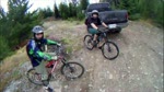
A great example of an old school DH trail.
Starts out technical then fast and flowy into Berms trail and then finishes up with Godey creek.
Includes some fairly committing steep rock sections at the top.
Access Info
Recommended as a shuttle only. From the old visitors center parking lot drive south on the Coquihalla to Comstock road, turn off onto Iron Mountain road and drive to the top (radio tower)
Local Trail Association
-
Please consider joining or donating to the local trail association to supportdonate to earn trail karma!
trail development & maintenance.
Traditionally Indigenous Territory
More Stats for 98 mountain bike trail trail
-
Altitude change-1,268 ft
-
Altitude min4,282 ft
-
Altitude max5,553 ft
-
Altitude start5,550 ft
-
Altitude end4,281 ft
-
Grade-13.8%
-
Grade max-62.8%
-
Grade min3.3%
-
Distance climb276 ft
-
Distance down2 miles
-
Distance flat243 ft
-
Avg time00:43:25
-
Avg reverse time01:17:25
- view trail stats
close
3D
Trail Conditions
- Unknown
- Snow Groomed
- Snow Packed
- Snow Covered
- Snow Cover Inadequate
- Freeze/thaw Cycle
- Icy
- Prevalent Mud
- Wet
- Variable
- Ideal
- Dry
- Very Dry
Trail Flow (Ridden Direction)
Trailforks scans users ridelogs to determine the most popular direction each trail is ridden. A good flowing trail network will have most trails flowing in a single direction according to their intension.
The colour categories are based on what percentage of riders are riding a trail in its intended direction.
- > 96%
- > 90%
- > 80%
- > 70%
- > 50%
- < 50%
- bi-directional trail
- no data
Trail Last Ridden
Trailforks scans ridelogs to determine the last time a trail was ridden.
- < 2 days
- < 1 week
- < 2 weeks
- < 1 month
- < 6 months
- > 6 months
Trail Ridden Direction
The intended direction a trail should be ridden.
- Downhill Only
- Downhill Primary
- Both Directions
- Uphill Primary
- Uphill Only
- One Direction
Contribute Details
Colors indicate trail is missing specified detail.
- Description
- Photos
- Description & Photos
- Videos
Trail Popularity ?
Trailforks scans ridelogs to determine which trails are ridden the most in the last 9 months.
Trails are compared with nearby trails in the same city region with a possible 25 colour shades.
Think of this as a heatmap, more rides = more kinetic energy = warmer colors.
- most popular
- popular
- less popular
- not popular
ATV/ORV/OHV Filter
Max Vehicle Width
inches
Radar Time
x
Activity Recordings
Trailforks users anonymized public ridelogs from the past 6 months.
- mountain biking recent
- mountain biking (>6 month)
- hiking (1 year)
- moto (1 year)
Activity Recordings
Trailforks users anonymized public skilogs from the past 12 months.
- Downhill Ski
- Backcountry Ski
- Nordic Ski
- Snowmobile
Jump Magnitude Heatmap
Heatmap of where riders jump on trails. Zoom in to see individual jumps, click circles to view jump details.
Trails Deemphasized
Trails are shown in grey.
Only show trails with NO bikes.
Save the current map location and zoom level as your default home location whenever this page is loaded.
Save
Directions to 98 trailhead
(50.047560, -120.758050)
update trails status or condition
98 Trail Reports
view all reports »
Recent Ridelog Activity on Trail
Past Week
- 0 rides
6 Months
- 2 rides
- 8 miles avg distance
All
- 80 rides
- Last: Oct 8, 2022
Photos
more »
Trail Products
5 Reviews & Comments
-
+ 0
Elmeffe
(Sep 16, 2022 at 16:55)

Section below access 2 is overgrown and really hard to follow. If coming up fox farm, save yourself the trouble and just start at berms
[Reply]
Twowheelsforever
(Jun 12, 2022 at 8:34)

There’s still fun portions of trail but flow was blown with 10-12 trees down. No down trees on blind corners or affecting steeps except the biggest rock line which is covered in deadfall
[Reply]
Nearby Trails
- Treats 807 ft
- Upper Revival 860 ft
- Access03 1,398 ft
- Hornet 2,001 ft
- Chrispy's 2,103 ft
- embed 98 trail on your website
- By canadaka
Trailforks & contributors
- #1846 - 3,049 views
- subscribe
- login to download gpx or kml files.