more stats
4,931 ft
Distance
-454 ft
Descent
00:07:13
Avg time
-454 ft
Altitude change
5,613 ft
Altitude min
6,067 ft
Altitude max
6,067 ft
Altitude start
5,614 ft
Altitude end
-9.2%
Grade
-27.8%
Grade max
-1%
Grade min
4,803 ft
Distance down
125 ft
Distance flat
00:07:13
Avg time

Antelope Details

  • Activities
    • Mountain Bike
    • Hike
    • Trail Running
  • Riding Area
    Hall Ranch
    Lyons, Colorado
  • Difficulty Rating
  • Voted Difficulty
    Blue (1 vote)
  • Local Popularity
    95 in Mountain Biking [+]
    • 75 in Trail Running
    • 50 in Hiking
  • Global Ranking
    #56561 in Mountain Biking [+]
    • #122973 in Trail Running
    • #148675 in Hiking
  • State Ranking
    #944 in Mountain Biking · Colorado [+]
    • #3,519 in Trail Running
    • #4,500 in Hiking
  • Trail Type
    Singletrack
  • Direction
    Both Directions
  • Climb Difficulty
    Green
  • Physical Rating
    Moderate
  • Trail Visibility
    Always easy to follow
  • eBike Allowed
  • Land Owner

Antelope is a fun trail both climbing and descending. This trail is mostly used as an alternative to climbing or descending the very technical Lower Bitterbrush trail and can be used to access the upper parts of Hall ranch. Expect fun twisty singletrack, tacky red dirt, and a few small, technical rock features. Watch your speed on the descent as most of the corners are blind and this is a multi-directional trail

Disclaimer

The trailhead on Apple Valley road is very small - expect to park elsewhere if riding on Weekends. Lyons has ample parking and the ride from Lyons to the Trailhead is a nice warmup.

Tags
Tight and twisty
Local Trail Association

Recent Activity on Trail

Past Week
  • 19 rides
  • 10 miles average
6 Months
  • 351 rides
  • 12 miles avg distance
All
  • 1,839 rides
  • Last: Oct 2, 2026
c1c2c3c4
January
February
March
April
May
June
July
August
September
October
November
December
update trails status or condition

Antelope Trail Reports

statusdatedescription
Jul 11, 2026 @ 10:48am (America/Denver)
Jul 11, 2026
Jun 10, 2026 @ 6:03pm (America/Denver)
Jun 10, 2026
May 22, 2026 @ 5:12pm (America/Denver)
May 22, 2026
Trail is open. Please update conditions if you ride
May 19, 2026 @ 1:25pm (America/Denver)
May 19, 2026
Trails closed for muddy conditions. Status will be update when trail reopens.
May 9, 2026 @ 11:21am (America/Denver)
May 9, 2026
Trail is open. Please update conditions if you ride
more »
Status:
on Jul 11, 2026
Dry
Avg: 3.8 (19 votes)
Your vote: 0

view (13,020)
close
      Directions to antelope trailhead (40.220270, -105.305600)

      Photos

      14 more »
      mtb
      145 |
      Jul 11, 2021 @ 10:26am
      Jul 11, 2021
      mtb
      195 |
      Feb 4, 2021 @ 4:25pm
      Feb 4, 2021
      mtb
      489 |
      Nov 29, 2018 @ 5:43pm
      Nov 29, 2018
      mtb
      213 |
      Jun 29, 2018 @ 7:28pm
      Jun 29, 2018

      Videos

      4 more »
      youtuber CO MTB | West Magnolia | Rocks and Roots Descent
      mtb
      5:13 | 760 | May 28, 2018 , Lyons
      youtuber Not a review of the 2018 Transition Scout
      mtb
      7:05 | 694 | Jun 4, 2018 , Lyons
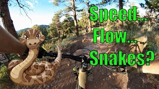
      Hall Ranch MTB: Speed, Flow, Fun, and... SNAKES?
      mtb
      22:20 | 485 | Aug 8, 2022 , Lyons
      Antelope - Hall Ranch - Lyons - Colorado -...
      mtb
      0:01 | 383 | Sep 27, 2021 , Lyons

      Routes with this trail

      ★ 4.0 • 9 miles • 1,547 ft • 8 •
      Flow line at Hall Ranch. Lots of fun to be had by all!
      ★ 4.4 • 7 miles • 1,191 ft • 5 • Out & Back •
      This is an great alternative if you're not up to the black diamond Lower Bitterbrush challenge. It's...
      ★ 3.8 • 12 miles • 1,670 ft • 5 • Loop •
      By far the best way to ride Hall Ranch. This ride is best started by parking in the town of Lyons either...
      3.8 ★★★★★
      19 Ratings
      5 ★ 16%
      4 ★ 53%
      3 ★ 26%
      2 ★
      1 ★ 5%

      3 Reviews & Comments

      BearsMTB
      Tight turns with extended rock gardens make this a tricky climb and descent. Be prepared to stop; some of the turns are blind. This section has a unique feel to it that's much techier than the rest of the trail system. Check out my youtube video on the trail if you want to see video of the trail! https://youtu.be/aVmrf4V97oc
      markymarkindenver
      Lots of traffic during peak hours both up and down - keep your speed in check on the downhill as a good bit of it is blind.

      We hope you've been enjoying Trailforks!

      Create a FREE account to view all trail reviews and much more.

      • By toddTF Pro Trailforks & contributors
      • #13698 - 7,184 views

      Frequently Asked Questions

      ▼ Where is Antelope located?
      Antelope is located in Hall Ranch, Lyons, Colorado, United States. It is part of the Hall Ranch trail network. The trailhead is located at coordinates 40.22027, -105.3056.
      ▼ How hard is Antelope?
      Antelope is rated as Blue difficulty. The physical rating is Moderate. The average grade is 9.2%. The climb difficulty is rated Green.
      ▼ What is the elevation gain for Antelope?
      The trail has 454 ft of elevation descent. The elevation ranges from 5,613 ft to 6,067 ft.
      ▼ Is Antelope a point to point trail?
      Antelope is not a point to point trail. The direction is Both Directions. The trail type is singletrack.
      ▼ How long is Antelope?
      Antelope is 4,931 ft long. The trail type is singletrack.
      ▼ Are dogs allowed on Antelope?
      There is no information about dogs being allowed on Antelope. Check with local trail managers or the trail page for the latest access rules.
      ▼ How do I access Antelope? Where is the closest parking trailhead?
      The closest parking and trailhead locations to Antelope are: View all parking locations in the area.
      ▼ How long does it take to ride Antelope?
      Based on recorded activities, it takes an average of 7 minutes to ride Antelope. The trail is 4,931 ft long. Actual times will vary based on fitness level, conditions, and pace. View recent activity logs for more details.
      ▼ How busy is Antelope?
      Antelope is a very popular trail. There have been 12,693 recorded activities on this trail. The trail has received 13,014 check-ins. View recent activity on this trail.

      Hit the Trail

      Open in App

      Get this trail on your phone instantly.

      open trail in app

      Download Trail

      Save to wishlist, Garmin & download.
      save the trail

      Find Related Routes

      Find routes and users activities that include this trail.
      find routes for this trail

      You must enter a description before submitting.