more stats
2.2 miles
Distance
323 ft
Climb
-327 ft
Descent
00:21:36
Avg time
-4 ft
Altitude change
6,403 ft
Altitude min
6,696 ft
Altitude max
6,406 ft
Altitude start
6,404 ft
Altitude end
-0%
Grade
-23.3%
Grade max
21.7%
Grade min
1 mile
Distance climb
1 mile
Distance down
138 ft
Distance flat
00:21:36
Avg time

Nelson Loop Details

  • Activities
    • Mountain Bike
    • Hike
    • Trail Running
  • Riding Area
    Hall Ranch
    Lyons, Colorado
  • Difficulty Rating
  • Voted Difficulty
    Blue (1 vote)
  • Local Popularity
    100 in Mountain Biking [+]
    • 55 in Trail Running
    • 100 in Hiking
  • Global Ranking
    #12488 in Mountain Biking [+]
    • #99230 in Trail Running
    • #2183 in Hiking
  • Trail Type
    Singletrack
  • Bike Type
    AM, XC, Fat
  • Direction
    Both Directions
    Popular Direction Shown
  • Climb Difficulty
    Blue
  • Physical Rating
    Moderate
  • Family Friendly
    Yes
  • eBike Allowed
  • Land Owner
    Boulder County Parks & Open Space

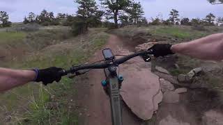
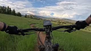
Nelson loop is when the fun descending of Hall Ranch begins Climb all the way up to Nelson loop and prepare for a fast descent the entire way down! This trail is a bi-directional loop but is best when ridden in a clockwise direction. If it has rained or snowed recently this trail tends to get closed easily due to mud.

Access Info

Starting Monday, April 14, 2025 Nelson (clockwise for half a mile) will be closed for bridge maintenance. The project is expected to be completed in three weeks.

Trail Supporters
Local Trail Association
Traditionally Indigenous Territory

Recent Activity on Trail

Past Week
  • 13 rides
  • 13 miles average
6 Months
  • 286 rides
  • 13 miles avg distance
All
  • 1,667 rides
  • Last: Jun 23, 2026
c1c2c3c4
January
February
March
April
May
June
July
August
September
October
November
December
update trails status or condition

Nelson Loop Trail Reports

statusdatedescription
Jun 10, 2026 @ 6:03pm (America/Denver)
Jun 10, 2026
May 22, 2026 @ 5:12pm (America/Denver)
May 22, 2026
Trail is open. Please update conditions if you ride
May 19, 2026 @ 1:25pm (America/Denver)
May 19, 2026
Trails closed for muddy conditions. Status will be update when trail reopens.
May 9, 2026 @ 5:01pm (America/Denver)
May 9, 2026
Trail is open. Please update conditions if you ride
May 5, 2026 @ 11:31am (America/Denver)
May 5, 2026
Closed for muddy conditions. Status will be updated when trail reopens
more »
Status:
on Jun 10, 2026
Dry
Avg: 4.46 (23 votes)
Your vote: 0

view (18,533)
close
3D
Trail Conditions
  • Unknown
  • Snow Groomed
  • Snow Packed
  • Snow Covered
  • Snow Cover Partial
  • Freeze/thaw Cycle
  • Icy
  • Prevalent Mud
  • Wet
  • Variable
  • Ideal
  • Dry
  • Very Dry
Trail Flow (Ridden Direction)
Trailforks scans users ridelogs to determine the most popular direction each trail is ridden. A good flowing trail network will have most trails flowing in a single direction according to their intension.
The colour categories are based on what percentage of riders are riding a trail in its intended direction.
  • > 96%
  • > 90%
  • > 80%
  • > 70%
  • > 50%
  • < 50%
  • bi-directional trail
  • no data
Trail Last Ridden
Trailforks scans ridelogs to determine the last time a trail was ridden.
  • < 2 days
  • < 1 week
  • < 2 weeks
  • < 1 month
  • < 6 months
  • > 6 months
Trail Ridden Direction
The intended direction a trail should be ridden.
  • Downhill Only
  • Downhill Primary
  • Both Directions
  • Uphill Primary
  • Uphill Only
  • One Direction
Contribute Details
Colors indicate trail is missing specified detail.
  • Description
  • Photos
  • Description & Photos
  • Videos
Trail Popularity ?
Trailforks scans ridelogs to determine which trails are ridden the most in the last 9 months. Trails are compared with nearby trails in the same city region with a possible 25 colour shades. Think of this as a heatmap, more rides = more kinetic energy = warmer colors.
  • most popular
  • popular
  • less popular
  • not popular
ATV/ORV/OHV Filter
Max Vehicle Width
inches
US Cell Coverage
Legend
cell carrier legend

Radar Time
Activity Recordings
Trailforks uses anonymized public activity data. ?
Activity Recordings
Trailforks uses anonymized public activity data. ?
Personal Heatmap
Activity Types
all / none
Options
2
Date range month
Winter Trails
Warning A routing network for winter maps does not exist. Selecting trails using the winter trails layer has been disabled.
Missing Trails
Most Popular
Least Popular
Trails are colored based on popularity. The more popular a trail is, the more red. Less popular trails trend towards green.
Jump Magnitude Heatmap
Heatmap of where riders jump on trails. Zoom in to see individual jumps, click circles to view jump details.
BC Backroad Status

Service Road Atlas is a free to use, community-driven service for viewing and creating reports on the numerous back-country service roads around B.C. and Alberta.

map legend
Slope Aspect
Direction the slope faces
Flat N NE E SE S SW W NW
Trails Deemphasized
Trails are shown in grey.
disable
Only show trails with no bike usage.
Enable
Suggested Layers
Based on selected activity type

    Save the current map location and zoom level as your default home location whenever this page is loaded.

    Save
        Directions to nelson-loop trailhead (40.226600, -105.322890)

        Photos

        33 more »
        47 |
        Apr 11, 2025 @ 4:33pm
        Apr 11, 2025
        96 |
        Sep 26, 2023 @ 5:34pm
        Sep 26, 2023
        126 |
        May 28, 2022 @ 10:41am
        May 28, 2022
        228 |
        Dec 28, 2020 @ 10:22am
        Dec 28, 2020

        Videos

        6 more »
        youtuber Mountain Biking Hall Ranch, Upper Bitterbrush...
        12:49 | 726 | May 28, 2018 , Lyons
        Nelson Loop
        9:03 | 56 | May 13, 2025 , Lyons
        Hall Ranch on the FATBOY - Now with extra...
        3:13 | 192 | Jun 8, 2023 , Lyons
        Hall Ranch MTB: Speed, Flow, Fun, and... SNAKES?
        22:20 | 267 | Aug 8, 2022 , Lyons

        Routes with this trail

        4.0 9 miles 1,547 ft 8
        Flow line at Hall Ranch. Lots of fun to be had by all!
        5.0 10 miles 1,594 ft 6 Out & Back
        Tackling Hall Ranch up aka "The Rock Garden" bumps this intermediate/advanced area into solid double...
        4.4 7 miles 1,191 ft 5 Out & Back
        This is an great alternative if you're not up to the black diamond challenge. It's primarily uphill all...

        3 Reviews & Comments


        We hope you've been enjoying Trailforks!

        Create a FREE account to view trail comments and much more.

        • By toddTF Pro Trailforks & contributors
        • #13703 - 7,365 views

        Frequently Asked Questions About Nelson Loop

        Where is Nelson Loop located?
        Nelson Loop is located in Hall Ranch, Lyons, Colorado, United States. It is part of the Hall Ranch trail network. The trailhead is located at coordinates 40.2266, -105.32289.
        How hard is Nelson Loop?
        Nelson Loop is rated as Blue difficulty. The physical rating is Moderate. The climb difficulty is rated Blue.
        What is the elevation gain for Nelson Loop?
        Nelson Loop has 323 ft of elevation gain. The trail has 327 ft of elevation descent. The elevation ranges from 6,403 ft to 6,696 ft.
        Is Nelson Loop a point to point trail?
        Nelson Loop is not a point to point trail. The direction is Both Directions. The trail type is singletrack.

        Hit the Trail

        Open in App

        Get this trail on your phone instantly.
        open trail in app

        Download Trail

        Save to wishlist, Garmin & download.
        save the trail

        Find Related Routes

        Find routes and users activities that include this trail.
        find routes for this trail

        You must enter a description before submitting.