more stats
3.8 miles
Distance
254 ft
Climb
-1,272 ft
Descent
00:34:56
Avg time
-1,018 ft
Altitude change
7,669 ft
Altitude min
8,720 ft
Altitude max
8,720 ft
Altitude start
7,702 ft
Altitude end
-5.031%
Grade
-39.041%
Grade max
24.13%
Grade min
4,540 ft
Distance climb
2 miles
Distance down
3,155 ft
Distance flat
00:34:56
Avg time

Armstrong Pass Trail Details

  • Activities
    • Mountain Bike
    • Horse
    • Hike
    • Trail Running
  • Riding Area
    Freel High Country
    South Lake Tahoe, California
  • Ref Number
    #18E09
  • Difficulty Rating
  • Global Ranking
    #122758 in Mountain Biking [+]
    • #159618 in Trail Running
    • #158826 in Hiking
    • #1064 in Horseback
  • State Ranking
    #4,530 in Mountain Biking · California [+]
    • #8,416 in Trail Running
    • #9,506 in Hiking
    • #89 in Horseback
  • Hiking SAC Scale
    T1 Hiking
  • Trail Type
    Singletrack
  • Bike Type
    AM, XC
  • Direction
    Both Directions
  • Climb Difficulty
    Blue
  • Physical Rating
    Moderate
  • Trail Visibility
    Always easy to follow
  • Season
    May-November
  • Dogs Allowed
    Yes
  • eBike Allowed
  • TTFs on Trail
    Berm, Jump, Rock Face
  • Land Owner
    USFS Lake Tahoe Basin Management Unit

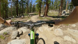
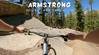
Armstrong Trail is 4 miles of sustained moderate climbing to the Tahoe Rim Trail. The lower section features moderately banked turns, but overall the trail is narrow with good traction and the occasional moderately technical section. From Armstrong Pass, ride south on the TRT to access Mr. Toad's Wild Ride.

Access Info

The lower trailhead is at the end of Fountain Place Rd on the south side. The upper trailhead is off the Tahoe Rim Trail at Armstrong Pass.

Tags
BermsJumpsRock slabsViews

Trail Supporters

Local Trail Association

Traditionally Indigenous Territory

Recent Activity on Trail

Past Week
  • 0 rides
  •  
6 Months
  • 184 rides
  • 21 miles avg distance
All
  • 863 rides
  • Last: Oct 28, 2026
c1c2c3c4
January
February
March
April
May
June
July
August
September
October
November
December
Status:
on Oct 11, 2026
Ideal
Avg: 4.53 (26 votes)
Your vote: 0

view (1,845)
close
      Directions to armstrong-pass-trail trailhead (38.832090, -119.912140)

      Photos

      41 more »
      mtb
      144 |
      Aug 22, 2024 @ 7:12am
      Aug 22, 2024
      mtb
      140 |
      Aug 22, 2024 @ 7:12am
      Aug 22, 2024
      mtb
      135 |
      Aug 22, 2024 @ 7:12am
      Aug 22, 2024
      mtb
      148 |
      Aug 22, 2024 @ 7:11am
      Aug 22, 2024

      Videos

      8 more »
      youtuber Ride Day w RGMTB & B1KER 2018 (South Lake ...
      mtb
      16:41 | 608 | Jun 19, 2018 , South Lake Tahoe
      youtuber Corral Trail, Armstrong Trail (South Lake...
      mtb
      1081 | Sep 16, 2017 , South Lake Tahoe
      youtuber Armstrong Pass Trail / Lake Tahoe / MTB
      mtb
      15:50 | 513 | Sep 11, 2022 , South Lake Tahoe
      youtuber Armstrong / South Lake Tahoe, CA / MTB
      mtb
      11:40 | 312 | Aug 25, 2025 , South Lake Tahoe

      Trail Lists

      Routes with this trail

      more »
      ★ 4.0 • 19 miles • 3,301 ft • 8 • Loop •
      Great Loop in South Lake Tahoe.
      ★ 3.2 • 25 miles • 4,762 ft • 25 • Loop •
      The Tahoe Mountain Bike Festival’s signature ride starts with a “Triple Crown Ride” covering 30+...
      ★ 4.5 • 26 miles • 4,490 ft • 13 • Loop •
      26-mile ride with almost 100% singletrack, two summits and amazing descents. Lots of tecnical singletrack...
      4.7 ★★★★★
      26 Ratings
      5 ★ 73%
      4 ★ 23%
      3 ★ 4%
      2 ★
      1 ★

      7 Reviews & Comments

      DirtbagMusubi DirtbagMusubi
      Great ride down, playful and chunky. Hard but very doable climb with lots of features that feel great to clean.
      DzoK3M
      Rode it today. It’s completely doable with only 4 patches of rideable snow and shallow water crossings. Super fun trail. Time to wash the bike
      Hoolie
      I made it up 0.8 miles from paved today.

      We hope you've been enjoying Trailforks!

      Create a FREE account to view all trail reviews and much more.

      • By TheAngryTomato TRAILFORKS & contributors
      • #23960 - 14,052 views

      Frequently Asked Questions

      ▼ Where is Armstrong Pass Trail located?
      Armstrong Pass Trail is located in Freel High Country, South Lake Tahoe, California, United States. It is part of the Freel High Country trail network. The trailhead is located at coordinates 38.83209, -119.91214.
      ▼ How hard is Armstrong Pass Trail?
      Armstrong Pass Trail is rated as Blue difficulty. The physical rating is Moderate. The average grade is 5.031%. The climb difficulty is rated Blue.
      ▼ What is the elevation gain for Armstrong Pass Trail?
      Armstrong Pass Trail has 254 ft of elevation gain. The trail has 1,272 ft of elevation descent. The elevation ranges from 7,669 ft to 8,720 ft.
      ▼ Is Armstrong Pass Trail a point to point trail?
      Armstrong Pass Trail is not a point to point trail. The direction is Both Directions. The trail type is singletrack.
      ▼ How long is Armstrong Pass Trail?
      Armstrong Pass Trail is 3.8 miles long. The trail type is singletrack.
      ▼ Are dogs allowed on Armstrong Pass Trail?
      Yes, dogs are allowed on Armstrong Pass Trail. Please keep dogs on a leash where required and clean up after them.
      ▼ When is the best time of year to ride Armstrong Pass Trail?
      Based on activity log data, the most popular months to ride Armstrong Pass Trail are:
      • August (105 activities)
      • July (103 activities)
      • September (82 activities)
      Check the reports page for current trail conditions.
      ▼ How do I access Armstrong Pass Trail? Where is the closest parking trailhead?
      The closest parking and trailhead locations to Armstrong Pass Trail are: View all parking locations in the area.
      ▼ How long does it take to ride Armstrong Pass Trail?
      Based on recorded activities, it takes an average of 35 minutes to ride Armstrong Pass Trail. The trail is 3.8 miles long. Actual times will vary based on fitness level, conditions, and pace. View recent activity logs for more details.
      ▼ How busy is Armstrong Pass Trail?
      Armstrong Pass Trail is a less popular trail with lighter traffic. There have been 4,404 recorded activities on this trail. The trail has received 1,845 check-ins. View recent activity on this trail.

      Hit the Trail

      Open in App

      Get this trail on your phone instantly.

      open trail in app

      Download Trail

      Save to wishlist, Garmin & download.
      save the trail

      Find Related Routes

      Find routes and users activities that include this trail.
      find routes for this trail

      You must enter a description before submitting.