more stats
2,608 ft
Distance
33 ft
Climb
-310 ft
Descent
00:04:11
Avg time
-277 ft
Altitude change
3,252 ft
Altitude min
3,529 ft
Altitude max
3,529 ft
Altitude start
3,251 ft
Altitude end
-10.6%
Grade
-69.5%
Grade max
15.1%
Grade min
614 ft
Distance climb
1,775 ft
Distance down
171 ft
Distance flat
00:04:11
Avg time

Atari Details

  • Activities
    • Mountain Bike
    • Hike
    • Trail Running
  • Riding Area
    Macacos
    Nova Lima
  • Difficulty Rating
  • Local Popularity
    5 in Mountain Biking [+]
    • 5 in Trail Running
    • 5 in Hiking
  • Global Ranking
    #268285 in Mountain Biking [+]
    • #147070 in Trail Running
    • #142086 in Hiking
  • Hiking SAC Scale
    T1 Hiking
  • Trail Type
    Singletrack
  • Direction
    Downhill Primary
    Popular Direction Shown
  • Climb Difficulty
    Black Diamond
  • Physical Rating
    Moderate
  • Trail Visibility
    Sometimes hard to follow
  • Dogs Allowed
    Yes
  • TTFs on Trail
    Drop

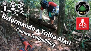
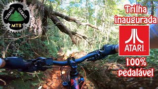
o início da trilha é bem discreto, saindo da estrada a esquerda próximo ao portão da rua. Parte da trilha é em comum com a Trilha Play Station. trecho final quase no Bar do Marcinho tem valas profundas de difícil passagem.

Local Trail Association

Recent Activity on Trail

Past Week
  • 0 rides
  •  
6 Months
  • 0 rides
  •  
All
  • 7 rides
  • Last: Sep 16, 2023
c1c2c3c4
January
February
March
April
May
June
July
August
September
October
November
December
update trails status or condition

Atari Trail Reports

statusdatedescription
Aug 10, 2025 @ 6:36pm
Aug 10, 2025
Entrada da trilha sumiu coberta pelo mato.
Apr 3, 2023 @ 9:03am
Apr 3, 2023
Logo no início, têm uma árvore grande caída, atravessando a trilha impedindo a passagem. Será necessário serrar os galhos para pelo menos...
more »
Status:
on Aug 10, 2025
no votes yet
Your vote: 0

view (35)
close
3D
Trail Conditions
  • Unknown
  • Snow Groomed
  • Snow Packed
  • Snow Covered
  • Snow Cover Partial
  • Freeze/thaw Cycle
  • Icy
  • Prevalent Mud
  • Wet
  • Variable
  • Ideal
  • Dry
  • Very Dry
Trail Flow (Ridden Direction)
Trailforks scans users ridelogs to determine the most popular direction each trail is ridden. A good flowing trail network will have most trails flowing in a single direction according to their intension.
The colour categories are based on what percentage of riders are riding a trail in its intended direction.
  • > 96%
  • > 90%
  • > 80%
  • > 70%
  • > 50%
  • < 50%
  • bi-directional trail
  • no data
Trail Last Ridden
Trailforks scans ridelogs to determine the last time a trail was ridden.
  • < 2 days
  • < 1 week
  • < 2 weeks
  • < 1 month
  • < 6 months
  • > 6 months
Trail Ridden Direction
The intended direction a trail should be ridden.
  • Downhill Only
  • Downhill Primary
  • Both Directions
  • Uphill Primary
  • Uphill Only
  • One Direction
Contribute Details
Colors indicate trail is missing specified detail.
  • Description
  • Photos
  • Description & Photos
  • Videos
Trail Popularity ?
Trailforks scans ridelogs to determine which trails are ridden the most in the last 9 months. Trails are compared with nearby trails in the same city region with a possible 25 colour shades. Think of this as a heatmap, more rides = more kinetic energy = warmer colors.
  • most popular
  • popular
  • less popular
  • not popular
ATV/ORV/OHV Filter
Max Vehicle Width
inches
US Cell Coverage
Legend
cell carrier legend

Radar Time
Activity Recordings
Trailforks uses anonymized public activity data. ?
Activity Recordings
Trailforks uses anonymized public activity data. ?
Personal Heatmap
Activity Types
all / none
Options
2
Date range month
Winter Trails
Warning A routing network for winter maps does not exist. Selecting trails using the winter trails layer has been disabled.
Missing Trails
Most Popular
Least Popular
Trails are colored based on popularity. The more popular a trail is, the more red. Less popular trails trend towards green.
Jump Magnitude Heatmap
Heatmap of where riders jump on trails. Zoom in to see individual jumps, click circles to view jump details.
BC Backroad Status

Service Road Atlas is a free to use, community-driven service for viewing and creating reports on the numerous back-country service roads around B.C. and Alberta.

map legend
Slope Aspect
Direction the slope faces
Flat N NE E SE S SW W NW
Trails Deemphasized
Trails are shown in grey.
disable
Only show trails with no bike usage.
Enable
Suggested Layers
Based on selected activity type

    Save the current map location and zoom level as your default home location whenever this page is loaded.

    Save
        Directions to atari trailhead (-20.045120, -43.940760)

        Photos

        1 more »
        37 |
        Aug 10, 2025 @ 6:40pm
        Aug 10, 2025
        38 |
        Aug 10, 2025 @ 6:39pm
        Aug 10, 2025
        40 |
        Apr 3, 2023 @ 9:03am
        Apr 3, 2023

        Videos

        7 more »
        youtuber Reformando a Atari, Trilha em Macacos. Viva a...
        14:31 | 213 | Mar 28, 2021 , Nova Lima
        youtuber Testei a GoPro 9 com Max Lens Mod: Deu Bom Mas...
        9:31 | 210 | Apr 28, 2021 , Nova Lima
        youtuber Ciclista Consciente Cuida da Trilha. Cultura...
        3:48 | 260 | Jul 29, 2020 , Nova Lima
        youtuber Atari Inaugurada. Agora 100% Pedalável....
        5:58 | 330 | Jul 26, 2020 , Nova Lima

        1 Review & Comments


        We hope you've been enjoying Trailforks!

        Create a FREE account to view trail comments and much more.

        Nearby Trails

        • By renatobaltarTF Pro WTFB & contributors
        • #279336 - 893 views

        Frequently Asked Questions About Atari

        Where is Atari located?
        Atari is located in Macacos, Nova Lima, Brazil. It is part of the Macacos trail network. The trailhead is located at coordinates -20.04512, -43.94076.
        How hard is Atari?
        Atari is rated as Black Diamond difficulty. The physical rating is Moderate. The average grade is 10.6%. The climb difficulty is rated Black Diamond.
        What is the elevation gain for Atari?
        Atari has 33 ft of elevation gain. The trail has 310 ft of elevation descent. The elevation ranges from 3,252 ft to 3,529 ft.
        Is Atari a point to point trail?
        Atari is not a point to point trail. The direction is Downhill Primary. The trail type is singletrack.

        Hit the Trail

        Open in App

        Get this trail on your phone instantly.
        open trail in app

        Download Trail

        Save to wishlist, Garmin & download.
        save the trail

        Find Related Routes

        Find routes and users activities that include this trail.
        find routes for this trail

        You must enter a description before submitting.