more stats
1.8 miles
Distance
459 ft
Climb
-572 ft
Descent
00:38:24
Avg time
-113 ft
Altitude change
3,091 ft
Altitude min
3,495 ft
Altitude max
3,360 ft
Altitude start
3,248 ft
Altitude end
-1.2%
Grade
-51.7%
Grade max
60.8%
Grade min
3,638 ft
Distance climb
1 mile
Distance down
499 ft
Distance flat
00:38:24
Avg time

Play Station Details

  • Activities
    • Mountain Bike
    • Hike
    • Trail Running
  • Riding Area
    Macacos
    Nova Lima
  • Difficulty Rating
  • Local Popularity
    45 in Mountain Biking [+]
    • 85 in Trail Running
    • 5 in Hiking
  • Global Ranking
    #251442 in Mountain Biking [+]
    • #108526 in Trail Running
    • #353609 in Hiking
  • National Ranking
    #2,062 in Mountain Biking · Brazil [+]
    • #459 in Trail Running
    • #2,326 in Hiking
  • Hiking SAC Scale
    T2 Mountain Hiking
  • Trail Type
    Singletrack
  • Bike Type
    AM, XC
  • Direction
    Downhill Primary
    Popular Direction Shown
  • Climb Difficulty
    Black Diamond
  • Physical Rating
    Moderate
  • Trail Visibility
    Sometimes hard to follow
  • Dogs Allowed
    Yes
  • TTFs on Trail
    Drop

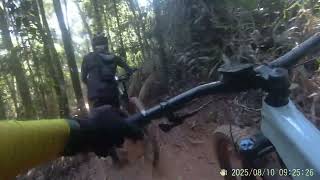
trilha utilizada por motos (cuidado), que vai do Bar do Marcinho até a represa da Mina Mar Azul, ´passando dentro da florestas, com vários trechos íngremes e muita vegetação dentro da trilha. Atenção com as bifurcações e muitos troncos caídos dentro da trilha.

Tags
DropsFaint trail

Local Trail Association

Recent Activity on Trail

Past Week
  • 0 rides
  •  
6 Months
  • 0 rides
  •  
All
  • 15 rides
  • Last: Sep 12, 2026
c1c2c3c4
January
February
March
April
May
June
July
August
September
October
November
December
update trails status or condition

Play Station Trail Reports

statusdatedescription
Nov 20, 2024 @ 3:19pm
Nov 20, 2024
Trilha bem dura para passar de bike mesmo que elétrica, empurra muito, flui pouco melhor passar pela estrada ou casarões
Jul 28, 2024 @ 7:32am
Jul 28, 2024
Muitas cavas de moto, pózão
Sep 27, 2022 @ 7:39pm
Sep 27, 2022
Jul 25, 2020 @ 12:46pm
Jul 25, 2020
Jul 18, 2020 @ 3:17am
Jul 18, 2020
more »
Status:
on Nov 20, 2024
Prevalent Mud
no votes yet
Your vote: 0

view (279)
close
      Directions to play-station trailhead (-20.043090, -43.945500)

      Photos

      2 more »
      report
      mtb
      70 |
      Sep 27, 2022 @ 7:39pm
      Sep 27, 2022
      report
      mtb
      57 |
      Sep 27, 2022 @ 7:39pm
      Sep 27, 2022

      Videos

      3 more »
      youtuber AtariStation: MISTURANDO DUAS TRILHAS,...
      mtb
      13:42 | 402 | Apr 25, 2021 , Nova Lima
      youtuber PlayStation, Trilha de Mountain Bike próximo...
      mtb
      8:32 | 454 | May 6, 2020 , Nova Lima
      Trilha Playstation
      mtb
      4:02 | 26 | Sep 26, 2025 , Nova Lima

      1 Review & Comments

      AndersonsY53d9
      Trilha bem dura, mesmo de bike elétrica empurra muito em valas, debaixo de árvores caídas. Famoso rolê furada ou aventura, mas passa.

      We hope you've been enjoying Trailforks!

      Create a FREE account to view all trail reviews and much more.

      Nearby Trails

      • By renatobaltarTF Pro WTFB & contributors
      • #279367 - 931 views

      Frequently Asked Questions

      ▼ Where is Play Station located?
      Play Station is located in Macacos, Nova Lima, Brazil. It is part of the Macacos trail network. The trailhead is located at coordinates -20.04309, -43.9455.
      ▼ How hard is Play Station?
      Play Station is rated as Black Diamond difficulty. The physical rating is Moderate. The average grade is 1.2%. The climb difficulty is rated Black Diamond.
      ▼ What is the elevation gain for Play Station?
      Play Station has 459 ft of elevation gain. The trail has 572 ft of elevation descent. The elevation ranges from 3,091 ft to 3,495 ft.
      ▼ Is Play Station a point to point trail?
      Play Station is not a point to point trail. The direction is Downhill Primary. The trail type is singletrack.
      ▼ How long is Play Station?
      Play Station is 1.8 miles long. The trail type is singletrack.
      ▼ Are dogs allowed on Play Station?
      Yes, dogs are allowed on Play Station. Please keep dogs on a leash where required and clean up after them.
      ▼ When is the best time of year to ride Play Station?
      Based on activity log data, the most popular months to ride Play Station are:
      • April (1 activities)
      • September (1 activities)
      • October (1 activities)
      Check the reports page for current trail conditions.
      ▼ How do I access Play Station? Where is the closest parking trailhead?
      The closest parking and trailhead locations to Play Station are: View all parking locations in the area.
      ▼ How long does it take to ride Play Station?
      Based on recorded activities, it takes an average of 38 minutes to ride Play Station. The trail is 1.8 miles long. Actual times will vary based on fitness level, conditions, and pace. View recent activity logs for more details.
      ▼ How busy is Play Station?
      Play Station is a moderately popular trail. There have been 278 recorded activities on this trail. The trail has received 279 check-ins. View recent activity on this trail.

      Hit the Trail

      Open in App

      Get this trail on your phone instantly.

      open trail in app

      Download Trail

      Save to wishlist, Garmin & download.
      save the trail

      Find Related Routes

      Find routes and users activities that include this trail.
      find routes for this trail

      You must enter a description before submitting.