more stats
1,900 ft
Distance
16 ft
Climb
-340 ft
Descent
00:05:18
Avg time
-325 ft
Altitude change
2,172 ft
Altitude min
2,497 ft
Altitude max
2,497 ft
Altitude start
2,172 ft
Altitude end
-17.1%
Grade
-59.6%
Grade max
7.8%
Grade min
262 ft
Distance climb
1,621 ft
Distance down
16 ft
Distance flat
00:05:18
Avg time

Atomiko Details

  • Activities
    • Mountain Bike
    • E-Bike
    • Hike
    • Trail Running
  • Riding Area
    Basaburua
    Lekunberri
  • Difficulty Rating
  • Local Popularity
    95 in Mountain Biking [+]
    • 95 in E-Biking
    • 5 in Trail Running
    • 5 in Hiking
  • Global Ranking
    #8170 in Mountain Biking [+]
    • #16767 in E-Biking
    • #148110 in Trail Running
    • #142758 in Hiking
  • Hiking SAC Scale
    T1 Hiking
  • Trail Type
    Singletrack
  • Bike Type
    DH, AM
  • Direction
    Downhill Primary
    Popular Direction Shown
  • Climb Difficulty
    Black Diamond
  • Physical Rating
    Moderate
  • Trail Visibility
    Sometimes hard to follow
  • Dogs Allowed
    Yes
  • eBike Allowed
    Yes up to Class 1

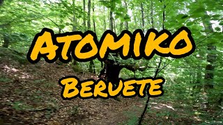
Sendero llamado Atomiko, en relación a la "hormiga atómica", debido a la velocidad a la que se abrió el sendero. Este fue abierto en el mes de Febrero del 2021, principalmente durante la noche, por la falta de tiempo durante el día. El hacerlo por la noche, tuvo sus desventajas, ya que algunas curvas no tenían una buena fluidez. Por eso, después hubo que arreglarlo a una velocidad atómica.

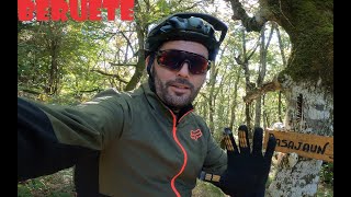
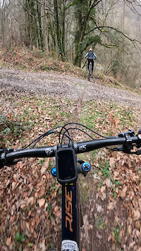
El sendero se cruza al principio con el sendero Basajaun. Nada más cruzarlo, tendremos una pequeña subida. Una vez superada esta parte, comienza una parte fluida ladeando un precioso robledal. Tras unas zona revirada, de curvas y cambios de rasante en el que habrá que coger bien las inercias, entraremos en un hayedo a través de un pequeño barranco. Junto al cambio de bosque viene el cambio de terreno, algo más arcilloso y resbaladizo en húmedo, en el que un par de pasos verticales nos pondrán los pelos de punta. El sendero llega a una pista de grava, pero la fiesta sigue, ya que tendremos otro tramo corto para terminar con un sendero divertido.

Trail Supporters
Local Trail Association

Recent Activity on Trail

Past Week
  • 0 rides
  •  
6 Months
  • 16 rides
  • 22.6 km avg distance
All
  • 114 rides
  • Last: May 24, 2026
c1c2c3c4
January
February
March
April
May
June
July
August
September
October
November
December
update trails status or condition

Atomiko Trail Reports

statusdatedescription
May 27, 2026 @ 9:14am (Europe/Andorra)
May 27, 2026
Perfectamente ciclable pero hay que tener cuidado con el terreno suelto en el paso por curva.
May 10, 2026 @ 5:14pm (Europe/Andorra)
May 10, 2026
Apr 10, 2026 @ 3:51pm (Europe/Madrid)
Apr 10, 2026
Jan 28, 2026 @ 4:55pm (Europe/Andorra)
Jan 28, 2026
reporter En la zona alta el terreno estaba perfecto. La zona baja un poco más húmeda pero muy bien.
Jan 1, 2026 @ 1:26pm (Europe/Madrid)
Jan 1, 2026
reporter El parón invernal y los trabajos realizados la han dejado espectacular.
more »
Status:
on May 27, 2026
Dry
Avg: 3.94 (12 votes)
Your vote: 0

view (330)
close
3D
Trail Conditions
  • Unknown
  • Snow Groomed
  • Snow Packed
  • Snow Covered
  • Snow Cover Partial
  • Freeze/thaw Cycle
  • Icy
  • Prevalent Mud
  • Wet
  • Variable
  • Ideal
  • Dry
  • Very Dry
Trail Flow (Ridden Direction)
Trailforks scans users ridelogs to determine the most popular direction each trail is ridden. A good flowing trail network will have most trails flowing in a single direction according to their intension.
The colour categories are based on what percentage of riders are riding a trail in its intended direction.
  • > 96%
  • > 90%
  • > 80%
  • > 70%
  • > 50%
  • < 50%
  • bi-directional trail
  • no data
Trail Last Ridden
Trailforks scans ridelogs to determine the last time a trail was ridden.
  • < 2 days
  • < 1 week
  • < 2 weeks
  • < 1 month
  • < 6 months
  • > 6 months
Trail Ridden Direction
The intended direction a trail should be ridden.
  • Downhill Only
  • Downhill Primary
  • Both Directions
  • Uphill Primary
  • Uphill Only
  • One Direction
Contribute Details
Colors indicate trail is missing specified detail.
  • Description
  • Photos
  • Description & Photos
  • Videos
Trail Popularity ?
Trailforks scans ridelogs to determine which trails are ridden the most in the last 9 months. Trails are compared with nearby trails in the same city region with a possible 25 colour shades. Think of this as a heatmap, more rides = more kinetic energy = warmer colors.
  • most popular
  • popular
  • less popular
  • not popular
ATV/ORV/OHV Filter
Max Vehicle Width
inches
US Cell Coverage
Legend
cell carrier legend

Radar Time
Activity Recordings
Trailforks uses anonymized public activity data. ?
Activity Recordings
Trailforks uses anonymized public activity data. ?
Personal Heatmap
Activity Types
all / none
Options
2
Date range month
Winter Trails
Warning A routing network for winter maps does not exist. Selecting trails using the winter trails layer has been disabled.
Missing Trails
Most Popular
Least Popular
Trails are colored based on popularity. The more popular a trail is, the more red. Less popular trails trend towards green.
Jump Magnitude Heatmap
Heatmap of where riders jump on trails. Zoom in to see individual jumps, click circles to view jump details.
BC Backroad Status

Service Road Atlas is a free to use, community-driven service for viewing and creating reports on the numerous back-country service roads around B.C. and Alberta.

map legend
Slope Aspect
Direction the slope faces
Flat N NE E SE S SW W NW
Trails Deemphasized
Trails are shown in grey.
disable
Only show trails with no bike usage.
Enable
Suggested Layers
Based on selected activity type

    Save the current map location and zoom level as your default home location whenever this page is loaded.

    Save
        Directions to atomiko trailhead (43.015160, -1.818590)

        Photos

        9 more »
        68 |
        Dec 15, 2023 @ 1:14pm
        Dec 15, 2023
        55 |
        Sep 12, 2025 @ 5:55am
        Sep 12, 2025
        22 |
        Sep 13, 2025 @ 6:26am
        Sep 13, 2025
        50 |
        Nov 11, 2022 @ 2:41pm
        Nov 11, 2022

        Videos

        4 more »
        Beruete: Atomiko
        2:42 | 267 | Oct 20, 2022 , Lekunberri
        TRAILS POR BERUETE IRATXO ATOMIKO BASAJAUN
        16:37 | 137 | Jan 3, 2022 , Lekunberri
        0:13 | 26 | Feb 2, 2024 , Lekunberri
        0:14 | 16 | Feb 1, 2024 , Lekunberri

        Routes with this trail

        4.0 12 miles 2,718 ft 9 Loop
        de , , que une varias bajadas divertidas en bucle, cuidadas con mucho mimo y cariño para que siempre...

        Reviews / Comments

        No reviews yet, be the first to write a review or ask a question.
        Use trail reports to comment on trail conditions.


        We hope you've been enjoying Trailforks!

        Create a FREE account to view trail comments and much more.

        Frequently Asked Questions About Atomiko

        Where is Atomiko located?
        Atomiko is located in Basaburua, Lekunberri, Spain. It is part of the Basaburua trail network. The trailhead is located at coordinates 43.01516, -1.81859.
        How hard is Atomiko?
        Atomiko is rated as Red difficulty. The physical rating is Moderate. The average grade is 17.1%. The climb difficulty is rated Black Diamond.
        What is the elevation gain for Atomiko?
        Atomiko has 5 m of elevation gain. The trail has 104 m of elevation descent. The elevation ranges from 662 m to 761 m.
        Is Atomiko a point to point trail?
        Atomiko is not a point to point trail. The direction is Downhill Primary. The trail type is singletrack.

        Hit the Trail

        Open in App

        Get this trail on your phone instantly.
        open trail in app

        Download Trail

        Save to wishlist, Garmin & download.
        save the trail

        Find Related Routes

        Find routes and users activities that include this trail.
        find routes for this trail

        You must enter a description before submitting.