
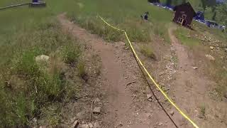
more stats
1.8 miles
Distance
340 ft
Climb
-365 ft
Descent
00:23:39
Avg time
-25 ft
Altitude change
7,118 ft
Altitude min
7,226 ft
Altitude max
7,226 ft
Altitude start
7,201 ft
Altitude end
-0.265%
Grade
-21.214%
Grade max
32.328%
Grade min
4,069 ft
Distance climb
4,505 ft
Distance down
790 ft
Distance flat
00:23:39
Avg time

Bjorr Details

  • Activities
    • Mountain Bike
    • Hike
    • Trail Running
  • Riding Area
    Beaver Mountain
    Logan, Utah
  • Difficulty Rating
  • Local Popularity
    80 in Mountain Biking [+]
    • 5 in Trail Running
    • 60 in Hiking
  • Global Ranking
    #84122 in Mountain Biking [+]
    • #297773 in Trail Running
    • #139988 in Hiking
  • State Ranking
    #1,426 in Mountain Biking · Utah [+]
    • #5,426 in Trail Running
    • #3,215 in Hiking
  • Trail Type
    Singletrack
  • Direction
    Both Directions
  • Climb Difficulty
    Blue
  • Physical Rating
    Moderate
  • Dogs Allowed
    Yes

A bit new and doesn't get a lot of riders, except during the music festival race. Mostly easy loop with some punchy climbs and soft dirt, but not rocky or technical.

Tags

Local Trail Association

Traditionally Indigenous Territory

Recent Activity on Trail

Past Week
  • 0 rides
  •  
6 Months
  • 9 rides
  • 10 miles avg distance
All
  • 51 rides
  • Last: Aug 29, 2026
update trails status or condition

Bjorr Trail Reports

statusdatedescription
Sep 30, 2023 @ 9:18am
Sep 30, 2023
Major logging operation for fire mitigation, closed signs at several trail entrances.
Jul 3, 2023 @ 9:45pm
Jul 3, 2023
Construction near the top of the loop has destroyed a small section of the trail. That section may or may not be rideable depending on...
Aug 1, 2022 @ 1:08pm
Aug 1, 2022
Preriding for upcoming HS races. Trail was loads of fun. A couple tricky spots where you need to keep your momentum (riding CCW)
May 21, 2022 @ 4:07pm
May 21, 2022
Had to hike a bike through snow banks and fallen trees. But made it through.
May 20, 2022 @ 5:29pm
May 20, 2022
Still some snow banks and fallen trees. We made it the full circle but had to hike a bike through several spots for snow and trees.
more »
Status:
on Sep 30, 2023
Avg: 3.69 (4 votes)
Your vote: 0

view (340)
close
      Directions to bjorr trailhead (41.967952, -111.540908)

      Photos

      11 more »
      mtb
      186 |
      Aug 24, 2019 @ 10:03pm
      Aug 24, 2019
      mtb
      183 |
      Aug 24, 2019 @ 10:01pm
      Aug 24, 2019
      report
      mtb
      112 |
      May 21, 2022 @ 4:07pm
      May 21, 2022
      report
      mtb
      175 |
      Aug 28, 2019 @ 11:59am
      Aug 28, 2019

      Videos

      1 more »
      Beaver Mountain Music Festival 2017 - Mountain...
      mtb
      1205 | Oct 9, 2017 , Logan
      3.3 ★★★★★
      4 Ratings
      5 ★ 25%
      4 ★ 25%
      3 ★
      2 ★ 50%
      1 ★

      5 Reviews & Comments

      dstone42
      I like this trail to lap a bunch if I want an easy ride. You currently can’t access it directly because of construction. You can access it from the blue trail though. The parking is not where it says on Trailforks because it’s new due to the construction. Beaver mountain has put up signs that lead to the correct lot though.
      taycras
      Trail is in terrible condition- not maintained and hard to get to the access point due to construction- I don’t recommend this trail - would be a waste of time to go here just for the trail
      Jwaddoups
      Good loop for beginners, kids (my 6 and 9 yo did it), or just for a fun short cruise. Trail was in perfect condition on 9/13/20, a little tacky but not muddy in the trees.

      We hope you've been enjoying Trailforks!

      Create a FREE account to view all trail reviews and much more.

      • By toddTF Pro Trailforks & contributors
      • #106026 - 4,268 views

      Frequently Asked Questions

      ▼ Where is Bjorr located?
      Bjorr is located in Beaver Mountain, Logan, Utah, United States. It is part of the Beaver Mountain trail network. The trailhead is located at coordinates 41.96795, -111.54091.
      ▼ How hard is Bjorr?
      Bjorr is rated as Green difficulty. The physical rating is Moderate. The average grade is 0.265%. The climb difficulty is rated Blue.
      ▼ What is the elevation gain for Bjorr?
      Bjorr has 340 ft of elevation gain. The trail has 365 ft of elevation descent. The elevation ranges from 7,118 ft to 7,226 ft.
      ▼ Is Bjorr a point to point trail?
      Bjorr is not a point to point trail. The direction is Both Directions. The trail type is singletrack.
      ▼ How long is Bjorr?
      Bjorr is 1.8 miles long. The trail type is singletrack.
      ▼ Are dogs allowed on Bjorr?
      Yes, dogs are allowed on Bjorr. Please keep dogs on a leash where required and clean up after them.
      ▼ How do I access Bjorr? Where is the closest parking trailhead?
      The closest parking and trailhead locations to Bjorr are: View all parking locations in the area.
      ▼ How long does it take to ride Bjorr?
      Based on recorded activities, it takes an average of 24 minutes to ride Bjorr. The trail is 1.8 miles long. Actual times will vary based on fitness level, conditions, and pace. View recent activity logs for more details.
      ▼ How busy is Bjorr?
      Bjorr is a very popular trail. There have been 275 recorded activities on this trail. The trail has received 340 check-ins. View recent activity on this trail.

      Hit the Trail

      Open in App

      Get this trail on your phone instantly.

      open trail in app

      Download Trail

      Save to wishlist, Garmin & download.
      save the trail

      Find Related Routes

      Find routes and users activities that include this trail.
      find routes for this trail

      You must enter a description before submitting.

