more stats
3,845 ft
Distance
311 ft
Climb
-289 ft
Descent
00:04:05
Avg time
23 ft
Altitude change
1,696 ft
Altitude min
1,865 ft
Altitude max
1,696 ft
Altitude start
1,719 ft
Altitude end
0.6%
Grade
-69.2%
Grade max
64.3%
Grade min
1,368 ft
Distance climb
988 ft
Distance down
1,493 ft
Distance flat
00:04:05
Avg time

Blåbærtrøkket Details

  • Activities
    • Mountain Bike
    • E-Bike
    • Gravel Bike
    • Hike
    • Trail Running
  • Riding Area
  • Difficulty Rating
  • Local Popularity
    100 in Mountain Biking [+]
    • 100 in E-Biking
    • 5 in Trail Running
    • 5 in Hiking
    • 5 in Gravel Biking
  • Global Ranking
    #77012 in Mountain Biking [+]
    • #83962 in E-Biking
    • #308896 in Trail Running
    • #299951 in Hiking
    • #46626 in Gravel Biking
  • National Ranking
    #489 in Mountain Biking · Norway [+]
    • #721 in E-Biking
    • #3,767 in Trail Running
    • #3,466 in Hiking
    • #358 in Gravel Biking
  • Trail Type
    Gravel Path
  • Bike Type
    AM, XC, Gravel
  • Direction
    One Direction
    Popular Direction Shown
  • Dogs Allowed
    Yes
  • eBike Allowed
    Yes up to Class 1
  • TTFs on Trail
    Berm, Drop, Jump
  • Year Opened
    2020

Norsk (English below):
Perfekt oppvarming før de brattere stiene fra Utsikten Denne 1,5 km lange rundløypa går parallelt med den populære familievennlige stien "Trytetrøkket" ved Trytetjern i Nesbyen. Stien er blågradert (moderat vanskelighetsgrad), noe som gjør den til et flott valg for syklister i alle aldre. Her finner du hopp, kuler og en liten "drop zone". Ved startpunktet er det også benker og bålplass. Badeplassen ved Trytetjern ligger bare et steinkast unna – perfekt for et forfriskende bad etter turen! Stien ble bygget av Trailhead Nesbyen for Nesbyen kommune, med støtte fra Tippemidler og Sparebank 1 Hallingdal Valdres.

For alt du trenger å vite om stisykling i Nesbyen, besøk Visitnesbyen.no.

Fra Nesbyen sentrum, kjør østover mot Vassfaret og Trytetjern. Parker ved Trytetjern. Stien starter i nordenden av vannet, til høyre for skytebanens klubbhus.

English:
Perfect Warm-Up Before Tackling the Steeper Trails from Utsikten! This 1.5 km loop trail runs alongside the popular family-friendly "Trytetrøkket" trail at Trytetjern in Nesbyen. The trail is blue-rated (moderate difficulty), making it a great option for cyclists of all ages to enjoy jumps, rollers, and a small "drop zone." There’s also a campfire area and benches at the trailhead. The Trytetjern swimming area is just a stone’s throw away—perfect for a refreshing dip after your ride! The trail was built by Trailhead Nesbyen for the municipality of Nesbyen, with support from Tippemidler and Sparebank 1 Hallingdal Valdres.

For everything you need to know about mountain biking in Nesbyen, go to Visitnesbyen.com.

From Nesbyen town center, drive east toward Vassfaret and Trytetjern. Park at Trytetjern. The trail starts at the northern end of the lake, to the right of the shooting club’s house.

Local Trail Association

Recent Activity on Trail

Past Week
  • 0 rides
  •  
6 Months
  • 14 rides
  • 9 miles avg distance
All
  • 38 rides
  • Last: Oct 8, 2026
c1c2c3c4
January
February
March
April
May
June
July
August
September
October
November
December
Status:
on Aug 19, 2026
Ideal
Avg: 3.88 (4 votes)
Your vote: 0

view (402)
close
      Directions to blabaertrokket trailhead (60.578730, 9.156570)

      Photos

      2 more »
      mtb
      210 |
      Dec 10, 2024 @ 12:10am
      Dec 10, 2024
      mtb
      103 |
      Dec 10, 2024 @ 12:09am
      Dec 10, 2024

      Videos

      1 more »
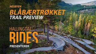
      Blåbærtrøkket - Nesbyen, Norway - Trail preview
      mtb
      0:10 | 248 | Feb 11, 2025 , My City
      4.0 ★★★★★
      4 Ratings
      5 ★ 25%
      4 ★ 50%
      3 ★ 25%
      2 ★
      1 ★

      Reviews / Comments

      No reviews yet, be the first to write a review or ask a question.
      Use trail reports to comment on trail conditions.


      We hope you've been enjoying Trailforks!

      Create a FREE account to view all trail reviews and much more.

      • By larsstorheimTF Pro H Rides & contributors
      • #332876 - 988 views

      Frequently Asked Questions

      ▼ Where is Blåbærtrøkket located?
      Blåbærtrøkket is located in Trytetjern, Norway. It is part of the Trytetjern trail network. The trailhead is located at coordinates 60.57873, 9.15657.
      ▼ How hard is Blåbærtrøkket?
      Blåbærtrøkket is rated as Blue difficulty. The average grade is 0.6%.
      ▼ What is the elevation gain for Blåbærtrøkket?
      Blåbærtrøkket has 311 ft of elevation gain. The trail has 289 ft of elevation descent. The elevation ranges from 1,696 ft to 1,865 ft.
      ▼ Is Blåbærtrøkket a point to point trail?
      Yes, Blåbærtrøkket is a point to point trail. The direction is One Direction. The trail type is gravel path.
      ▼ How long is Blåbærtrøkket?
      Blåbærtrøkket is 3,845 ft long. The trail type is gravel path.
      ▼ Are dogs allowed on Blåbærtrøkket?
      Yes, dogs are allowed on Blåbærtrøkket. Please keep dogs on a leash where required and clean up after them.
      ▼ When is the best time of year to ride Blåbærtrøkket?
      Based on activity log data, the most popular months to ride Blåbærtrøkket are:
      • July (15 activities)
      • August (9 activities)
      • September (3 activities)
      Check the reports page for current trail conditions.
      ▼ How do I access Blåbærtrøkket? Where is the closest parking trailhead?
      The closest parking and trailhead locations to Blåbærtrøkket are: View all parking locations in the area.
      ▼ How long does it take to ride Blåbærtrøkket?
      Based on recorded activities, it takes an average of 4 minutes to ride Blåbærtrøkket. The trail is 3,845 ft long. Actual times will vary based on fitness level, conditions, and pace. View recent activity logs for more details.
      ▼ How busy is Blåbærtrøkket?
      Blåbærtrøkket is a very popular trail. There have been 190 recorded activities on this trail. The trail has received 402 check-ins. View recent activity on this trail.

      Hit the Trail

      Open in App

      Get this trail on your phone instantly.

      open trail in app

      Download Trail

      Save to wishlist, Garmin & download.
      save the trail

      Find Related Routes

      Find routes and users activities that include this trail.
      find routes for this trail

      You must enter a description before submitting.