

more stats
2,920 ft
Distance
22 ft
Climb
-336 ft
Descent
00:10:05
Avg time
-314 ft
Altitude change
316 ft
Altitude min
630 ft
Altitude max
630 ft
Altitude start
315 ft
Altitude end
-10.7%
Grade
-41%
Grade max
22.3%
Grade min
256 ft
Distance climb
2,434 ft
Distance down
230 ft
Distance flat
00:10:05
Avg time

Blacking Out Details

  • Activities
    • Mountain Bike
    • E-Bike
  • Riding Area
  • Difficulty Rating
  • Voted Difficulty
    Black Diamond (4 votes)
  • Local Popularity
    95 in Mountain Biking [+]
    • 100 in E-Biking
  • Global Ranking
    #512 in Mountain Biking [+]
    • #2807 in E-Biking
  • Trail Type
    Singletrack
  • Bike Type
    DH, AM
  • Direction
    Downhill Only
    Popular Direction Shown
  • Physical Rating
    Moderate
  • Trail Visibility
    Always easy to follow
  • Season
    Best to ride drier weather
  • eBike Allowed
    Yes up to Class 1
  • TTFs on Trail
    Berm, Drop, Rock Face, Rock Garden
  • Year Opened
    2021
  • Land Owner
    Redland City Council

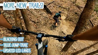
For those that like the flavor of Westy's trail (black diamond), Blacking Out is a new black diamond downhill trail created by Trailworx.

Access Info

Access via the trail junction of Summit track, Escalade, Shenanigans and Westy's.

Traditionally Indigenous Territory

Recent Activity on Trail

Past Week
  • 1 rides
  • 9 miles average
6 Months
  • 68 rides
  • 10 miles avg distance
All
  • 651 rides
  • Last: Sep 26, 2026
c1c2c3c4
January
February
March
April
May
June
July
August
September
October
November
December
update trails status or condition

Blacking Out Trail Reports

statusdatedescription
Jul 9, 2026 @ 8:29am (Australia/Brisbane)
Jul 8, 2026
Quite dusty and blown out at the top but the jumps and flow of the lower section are mint
Jan 6, 2026 @ 3:41pm (Australia/Brisbane)
Jan 5, 2026
Oct 4, 2025 @ 6:40am (Australia/Brisbane)
Oct 3, 2025
It sucks to ride in a group too dusty
Oct 4, 2025 @ 6:40am (Australia/Brisbane)
Oct 3, 2025
It sucks to ride in a group too dusty
May 18, 2024 @ 10:50pm
May 18, 2024
more »
Status:
on Jul 9, 2026
Variable
Avg: 4.46 (7 votes)
Your vote: 0

view (7,235)
close
      Directions to blacking-out trailhead (-27.612260, 153.209620)

      Photos

      3 more »
      mtb
      212 |
      Apr 30, 2023 @ 1:45am
      Apr 30, 2023
      ebike
      172 |
      Apr 1, 2023 @ 5:48pm
      Apr 1, 2023
      ebike
      159 |
      Apr 1, 2023 @ 5:48pm
      Apr 1, 2023

      Videos

      10 more »
      youtuber We Avoid Blacking Out on Brisbane's Newest...
      mtb
      11:35 | 1469 | Apr 24, 2021 , Redland City
      youtuber Mt Cotton is Open and Scarier than Ever!
      mtb
      21:11 | 564 | Apr 15, 2022 , Redland City
      youtuber Mountain bike South BRISBANE | The best!
      mtb
      10:43 | 140 | Sep 2, 2025 , Redland City
      youtuber Best Black trails in Brisbane | Australia
      mtb
      20:14 | 285 | Jul 16, 2024 , Redland City
      4.9 ★★★★★
      7 Ratings
      5 ★ 86%
      4 ★ 14%
      3 ★
      2 ★
      1 ★

      2 Reviews & Comments

      snickdavidson
      The top half is sketchy AF but the bottom half has amazing berms and jumps... loved the bottom section. Bitch of a climb to get to it but worth it.
      Cubumba
      This would be the hardest trail in the Redlands area from my opinion!

      We hope you've been enjoying Trailforks!

      Create a FREE account to view all trail reviews and much more.

      • By TrailsplannerTF Pro & contributors
      • #426459 - 2,932 views

      Frequently Asked Questions

      ▼ Where is Blacking Out located?
      Blacking Out is located in Eastern Escarpment Conservation Area, Redland City, Australia. It is part of the Eastern Escarpment Conservation Area trail network. The trailhead is located at coordinates -27.61226, 153.20962.
      ▼ How hard is Blacking Out?
      Blacking Out is rated as Black Diamond difficulty. The physical rating is Moderate. The average grade is 10.7%.
      ▼ What is the elevation gain for Blacking Out?
      Blacking Out has 22 ft of elevation gain. The trail has 336 ft of elevation descent. The elevation ranges from 316 ft to 630 ft.
      ▼ Is Blacking Out a point to point trail?
      Yes, Blacking Out is a point to point trail. The direction is Downhill Only. The trail type is singletrack.
      ▼ How long is Blacking Out?
      Blacking Out is 2,920 ft long. The trail type is singletrack.
      ▼ Are dogs allowed on Blacking Out?
      There is no information about dogs being allowed on Blacking Out. Check with local trail managers or the trail page for the latest access rules.
      ▼ When is the best time of year to ride Blacking Out?
      Blacking Out is best visited during: Best to ride drier weather.
      ▼ How do I access Blacking Out? Where is the closest parking trailhead?
      The closest parking and trailhead locations to Blacking Out are: View all parking locations in the area.
      ▼ How long does it take to ride Blacking Out?
      Based on recorded activities, it takes an average of 9 minutes to ride Blacking Out. The trail is 2,920 ft long. Actual times will vary based on fitness level, conditions, and pace. View recent activity logs for more details.
      ▼ How busy is Blacking Out?
      Blacking Out is a very popular trail. There have been 5,324 recorded activities on this trail. The trail has received 7,232 check-ins. View recent activity on this trail.

      Hit the Trail

      Open in App

      Get this trail on your phone instantly.

      open trail in app

      Download Trail

      Save to wishlist, Garmin & download.
      save the trail

      Find Related Routes

      Find routes and users activities that include this trail.
      find routes for this trail

      You must enter a description before submitting.



