
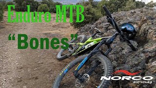

more stats
3,848 ft
Distance
-526 ft
Descent
00:07:21
Avg time
-527 ft
Altitude change
3,359 ft
Altitude min
3,885 ft
Altitude max
3,885 ft
Altitude start
3,360 ft
Altitude end
-13.7%
Grade
-38.2%
Grade max
1%
Grade min
62 ft
Distance climb
3,773 ft
Distance down
13 ft
Distance flat
00:07:21
Avg time

Bones Details

  • Activities
    • Mountain Bike
    • E-Bike
    • Hike
    • Trail Running
  • Riding Area
    Cerro del Telégrafo
    Moralzarzal
  • Ref Number
    #1
  • Difficulty Rating
  • Voted Difficulty
    Red (4 votes)
  • Local Popularity
    50 in Mountain Biking [+]
    • 65 in E-Biking
    • 90 in Trail Running
    • 5 in Hiking
  • Global Ranking
    #151853 in Mountain Biking [+]
    • #111747 in E-Biking
    • #84201 in Trail Running
    • #338143 in Hiking
  • National Ranking
    #13,915 in Mountain Biking · Spain [+]
    • #25,050 in E-Biking
    • #7,111 in Trail Running
    • #33,846 in Hiking
  • Hiking SAC Scale
    T1 Hiking
  • Trail Type
    Singletrack
  • Bike Type
    DH, AM
  • Direction
    Downhill Only
    Popular Direction Shown
  • Trail Visibility
    Always easy to follow
  • Dogs Allowed
    Yes
  • eBike Allowed
    Yes up to Class 1
  • TTFs on Trail
    Jump, Rock Face, Skinny
  • Ride in Rain
    Yes
  • Land Owner
    Comunidad de Madrid

Uno de los miticos circuitos del cerro usado en los enduros de Moralzarzal y reconocido oficialmente por IMBA .Podras disfrutar de él sin miedo a ser sancionado.
Sendero rapido y fisico repleto de piedras principalmente en su inicio para mas tarde meterse en el bosque cruzando el rio varias veces.

This trail is unsanctioned.

Tags
JumpsRock slabsSkinnies

Recent Activity on Trail

Past Week
  • 0 rides
  •  
6 Months
  • 2 rides
  • 8 miles avg distance
All
  • 22 rides
  • Last: Nov 1, 2026
c1c2c3c4
January
February
March
April
May
June
July
August
September
October
November
December
update trails status or condition

Bones Trail Reports

statusdatedescription
Nov 2, 2026 @ 9:56am (Europe/Madrid)
Nov 2, 2026
Sep 5, 2026 @ 7:54pm (Europe/Madrid)
Sep 5, 2026
Muy roto y poco transitado. Cuesta coger una linea limpia continua y mantener inercia. Está más negro que rojo. Mucha erosión por cauce de agua.
Nov 16, 2023 @ 6:04am
Nov 16, 2023
Mar 28, 2021 @ 11:22am
Mar 28, 2021
Sep 26, 2020 @ 1:14am
Sep 26, 2020
more »
Status:
on Nov 2, 2026
Dry
Avg: 3.99 (6 votes)
Your vote: 0

view (282)
close
      Directions to bones-41962 trailhead (40.683700, -3.985400)

      Photos

      0 more »
      report
      mtb
      16 |
      Sep 13, 2026 @ 12:23am
      Sep 13, 2026
      report
      mtb
      52 |
      Sep 5, 2026 @ 11:03am
      Sep 5, 2026

      Videos

      2 more »
      Enduro MTB Moralzarzal 2019- 'Bones'
      mtb
      3:07 | 727 | Apr 25, 2020 , Moralzarzal
      Enduro Fun Festival 2018 Moralzarzal TC1 Bones
      mtb
      6:43 | 625 | Jun 21, 2018 , Moralzarzal
      3.2 ★★★★★
      6 Ratings
      5 ★
      4 ★ 67%
      3 ★
      2 ★ 17%
      1 ★ 17%

      1 Review & Comments

      rasdanny rasdanny
      Muy roto y pedregoso. Actualmente muy poco fluida. Se puede bajar todo o casi todo, pero actualmente está roja oscura.

      We hope you've been enjoying Trailforks!

      Create a FREE account to view all trail reviews and much more.

      • #41962 - 2,146 views

      Frequently Asked Questions

      ▼ Where is Bones located?
      Bones is located in Cerro del Telégrafo, Moralzarzal, Spain. It is part of the Cerro del Telégrafo trail network. The trailhead is located at coordinates 40.6837, -3.9854.
      ▼ How hard is Bones?
      Bones is rated as Red difficulty. The average grade is 13.7%.
      ▼ What is the elevation gain for Bones?
      The trail has 526 ft of elevation descent. The elevation ranges from 3,359 ft to 3,885 ft.
      ▼ Is Bones a point to point trail?
      Yes, Bones is a point to point trail. The direction is Downhill Only. The trail type is singletrack.
      ▼ How long is Bones?
      Bones is 3,848 ft long. The trail type is singletrack.
      ▼ Are dogs allowed on Bones?
      Yes, dogs are allowed on Bones. Please keep dogs on a leash where required and clean up after them.
      ▼ When is the best time of year to ride Bones?
      Based on activity log data, the most popular months to ride Bones are:
      • February (2 activities)
      • June (2 activities)
      • December (2 activities)
      Check the reports page for current trail conditions.
      ▼ How do I access Bones? Where is the closest parking trailhead?
      The closest parking and trailhead locations to Bones are: View all parking locations in the area.
      ▼ How long does it take to ride Bones?
      Based on recorded activities, it takes an average of 7 minutes to ride Bones. The trail is 3,848 ft long. Actual times will vary based on fitness level, conditions, and pace. View recent activity logs for more details.
      ▼ How busy is Bones?
      Bones is a moderately popular trail. There have been 293 recorded activities on this trail. The trail has received 282 check-ins. View recent activity on this trail.

      Hit the Trail

      Open in App

      Get this trail on your phone instantly.

      open trail in app

      Download Trail

      Save to wishlist, Garmin & download.
      save the trail

      Find Related Routes

      Find routes and users activities that include this trail.
      find routes for this trail

      You must enter a description before submitting.

