2,595 ft
Distance
-298 ft
Descent
00:03:45
Avg time

Bones Details

  • Activities
    • Mountain Bike
    • E-Bike
    • Hike
    • Trail Running
  • Riding Area
    Redstone
    Rossland, British Columbia
  • AKA
    B Merry
  • Difficulty Rating
  • Trail Type
    Singletrack
  • Bike Type
    DH, AM
  • Direction
    Downhill Only
    Popular direction shown
  • Physical Rating
    Easy
  • Season
    April - Oct
  • Dogs Allowed
    Yes
  • eBike Allowed
    Yes up to Class 1
  • TTFs on Trail
    Rock Face
  • Global Ranking
    #76673 in Mountain Biking [+]
    • #36442 in Trail Running
  • Local Popularity
    65 in Mountain Biking [+]
    • 60 in E-Biking
    • 5 in Trail Running
    • 5 in Hiking

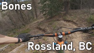
A short single track trail which makes for a great early season flowy addition to a Cemetery lap. The trail is fast and flowy with a couple of rocky features to add spice to your life Also and originally named B Merry.

Access Info

From the bottom of Cemetery, cross the highway. About 200m past the gate you'll see Bones marked on your left hand side off the road. Bones ends on the Wagon Road where you can pedal back to town.

This trail is unsanctioned.

More Stats for Bones mountain bike trail trail
  • Altitude change
    -298 ft
  • Altitude min
    2,539 ft
  • Altitude max
    2,838 ft
  • Altitude start
    2,838 ft
  • Altitude end
    2,539 ft
  • Grade
    -11.5%
  • Grade max
    -42.4%
  • Grade min
    1.6%
  • Distance climb
    59 ft
  • Distance down
    2,352 ft
  • Distance flat
    184 ft
  • Avg time
    00:03:45
  • Avg reverse time
    00:19:00
  • view trail stats
Status:
on Sep 15, 2024
Ideal
Avg: 3.89 (4 votes)
Your vote: 0

view (1,068)
close
3D
Trail Conditions
  • Unknown
  • Snow Groomed
  • Snow Packed
  • Snow Covered
  • Snow Cover Partial
  • Freeze/thaw Cycle
  • Icy
  • Prevalent Mud
  • Wet
  • Variable
  • Ideal
  • Dry
  • Very Dry
Trail Flow (Ridden Direction)
Trailforks scans users ridelogs to determine the most popular direction each trail is ridden. A good flowing trail network will have most trails flowing in a single direction according to their intension.
The colour categories are based on what percentage of riders are riding a trail in its intended direction.
  • > 96%
  • > 90%
  • > 80%
  • > 70%
  • > 50%
  • < 50%
  • bi-directional trail
  • no data
Trail Last Ridden
Trailforks scans ridelogs to determine the last time a trail was ridden.
  • < 2 days
  • < 1 week
  • < 2 weeks
  • < 1 month
  • < 6 months
  • > 6 months
Trail Ridden Direction
The intended direction a trail should be ridden.
  • Downhill Only
  • Downhill Primary
  • Both Directions
  • Uphill Primary
  • Uphill Only
  • One Direction
Contribute Details
Colors indicate trail is missing specified detail.
  • Description
  • Photos
  • Description & Photos
  • Videos
Trail Popularity ?
Trailforks scans ridelogs to determine which trails are ridden the most in the last 9 months. Trails are compared with nearby trails in the same city region with a possible 25 colour shades. Think of this as a heatmap, more rides = more kinetic energy = warmer colors.
  • most popular
  • popular
  • less popular
  • not popular
ATV/ORV/OHV Filter
Max Vehicle Width
inches
US Cell Coverage
Legend
cell carrier legend

Radar Time
x Activity Recordings
Trailforks users anonymized public ridelogs from the past 6 months.
  • mountain biking recent
  • mountain biking (>6 month)
  • hiking (1 year)
  • moto (1 year)
Activity Recordings
Trailforks users anonymized public skilogs from the past 12 months.
  • Downhill Ski
  • Backcountry Ski
  • Nordic Ski
  • Snowmobile
Winter Trails
Warning A routing network for winter maps does not exist. Selecting trails using the winter trails layer has been disabled.
x Missing Trails
Most Popular
Least Popular
Trails are colored based on popularity. The more popular a trail is, the more red. Less popular trails trend towards green.
Jump Magnitude Heatmap
Heatmap of where riders jump on trails. Zoom in to see individual jumps, click circles to view jump details.
Trails Deemphasized
Trails are shown in grey.
disable
Only show trails with NO bikes.
enable

Save the current map location and zoom level as your default home location whenever this page is loaded.

Save
      Directions to bones trailhead (49.074250, -117.779390)
      update trails status or condition

      Bones Trail Reports

      statusdatedescription
      Sep 15, 2024 @ 12:32pm
      Sep 15, 2024
      A couple of trees are down on the lower half of the trail, below the powerline.
      Sep 13, 2024 @ 10:00am
      Sep 13, 2024
      reporter Cleared.
      Sep 6, 2024 @ 10:07am
      Sep 6, 2024
      Multiple trees down on the upper part of the trail.
      Sep 6, 2024 @ 10:05am
      Sep 6, 2024
      Multiple trees down on the upper part of the trail.
      Aug 3, 2024 @ 9:09am
      Aug 3, 2024
      Tree/branches hanging low over the trail in one section above the powerline.
      view all reports »

      Recent Ridelog Activity on Trail

      Past Week
      • 0 rides
      •  
      6 Months
      • 1 rides
      • 9 miles avg distance
      All
      • 65 rides
      • Last: Nov 15, 2024

      Photos

      more »
      1,025 |
      Dec 7, 2018 @ 3:15am
      Dec 7, 2018
      0 |
      Sep 15, 2024 @ 12:33pm
      Sep 15, 2024
      1 |
      Sep 6, 2024 @ 10:05am
      Sep 6, 2024
      1 |
      Sep 6, 2024 @ 10:05am
      Sep 6, 2024

      Routes with this trail

      titledistance
      May Funduro4 miles
      Diana's 60K Ride42 miles

      1 Review & Comments


      We hope you've been enjoying Trailforks!

      Create a FREE account to view trail comments and much more.

      Videos

      more »
      youtuber Bones - Rossland, BC
      2:45 | 227 | Jun 17, 2021 , Rossland
      • #8145 - 2,326 views

      You must enter a description before submitting.