more stats
1,135 ft
Distance
-142 ft
Descent
00:02:54
Avg time
-142 ft
Altitude change
1,504 ft
Altitude min
1,646 ft
Altitude max
1,646 ft
Altitude start
1,506 ft
Altitude end
-12.5%
Grade
-36.7%
Grade max
-0.7%
Grade min
1,073 ft
Distance down
00:02:54
Avg time

Booter Details

  • Activities
    • Dirtbike/Moto
    • E-Bike
  • Riding Area
    Cat Lake
    Squamish, British Columbia
  • Difficulty Rating
  • Local Popularity
    90 in Dirtbiking [+]
    • 65 in E-Biking
  • Global Ranking
    #1069 in Dirtbiking [+]
    • #65385 in E-Biking
  • Trail Type
    Singletrack
  • Direction
    Both Directions
  • Physical Rating
    Easy
  • Trail Visibility
    Always easy to follow
  • eBike Allowed
    Yes up to Class 1

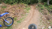
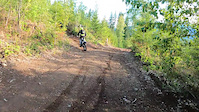
Booter is a short fast flow trail located in the upper Cat Lake SDBA riding area. This trail can be ridden in both directions.

** Tool Cashe containing a rake and shovel for trail maintenance can be found at the top of Booter **

Access Info

Lower access from Skidder Hill and upper access from Triac Spur South at Hayden's trail.

Local Trail Association
Traditionally Indigenous Territory

Recent Activity on Trail

Past Week
  • 2 rides
  • 33 miles average
6 Months
  • 19 rides
  • 16 miles avg distance
All
  • 412 rides
  •  
c1c2c3c4
January
February
March
April
May
June
July
August
September
October
November
December
Status:
on Nov 2, 2025
Variable
Avg: 4 (2 votes)
Your vote: 0

view (790)
close
3D
Trail Conditions
  • Unknown
  • Snow Groomed
  • Snow Packed
  • Snow Covered
  • Snow Cover Partial
  • Freeze/thaw Cycle
  • Icy
  • Prevalent Mud
  • Wet
  • Variable
  • Ideal
  • Dry
  • Very Dry
Trail Flow (Ridden Direction)
Trailforks scans users ridelogs to determine the most popular direction each trail is ridden. A good flowing trail network will have most trails flowing in a single direction according to their intension.
The colour categories are based on what percentage of riders are riding a trail in its intended direction.
  • > 96%
  • > 90%
  • > 80%
  • > 70%
  • > 50%
  • < 50%
  • bi-directional trail
  • no data
Trail Last Ridden
Trailforks scans ridelogs to determine the last time a trail was ridden.
  • < 2 days
  • < 1 week
  • < 2 weeks
  • < 1 month
  • < 6 months
  • > 6 months
Trail Ridden Direction
The intended direction a trail should be ridden.
  • Downhill Only
  • Downhill Primary
  • Both Directions
  • Uphill Primary
  • Uphill Only
  • One Direction
Contribute Details
Colors indicate trail is missing specified detail.
  • Description
  • Photos
  • Description & Photos
  • Videos
Trail Popularity ?
Trailforks scans ridelogs to determine which trails are ridden the most in the last 9 months. Trails are compared with nearby trails in the same city region with a possible 25 colour shades. Think of this as a heatmap, more rides = more kinetic energy = warmer colors.
  • most popular
  • popular
  • less popular
  • not popular
ATV/ORV/OHV Filter
Max Vehicle Width
inches
US Cell Coverage
Legend
cell carrier legend

Radar Time
Activity Recordings
Trailforks uses anonymized public activity data. ?
Activity Recordings
Trailforks uses anonymized public activity data. ?
Personal Heatmap
Activity Types
all / none
Options
2
Date range month
Winter Trails
Warning A routing network for winter maps does not exist. Selecting trails using the winter trails layer has been disabled.
Missing Trails
Most Popular
Least Popular
Trails are colored based on popularity. The more popular a trail is, the more red. Less popular trails trend towards green.
Jump Magnitude Heatmap
Heatmap of where riders jump on trails. Zoom in to see individual jumps, click circles to view jump details.
BC Backroad Status

Service Road Atlas is a free to use, community-driven service for viewing and creating reports on the numerous back-country service roads around B.C. and Alberta.

map legend
Slope Aspect
Direction the slope faces
Flat N NE E SE S SW W NW
Trails Deemphasized
Trails are shown in grey.
disable
Only show trails with no bike usage.
Enable
Suggested Layers
Based on selected activity type

    Save the current map location and zoom level as your default home location whenever this page is loaded.

    Save
        Directions to booter trailhead (49.800010, -123.097390)

        Photos

        No photos have been added for Booter yet, add a photo.

        Videos

        2 more »
        Booter Descent
        0:53 | 91 | May 22, 2021 , Squamish
        Booter Ascent
        0:50 | 61 | May 22, 2021 , Squamish

        Routes with this trail

        2.5 6 miles 1,504 ft 19 Loop
        Proposed 2021 Member Appreciation Fun Ride B-Loop Route
        6 miles 1,526 ft 20 Loop
        Cat lake loop - all blue trails with some sort green/road connectors.
        5 miles 1,277 ft 15 Loop
        Proposed 2021 Member Appreciation Fun Ride B-Loop Route

        Reviews / Comments

        No reviews yet, be the first to write a review or ask a question.
        Use trail reports to comment on trail conditions.


        We hope you've been enjoying Trailforks!

        Create a FREE account to view trail comments and much more.

        Frequently Asked Questions About Booter

        Where is Booter located?
        Booter is located in Cat Lake, Squamish, British Columbia, Canada. It is part of the Cat Lake trail network. The trailhead is located at coordinates 49.80001, -123.09739.
        How hard is Booter?
        Booter is rated as Blue difficulty. The physical rating is Easy. The average grade is 12.5%.
        What is the elevation gain for Booter?
        The trail has 43 m of elevation descent. The elevation ranges from 459 m to 502 m.
        Is Booter a point to point trail?
        Booter is not a point to point trail. The direction is Both Directions. The trail type is singletrack.

        Hit the Trail

        Open in App

        Get this trail on your phone instantly.
        open trail in app

        Download Trail

        Save to wishlist, Garmin & download.
        save the trail

        Find Related Routes

        Find routes and users activities that include this trail.
        find routes for this trail

        You must enter a description before submitting.