1.3 miles
Distance
68 ft
Climb
-1,305 ft
Descent
00:09:09
Avg time

Bräckebäcksleden Details

  • Activities
    • Mountain Bike
  • Riding Area
  • AKA
    Bräcke
  • Difficulty Rating
  • Voted Difficulty
    Red (1 vote)
  • Trail Type
    Singletrack
  • Bike Type
    DH
  • Direction
    Downhill Only
    Popular direction shown
  • Physical Rating
    Moderate
  • Dogs Allowed
    Yes
  • TTFs on Trail
    Bridge, Ladder Bridge, Other
  • Global Ranking
    #5486 in Mountain Biking
  • Local Popularity
    55 in Mountain Biking

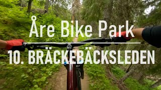
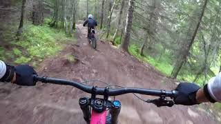
Skandinaviens vackraste singletrack? En böljande stig i perfekt jord som slingrar sig genom en lummig fjällbjörksskog, förbi magiska vattenfall, porlande bäckar och fortsätter i all evighet ända ner till VM8:ans dalstation. 400 fallhöjdsmeter av den finaste cykling som går att finna.

Bike Park

Traditionally Indigenous Territory
More Stats for Bräckebäcksleden mountain bike trail trail
  • Altitude change
    -1,238 ft
  • Altitude min
    1,331 ft
  • Altitude max
    2,600 ft
  • Altitude start
    2,569 ft
  • Altitude end
    1,332 ft
  • Grade
    -17.9%
  • Grade max
    -77.1%
  • Grade min
    16.1%
  • Distance climb
    997 ft
  • Distance down
    4,669 ft
  • Distance flat
    1,263 ft
  • Avg time
    00:09:09
  • Avg reverse time
    00:23:57
  • view trail stats
Status:
on Jun 30, 2023
Variable
Avg: 4.8 (19 votes)
Your vote: 0

view (1,852)
close
3D
Trail Conditions
  • Unknown
  • Snow Groomed
  • Snow Packed
  • Snow Covered
  • Snow Cover Partial
  • Freeze/thaw Cycle
  • Icy
  • Prevalent Mud
  • Wet
  • Variable
  • Ideal
  • Dry
  • Very Dry
Trail Flow (Ridden Direction)
Trailforks scans users ridelogs to determine the most popular direction each trail is ridden. A good flowing trail network will have most trails flowing in a single direction according to their intension.
The colour categories are based on what percentage of riders are riding a trail in its intended direction.
  • > 96%
  • > 90%
  • > 80%
  • > 70%
  • > 50%
  • < 50%
  • bi-directional trail
  • no data
Trail Last Ridden
Trailforks scans ridelogs to determine the last time a trail was ridden.
  • < 2 days
  • < 1 week
  • < 2 weeks
  • < 1 month
  • < 6 months
  • > 6 months
Trail Ridden Direction
The intended direction a trail should be ridden.
  • Downhill Only
  • Downhill Primary
  • Both Directions
  • Uphill Primary
  • Uphill Only
  • One Direction
Contribute Details
Colors indicate trail is missing specified detail.
  • Description
  • Photos
  • Description & Photos
  • Videos
Trail Popularity ?
Trailforks scans ridelogs to determine which trails are ridden the most in the last 9 months. Trails are compared with nearby trails in the same city region with a possible 25 colour shades. Think of this as a heatmap, more rides = more kinetic energy = warmer colors.
  • most popular
  • popular
  • less popular
  • not popular
ATV/ORV/OHV Filter
Max Vehicle Width
inches
US Cell Coverage
Legend
cell carrier legend

Radar Time
x Activity Recordings
Trailforks users anonymized public ridelogs from the past 6 months.
  • mountain biking recent
  • mountain biking (>6 month)
  • hiking (1 year)
  • moto (1 year)
Activity Recordings
Trailforks users anonymized public skilogs from the past 12 months.
  • Downhill Ski
  • Backcountry Ski
  • Nordic Ski
  • Snowmobile
Winter Trails
Warning A routing network for winter maps does not exist. Selecting trails using the winter trails layer has been disabled.
x Missing Trails
Most Popular
Least Popular
Trails are colored based on popularity. The more popular a trail is, the more red. Less popular trails trend towards green.
Jump Magnitude Heatmap
Heatmap of where riders jump on trails. Zoom in to see individual jumps, click circles to view jump details.
Trails Deemphasized
Trails are shown in grey.
disable
Only show trails with NO bikes.
enable

Save the current map location and zoom level as your default home location whenever this page is loaded.

Save
      Directions to brackebacksleden trailhead (63.416220, 13.054310)
      update trails status or condition

      Bräckebäcksleden Trail Reports

      Recent Ridelog Activity on Trail

      Past Week
      • 0 rides
      •  
      6 Months
      • 0 rides
      •  
      All
      • 1,354 rides
      • Last: Sep 21, 2023

      Photos

      more »
      56 |
      Sep 7, 2020 @ 5:51am
      Sep 7, 2020
      3,462 |
      Nov 27, 2019 @ 12:23am
      Nov 27, 2019
      131 |
      Jul 8, 2018 @ 10:04am
      Jul 8, 2018
      242 |
      Jul 17, 2016 @ 12:22pm
      Jul 17, 2016

      Routes with this trail

      titledistance
      Jörgens Megameny8 miles
      Jörgens Plusmeny featured4 miles
      SS1 Bräckebäcksleden5,026 ft

      1 Review & Comments


      We hope you've been enjoying Trailforks!

      Create a FREE account to view trail comments and much more.

      Videos

      more »
      Åre Bike Park - 10. Bräckebäcksleden
      6:34 | 266 | Aug 9, 2021 , Åre
      Åre Bräckebäcksleden
      4:54 | 431 | Sep 4, 2018 , Åre
      Mountain Mayhem
      18:02 | 307 | Aug 10, 2008 , Åre
      • By maciek1998 & contributors
      • #50298 - 2,612 views

      You must enter a description before submitting.