more stats
722 ft
Distance
3 ft
Climb
-54 ft
Descent
00:01:46
Avg time
-52 ft
Altitude change
958 ft
Altitude min
1,012 ft
Altitude max
1,010 ft
Altitude start
958 ft
Altitude end
-7.1%
Grade
-18.6%
Grade max
3.6%
Grade min
85 ft
Distance climb
548 ft
Distance down
89 ft
Distance flat
00:01:46
Avg time

BrightSide Details

  • Activities
    • Mountain Bike
    • Hike
    • Trail Running
    • Snowshoe
  • Riding Area
    Jefferson Forest
    Richmond Hill, Ontario
  • Difficulty Rating
  • Voted Difficulty
    Double Black Diamond (2 votes)
  • Local Popularity
    75 in Mountain Biking [+]
    • 5 in Trail Running
    • 60 in Hiking
    • 5 in Snowshoeing
  • Global Ranking
    #36256 in Mountain Biking [+]
    • #61409 in Trail Running
    • #50792 in Hiking
    • #1601 in Snowshoeing
  • Trail Type
    Singletrack
  • Bike Type
    DH, AM
  • Direction
    Downhill Only
    Popular Direction Shown
  • Climb Difficulty
    Green
  • Physical Rating
    Hard
  • Season
    April - October
  • Dogs Allowed
    Yes
  • eBike Allowed
  • TTFs on Trail
    Drop, Jump, Gap Jump
  • Land Owner
    Toronto Region Conservation Authority

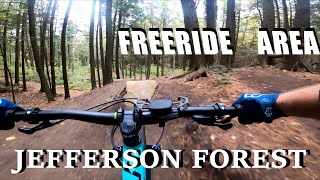
Jumps and Drops. Downhill/AM Bike Primary Trail.

DOWNHILL NOTE: Features Gap Jumps, highly recommend to walk through before riding downhill.

*trail was built to be ridden brakeless and can be ridden on a dirtjump bike .

This trail is unsanctioned.

Recent Activity on Trail

Past Week
  • 3 rides
  • 9 miles average
6 Months
  • 11 rides
  • 13 miles avg distance
All
  • 580 rides
  • Last: Jun 3, 2026
c1c2c3c4
January
February
March
April
May
June
July
August
September
October
November
December
update trails status or condition

BrightSide Trail Reports

statusdatedescription
Apr 13, 2026 @ 1:58pm (America/Toronto)
Apr 13, 2026
Major erosion (major ruts or slumping, large boulders and roots exposed due to erosion)
Sep 10, 2025 @ 12:01pm
Sep 10, 2025
May 4, 2025 @ 10:13am
May 4, 2025
Tree Large tree down across trail, blocking trail
Oct 28, 2023 @ 5:47pm
Oct 28, 2023
Tree down across the first feature
Jun 22, 2023 @ 7:44am
Jun 22, 2023
more »
Status:
on Apr 13, 2026
Variable
Avg: 4.45 (7 votes)
Your vote: 0

view (2,199)
close
3D
Trail Conditions
  • Unknown
  • Snow Groomed
  • Snow Packed
  • Snow Covered
  • Snow Cover Partial
  • Freeze/thaw Cycle
  • Icy
  • Prevalent Mud
  • Wet
  • Variable
  • Ideal
  • Dry
  • Very Dry
Trail Flow (Ridden Direction)
Trailforks scans users ridelogs to determine the most popular direction each trail is ridden. A good flowing trail network will have most trails flowing in a single direction according to their intension.
The colour categories are based on what percentage of riders are riding a trail in its intended direction.
  • > 96%
  • > 90%
  • > 80%
  • > 70%
  • > 50%
  • < 50%
  • bi-directional trail
  • no data
Trail Last Ridden
Trailforks scans ridelogs to determine the last time a trail was ridden.
  • < 2 days
  • < 1 week
  • < 2 weeks
  • < 1 month
  • < 6 months
  • > 6 months
Trail Ridden Direction
The intended direction a trail should be ridden.
  • Downhill Only
  • Downhill Primary
  • Both Directions
  • Uphill Primary
  • Uphill Only
  • One Direction
Contribute Details
Colors indicate trail is missing specified detail.
  • Description
  • Photos
  • Description & Photos
  • Videos
Trail Popularity ?
Trailforks scans ridelogs to determine which trails are ridden the most in the last 9 months. Trails are compared with nearby trails in the same city region with a possible 25 colour shades. Think of this as a heatmap, more rides = more kinetic energy = warmer colors.
  • most popular
  • popular
  • less popular
  • not popular
ATV/ORV/OHV Filter
Max Vehicle Width
inches
US Cell Coverage
Legend
cell carrier legend

Radar Time
Activity Recordings
Trailforks uses anonymized public activity data. ?
Activity Recordings
Trailforks uses anonymized public activity data. ?
Personal Heatmap
Activity Types
all / none
Options
2
Date range month
Winter Trails
Warning A routing network for winter maps does not exist. Selecting trails using the winter trails layer has been disabled.
Missing Trails
Most Popular
Least Popular
Trails are colored based on popularity. The more popular a trail is, the more red. Less popular trails trend towards green.
Jump Magnitude Heatmap
Heatmap of where riders jump on trails. Zoom in to see individual jumps, click circles to view jump details.
BC Backroad Status

Service Road Atlas is a free to use, community-driven service for viewing and creating reports on the numerous back-country service roads around B.C. and Alberta.

map legend
Slope Aspect
Direction the slope faces
Flat N NE E SE S SW W NW
Trails Deemphasized
Trails are shown in grey.
disable
Only show trails with no bike usage.
Enable
Suggested Layers
Based on selected activity type

    Save the current map location and zoom level as your default home location whenever this page is loaded.

    Save
        Directions to brightside trailhead (43.934870, -79.424630)

        Photos

        4 more »
        88 |
        Apr 1, 2024 @ 2:32pm
        Apr 1, 2024
        64 |
        Apr 1, 2024 @ 2:31pm
        Apr 1, 2024
        493 |
        Sep 18, 2020 @ 11:42pm
        Sep 18, 2020
        446 |
        Aug 3, 2019 @ 7:03am
        Aug 3, 2019

        Videos

        6 more »
        youtuber Freeride never dies! | Mountain Biking at...
        5:56 | 1728 | Jul 15, 2019 , Richmond Hill
        Jefferson Forest - Freeride area, Brightside...
        9:54 | 440 | Oct 25, 2021 , Richmond Hill
        BrightSide Full Trail at Jefferson Forest +...
        0:07 | 937 | Sep 12, 2020 , Richmond Hill
        BrightSide POV Raw | Jefferson Forest MTB
        0:44 | 253 | Jul 6, 2022 , Richmond Hill

        Routes with this trail

        5.0 36 miles 2,466 ft 126
        The Jeffy Whole Enchillada is an endurance route to complete every singletrack trail in Jefferson Forest...
        9 miles 744 ft 33 Point to Point
        Section 3 of The Jeffy Whole Enchillada. This section includes some of the quick downhill runs in the...

        14 Reviews & Comments


        We hope you've been enjoying Trailforks!

        Create a FREE account to view trail comments and much more.

        • #30655 - 4,304 views

        Frequently Asked Questions About BrightSide

        Where is BrightSide located?
        BrightSide is located in Jefferson Forest, Richmond Hill, Ontario, Canada. It is part of the Jefferson Forest trail network. The trailhead is located at coordinates 43.93487, -79.42463.
        How hard is BrightSide?
        BrightSide is rated as Double Black Diamond difficulty. The physical rating is Hard. The average grade is 7.1%. The climb difficulty is rated Green.
        What is the elevation gain for BrightSide?
        BrightSide has 1 m of elevation gain. The trail has 17 m of elevation descent. The elevation ranges from 292 m to 309 m.
        Is BrightSide a point to point trail?
        Yes, BrightSide is a point to point trail. The direction is Downhill Only. The trail type is singletrack.

        Hit the Trail

        Open in App

        Get this trail on your phone instantly.
        open trail in app

        Download Trail

        Save to wishlist, Garmin & download.
        save the trail

        Find Related Routes

        Find routes and users activities that include this trail.
        find routes for this trail

        You must enter a description before submitting.