more stats
1.8 miles
Distance
1,454 ft
Climb
00:47:27
Avg time
1,454 ft
Altitude change
1,231 ft
Altitude min
2,685 ft
Altitude max
1,231 ft
Altitude start
2,684 ft
Altitude end
15%
Grade
-1.3%
Grade max
54.8%
Grade min
2 miles
Distance climb
13 ft
Distance down
335 ft
Distance flat
00:47:27
Avg time

Cadillac Details

  • Activities
    • Mountain Bike
    • Gravel Bike
    • Adaptive Bike
    • Hike
    • Trail Running
  • Riding Area
    Cleveland National Forest
    Mission Viejo, California
  • Difficulty Rating
  • Local Popularity
    30 in Mountain Biking [+]
    • 60 in Trail Running
    • 70 in Hiking
    • 5 in Adaptive Biking
    • 50 in Gravel Biking
  • Trail Type
    Doubletrack
  • Bike Type
    AM, XC, Adaptive MTB, Gravel
  • Climb Difficulty
    Black Diamond
  • Physical Rating
    Extreme
  • Season
    Year Round
  • Dogs Allowed
    Yes
  • TTFs on Trail
    Drop, Rock Face
  • Land Owner
    Cleveland National Forest (Trabuco District)

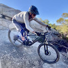
This is the super steep, horribly eroded with huge ruts jeep trail that links STT with Trabuco Creek.

Tags
DropsRock slabs
Local Trail Association
Traditionally Indigenous Territory

Recent Activity on Trail

Past Week
  • 0 rides
  •  
6 Months
  • 1 rides
  • 9 miles avg distance
All
  • 18 rides
  • Last: Sep 27, 2026
update trails status or condition

Cadillac Trail Reports

statusdatedescription
Feb 7, 2026 @ 2:05pm (America/Los_Angeles)
Feb 7, 2026
It's a challenging climb with loose and steep sections. If you're on an analog bike, prepare to hike-a-bike.
Nov 23, 2024 @ 4:25pm
Nov 23, 2024
Tragically this trail has been graded into a double track fire break as a result the airport fires.
Jun 11, 2024 @ 9:27am
Jun 11, 2024
Rode downhill, some loose and shale spots but still single black imo.
Nov 12, 2022 @ 8:29am
Nov 12, 2022
Washed out sections very steep downhills and very technical with the new ruts not a fun downhill but I consider it an accomplishment. I might even...
Jan 8, 2022 @ 1:22pm
Jan 8, 2022
more »
Status:
on Feb 7, 2026
Unknown
Avg: 2.79 (10 votes)
Your vote: 0

view (579)
close
      Directions to cadillac trailhead (33.671710, -117.559160)

      Photos

      4 more »
      mtb
      136 |
      May 24, 2023 @ 9:32pm
      May 24, 2023
      mtb
      140 |
      May 24, 2023 @ 9:32pm
      May 24, 2023
      mtb
      150 |
      May 24, 2023 @ 9:31pm
      May 24, 2023
      mtb
      521 |
      Dec 17, 2015 @ 4:05pm
      Dec 17, 2015

      Videos

      no videos have been added for Cadillac yet, add a video.
      1.7 ★★★★★
      10 Ratings
      5 ★
      4 ★ 20%
      3 ★
      2 ★ 10%
      1 ★ 70%

      6 Reviews & Comments

      JacksonFCDQ7H
      i thought this would be a easy way to the luge from rsm its not. Worst climb
      bobasurf
      This trail down is a total sh*t-show — in a good way. We used to do it a few times every year as the finale to a Holy Jim > Joplin > Cadillac loop. I hadn’t ridden it in 6 years but tried it today as part of an O’Neill > STT > Cadillac eBike loop. It was in the best shape I have ever seen it and I scored an easy clean down it. It was harder “back in the day” and we called it an “MTB chess game,” since line selection is/was so critical on it and it was a 50/50 chance of cleaning it on any given (winter, post-rain) day. Go give it a try now while it’s still tacky! Look ror ridges between the ruts that are “polished” (lighter in color), as those indicate the routes the motos chose as an up.
      rideagainsthemachine rideagainsthemachine
      It’s an accomplishment cleaning this on the EB, and on the regular bike, it’s just a huge pain in the ass. I’ve been riding it up it a couple times when a moto came by and was having a tough time. f*ck this trail. Unless it’s the shortcut you’re looking for to climb Joplin (which is way more fun than climbing this POS trail) or you just want to try a different way to access the Luge, I’d recommend pretty much anything else.

      We hope you've been enjoying Trailforks!

      Create a FREE account to view all trail reviews and much more.

      • By ericfoltzTF Pro TRAILFORKS & contributors
      • #51961 - 5,251 views

      Frequently Asked Questions

      ▼ Where is Cadillac located?
      Cadillac is located in Cleveland National Forest, Mission Viejo, California, United States. It is part of the Cleveland National Forest trail network. The trailhead is located at coordinates 33.67171, -117.55916.
      ▼ What is the elevation gain for Cadillac?
      Cadillac has 1,454 ft of elevation gain. The elevation ranges from 1,231 ft to 2,685 ft.
      ▼ How long is Cadillac?
      Cadillac is 1.8 miles long. The trail type is doubletrack.
      ▼ Are dogs allowed on Cadillac?
      Yes, dogs are allowed on Cadillac. Please keep dogs on a leash where required and clean up after them.
      ▼ When is the best time of year to ride Cadillac?
      Cadillac is best visited during: Year Round.
      ▼ How do I access Cadillac? Where is the closest parking trailhead?
      The closest parking and trailhead locations to Cadillac are: View all parking locations in the area.
      ▼ How long does it take to ride Cadillac?
      Based on recorded activities, it takes an average of 47 minutes to ride Cadillac. The trail is 1.8 miles long. Actual times will vary based on fitness level, conditions, and pace. View recent activity logs for more details.
      ▼ How busy is Cadillac?
      Cadillac is a less popular trail with lighter traffic. There have been 543 recorded activities on this trail. The trail has received 579 check-ins. View recent activity on this trail.

      Hit the Trail

      Open in App

      Get this trail on your phone instantly.

      open trail in app

      Download Trail

      Save to wishlist, Garmin & download.
      save the trail

      Find Related Routes

      Find routes and users activities that include this trail.
      find routes for this trail

      You must enter a description before submitting.