close
-
Layers w
- Weather Layers
- Pro
- Pro
- Pro
- Pro
- Pro
- Pro
- More Layers
- Pro
- Pro
- Pro
- Pro
-
Upgrade to

3D
Trail Conditions
- Unknown
- Snow Groomed
- Snow Packed
- Snow Covered
- Snow Cover Partial
- Freeze/thaw Cycle
- Icy
- Prevalent Mud
- Wet
- Variable
- Ideal
- Dry
- Very Dry
Trail Flow (Ridden Direction)
Trailforks scans users ridelogs to determine the most popular direction each trail is ridden. A good flowing trail network will have most trails flowing in a single direction according to their intension.
The colour categories are based on what percentage of riders are riding a trail in its intended direction.
The colour categories are based on what percentage of riders are riding a trail in its intended direction.
- > 96%
- > 90%
- > 80%
- > 70%
- > 50%
- < 50%
- bi-directional trail
- no data
Trail Last Ridden
Trailforks scans ridelogs to determine the last time a trail was ridden.
- < 2 days
- < 1 week
- < 2 weeks
- < 1 month
- < 6 months
- > 6 months
Trail Ridden Direction
The intended direction a trail should be ridden.
- Downhill Only
- Downhill Primary
- Both Directions
- Uphill Primary
- Uphill Only
- One Direction
Contribute Details
Colors indicate trail is missing specified detail.
- Description
- Photos
- Description & Photos
- Videos
Trail Popularity ?
Trailforks scans ridelogs to determine which trails are ridden the most in the last 9 months.
Trails are compared with nearby trails in the same city region with a possible 25 colour shades.
Think of this as a heatmap, more rides = more kinetic energy = warmer colors.
- most popular
- popular
- less popular
- not popular
ATV/ORV/OHV Filter
Max Vehicle Width
inches
US Cell Coverage
Legend

Radar Time
Activity Recordings
Trailforks uses anonymized public activity data.
?
Activity Recordings
Trailforks uses anonymized public activity data.
?
Personal Heatmap
▶
Activity Types
all
/
none
▶
Options
2
Date range
month
–
Winter Trails
Warning
A routing network for winter maps does not exist. Selecting trails using the winter trails layer has been disabled.
Missing Trails
Most Popular
Least Popular
Trails are colored based on popularity. The more popular a trail is, the more red. Less popular trails trend towards green.
Jump Magnitude Heatmap
Heatmap of where riders jump on trails. Zoom in to see individual jumps, click circles to view jump details.
BC Backroad Status
![map legend]()
Service Road Atlas is a free to use, community-driven service for viewing and creating reports on the numerous back-country service roads around B.C. and Alberta.

Slope Aspect
Direction the slope faces
Trails Deemphasized
Trails are shown in grey.
Only show trails with no bike usage.
Suggested Layers
Based on selected activity type
Save the current map location and zoom level as your default home location whenever this page is loaded.
SavePopular Trail Networks
view all areas »
No description for Orange County has been added yet!
Login or register to submit one.
Activities Click to view
- Mountain Bike
1,003 trails
- E-Bike
169 trails
- Horse
217 trails
- Hike
995 trails
- Trail Running
984 trails
- Dirtbike/Moto
9 trails
Stats
- Avg Trail Rating
- Trails (view details)
- 1,000
- Trails Mountain Bike
- 1,003
- Trails E-Bike
- 169
- Trails Gravel Bike
- 6
- Trails Adaptive Bike
- 5
- Trails Winter Fat Bike
- 10
- Trails Horse
- 217
- Trails Hike
- 995
- Trails Trail Running
- 984
- Trails Dirtbike/Moto
- 9
- Trails Observed Trials
- 1
- Trails ATV/ORV/OHV
- 1
- Trails Snowmobile
- 1
- Trails Snowshoe
- 1
- Trails Downhill Ski
- 1
- Trails Backcountry Ski
- 1
- Trails Nordic Ski
- 2
- Total Distance
- 1,016 miles
- Total Descent
- 205,167 ft
- Total Vertical
- 5,666 ft
- Highest Trailhead
- 5,668 ft
- Reports
- 13,916
- Photos
- 4,307
- Ridden Counter
- 336,220
Sub Regions
- Aliso Viejo (68)
- Anaheim Hills (15)
- Brea (6)
- Coto De Caza (1)
- Dana Point (3)
- Foothill Ranch (24)
- Fullerton (10)
- Fullerton (15)
- Huntington Beach (3)
- Irvine (70)
- Irvine Open Space (26)
- Irvine Ranch Open Space (40)
- Ladera Ranch (97)
- Laguna Beach (66)
- Laguna Hills (2)
- Laguna Niguel (5)
- Lake Forest (28)
- Las Flores (1)
- Mission Viejo (229)
- Newport Beach (1)
- Orange (130)
- Portola Hills (1)
- Rancho Mission Viejo (2)
- Rancho Santa Margarita (1)
- San Clemente (129)
- San Onofre (126)
- San Juan Capistrano (84)
- Santa Ana (2)
- Trabuco Canyon (6)
- Yorba Linda (8)
- Dog Park (43)
- Gypsum Canyon Wilderness (14)
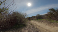
Popular Orange County Mountain Biking Trails
• 100 ★ 3.2 • 2,031 ft • 266 ft • 2,567 •
Short, technical, singletrack climb with lots of switchbacks and rock faces Beginning June 1, 2021, this trail will be uphill only for Mountain Bikes remain bidirectional for all users. The trail will be edited at that time to reflect...
• 100 ★ 4.1 • 1 mile • 10 ft • 2,357 •
Coming from the Newport side, the trail starts with a pretty technical downhill section (not beginner friendly). There are some man-made rock gardens with an optional easier dirt line. A couple small optional man made jumps as well....
• 100 ★ 4.3 • 3,916 ft • 55 ft • 2,113 •
Starting June 1st, 2021 trail is DH MTB only as part of OC Parks Trail Pilot Project. Please gently remind all other users to contact OC Parks with feedback when informing them of the trail designation. Primary attraction of Santiago...
• 100 ★ 4.5 • 1 mile • 155 ft • 2,068 •
Long, rocky, technical downhill for trail/DH riders and advanced XC riders. Top section is very loose, rocky and chunky giving way to flow lines mixed with patches of rocky sections further down.
• 100 ★ 4.1 • 3,504 ft • 47 ft • 2,056 •
Fun little trail usually approached from morro ridge road with a slight climb up where there is a sort of lookout over the entire park, beautiful view all the way to the ocean. then you drop down a fun descent that is fast and swoopy,...
Orange County Mountain Bike Routes
★ 3.0 • 8 miles • 1,384 ft • 2 •
The Luge is a long climb to a gnarlier descent. It isn’t part of any official wilderness park but is a...
★ 3.3 • 12 miles • 953 ft • 7 •
Fullerton Loop as taught to me by Primo
6 miles • 670 ft • 6 • Loop •
Whiting Ranch Wilderness Park encompasses approximately 2,500 acres of riparian and oak woodland canyons,...
★ 5.0 • 8 miles • 1,362 ft • 3 •
Ride The Luge like a local! Start at the parking lot and go right on S18. Continue until you turn right...
★ 5.0 • 16 miles • 3,415 ft • 1 • Loop •
Maple Springs is a long, tedious climb. Although, it isn't very steep it can get very hot during the...
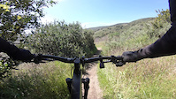
Photos of Orange County Mountain Bike
Videos of Orange County Mountain Bike
trail: Beer Run
0:13 |
9 |
May 25, 2026

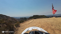
trail: Chutes Ridgeline
3:35 |
13 |
Jan 4, 2026
trail: Chutes Ridgeline
2:51 |
7 |
Jan 2, 2026
trail: Car Crash
0:11 |
46 |
Aug 6, 2025

trail: Block Trail (Troy Lee)
0:01 |
|
Jul 27, 2024
trail: The Luge
3:35 |
49 |
Jul 9, 2024
trail: Block Trail (Troy Lee)
0:07 |
51 |
Mar 27, 2024
trail: Meadows Trail
0:23 |
|
Mar 26, 2024
Current Trail Warnings
| status | trail | date | condition | user | info |
|---|---|---|---|---|---|
| Crossfire Tijeras Creek Trails | Jun 27, 2026 @ 9:26am (America/Los_Angeles) Jun 27, 2026 | Wet | hoodaman | E-Bike Bridge is out. Shoes are gonna get wet !... | |
| Late for Dinner Las Ramblas | Jun 22, 2026 @ 7:21pm (America/Los_Angeles) Jun 22, 2026 | Unknown | ARSuperstar | The bottom of the trail runs into a... | |
| Old Main Divide Cleveland National Forest | Jun 10, 2026 @ 5:17pm (America/Los_Angeles) Jun 10, 2026 | Ideal | darshahlu WSMTBC | Overgrown with toxic poodle dog bush. I... |
Recent Trail Reports
Activity Feed
| username | action | type | title | date |
|---|---|---|---|---|
| trailforks | add | video | activity #98827273 | Jul 9, 2026 @ 7:00pm 7 hours |
| TheEarl | add | karma | activity #98702955 | Jul 8, 2026 @ 4:29am 2 days |
| 8jyQ57 | wishlist | region | activity #98693700 | Jul 7, 2026 @ 11:35pm 2 days |
| claussm | add | report | activity #98693084 | Jul 7, 2026 @ 11:14pm 2 days |
| claussm | add | report | activity #98693082 and 4 more | Jul 7, 2026 @ 11:14pm 2 days |
Recent Comments
| username | type | title | comment | date |
|---|---|---|---|---|
| trail | I love this trail and I wish it was longer and... | Jul 1, 2026 @ 5:10pm Jul 1, 2026 | ||
| trail | I would call this a Blue + to use a rough... | Jul 1, 2026 @ 5:08pm Jul 1, 2026 | ||
| trail | PSA: This is a bi-directional fire road trail,... | Jun 28, 2026 @ 7:44am Jun 28, 2026 | ||
| trail | This trail is no longer accessible. It’s... | Jun 22, 2026 @ 8:07pm Jun 22, 2026 | ||
| trail | i thought this would be a easy way to the luge... | Jun 17, 2026 @ 3:26pm Jun 17, 2026 |
Local Badges
-
Good Dirt Ride0 awarded -

Climbing 10k Badge18 awarded -

Descent 100k Badge1 awarded -

Climbing 100k Badge1 awarded -

Epic Ride Descent 2k3 awarded -

Descent 10k Badge18 awarded
Bike & Skill Parks
| name | type | city | rating |
|---|---|---|---|
| Sheep Hills BMX Park | skill park | ||
| Secret Spot Dirt Jumps | skill park | Laguna Niguel | |
| San Juan Hills Dirt Jumps | skill park | San Juan Capistrano | |
| Dragon Jumps | skill park | San Juan Capistrano | |
| Orange Y BMX | skill park |
Upcoming Local Events
Local Trail Association
-
")
Local Trail Association
Activity Type Stats
| activitytype | trails | distance | descent | descent distance | total vertical | rating | global rank | state rank | photos | reports | routes | ridelogs |
|---|---|---|---|---|---|---|---|---|---|---|---|---|
| Mountain Bike | 1,003 | 968 miles | 201,647 ft | 443 miles | 5,666 ft | 4,355 | 13,896 | 146 | 417,422 | |||
| E-Bike | 169 | 179 miles | 29,045 ft | 79 miles | 5,659 ft | 53 | 11,450 | 10 | 56,266 | |||
| Gravel Bike | 6 | 2 | 21 | 5 | 1,971 | |||||||
| Adaptive Bike | 5 | 8 | 7 | |||||||||
| Winter Fat Bike | 10 | 12 | 3 | |||||||||
| Horse | 217 | 208 miles | 32,231 ft | 88 miles | 5,584 ft | 2,737 | 1 | 39 | ||||
| Hike | 995 | 995 miles | 191,398 ft | 441 miles | 5,666 ft | 22 | 13,705 | 26 | 17,336 | |||
| Trail Running | 984 | 990 miles | 189,846 ft | 438 miles | 5,666 ft | 28 | 13,681 | 21 | 13,591 | |||
| Dirtbike/Moto | 9 | 12 miles | 997 ft | 3 miles | 5,341 ft | 2,380 | 2 | 44 | ||||
| Observed Trials | 1 | 3,373 ft | 62 ft | 1,952 ft | 59 ft | 8 | 22 | |||||
| ATV/ORV/OHV | 1 | 3,373 ft | 62 ft | 1,952 ft | 59 ft | 1 | 2,377 | 49 | ||||
| Snowmobile | 1 | 3,373 ft | 62 ft | 1,952 ft | 59 ft | 3 | ||||||
| Snowshoe | 1 | 3,373 ft | 62 ft | 1,952 ft | 59 ft | 22 | 4 | |||||
| Downhill Ski | 1 | 3,373 ft | 62 ft | 1,952 ft | 59 ft | 42 | ||||||
| Backcountry Ski | 1 | 3,373 ft | 62 ft | 1,952 ft | 59 ft | 11 | 52 | |||||
| Nordic Ski | 2 | 1 mile | 112 ft | 4,012 ft | 171 ft | 2 | 7 |
Frequently Asked Questions About Orange County
▼
What are the best places to ride in Orange County?
Orange County has 32 areas to explore for mountain biking. The top rated areas are:
▼
What are the highest rated mountain biking trails in Orange County?
The highest rated mountain biking trails in Orange County are:
- Sloppy Seconds (4.6/5)
- Waterworks (4.5/5)
- San Juan (4.5/5)
- Car Wreck (4.5/5)
- 5 Oaks (4.5/5)
▼
What is the best time of the year to ride in Orange County?
Based on ride log data, the most popular months to ride in Orange County are:
- July (2,783 activities)
- May (2,034 activities)
- June (1,908 activities)
▼
What is the longest trail in Orange County?
The longest trail in Orange County is Santa Ana River Trail (Orange County) at 29.2 miles. View all trails sorted by distance.
Activities
Trails
- By rc4andrew & contributors
- Admins: jpmcghee, sanfret, brianpetry, OCMTBA
- #4117 - 65,197 views
- orange county activity log | embed map of Orange County mountain bike trails | orange county mountain biking points of interest
Downloading of trail gps tracks in kml & gpx formats is enabled for Orange County.
You must login to download files.