



more stats
2,083 ft
Distance
-501 ft
Descent
00:06:37
Avg time
-501 ft
Altitude change
7,015 ft
Altitude min
7,517 ft
Altitude max
7,517 ft
Altitude start
7,014 ft
Altitude end
-24.1%
Grade
-61.9%
Grade max
-1.8%
Grade min
2,083 ft
Distance down
00:06:37
Avg time

Captain Morgans Details

  • Activities
    • Mountain Bike
    • Hike
    • Trail Running
  • Riding Area
    North Cheyenne Cañon Park
    Colorado Springs, Colorado
  • Difficulty Rating
  • Voted Difficulty
    Double Black Diamond (3 votes)
  • Local Popularity
    75 in Mountain Biking [+]
    • 5 in Trail Running
    • 40 in Hiking
  • Global Ranking
    #34726 in Mountain Biking [+]
    • #159581 in Trail Running
    • #137728 in Hiking
  • State Ranking
    #481 in Mountain Biking · Colorado [+]
    • #4,954 in Trail Running
    • #4,066 in Hiking
  • Trail Type
    Singletrack
  • Bike Type
    DH, AM
  • Direction
    One Direction
    Popular Direction Shown
  • Physical Rating
    Hard
  • Dogs Allowed
    Yes
  • eBike Allowed
  • Land Owner
    City of Colorado Springs

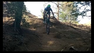
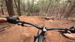
This trail branches off of Jack's and it is a different animal expect drops, jumps, rock gardens, and steep descent all the way down. It will end right on gold camp road.

Tags
JumpsRock gardens
Local Trail Association

Recent Activity on Trail

Past Week
  • 0 rides
  •  
6 Months
  • 40 rides
  • 15 miles avg distance
All
  • 272 rides
  • Last: Oct 16, 2026
update trails status or condition

Captain Morgans Trail Reports

statusdatedescription
Jul 19, 2026 @ 1:31am (America/Denver)
Jul 19, 2026
Holy shit is this trail dry, hadn't ridden it in a while and it is so loose and so dry. fun as fuck tho!
Oct 5, 2024 @ 1:40pm
Oct 5, 2024
Aug 6, 2024 @ 3:42pm
Aug 6, 2024
Jul 5, 2024 @ 4:05am
Jul 5, 2024
Jun 14, 2024 @ 1:40pm
Jun 14, 2024
Trail open, but still periodically under construction for completion of work. Wooden Feature is open, ready, and SICK!
more »
Status:
on Jul 19, 2026
Very Dry
Avg: 4.04 (21 votes)
Your vote: 0

view (2,932)
close
      Directions to captain-morgans trailhead (38.801190, -104.881840)

      Photos

      9 more »
      mtb
      98 |
      Apr 6, 2026 @ 9:30pm
      Apr 6, 2026
      mtb
      427 |
      Oct 24, 2021 @ 6:57am
      Oct 24, 2021
      mtb
      389 |
      Oct 24, 2021 @ 6:52am
      Oct 24, 2021
      mtb
      344 |
      Oct 24, 2021 @ 6:52am
      Oct 24, 2021

      Videos

      3 more »
      Captain morgan's and captain jack's
      mtb
      13:23 | 916 | Apr 21, 2021 , Colorado Springs
      Captain Morgans: Ultimate Breakdown, Double...
      mtb
      445 | Nov 13, 2020 , Colorado Springs
      Captain Morgan recon run
      mtb
      3:25 | 1287 | Jul 29, 2020 , Colorado Springs

      Routes with this trail

      14 miles • 1,592 ft • 9 • Shuttled •
      South Facing Cheyenne Canyon Shuttle DH ideal for winter shuttles when the North facing slopes are snow...
      14 miles • 2,712 ft • 8 •
      Loop of Chamberlain, Ladders, GoldCamp, SpringCreek, Columbine, GoldCamp, Buckhorn, CaptJacks, Morgans,...
      4.2 ★★★★★
      21 Ratings
      5 ★ 62%
      4 ★ 10%
      3 ★ 19%
      2 ★
      1 ★ 10%

      17 Reviews & Comments

      BrandonZnYG0z
      Rode in August 2025. Super loose but extremely fun . Fun rock features. Non stop Drops, a root drop challenging, two long rock chutes, a wooden drop. Extremely cool trail and worth hitting if you’re in area if you’re a very experienced down hiller. This trail is not easy and you need good tires and brakes. Even walking the bike down some of the features is hard because it has the kitty litter gravel and super steep. Ride it out !!
      Jborges91 Jborges91
      Super loose oct 2023. Im sure its a lot more fun after a rain, just hard to stay on any line with how much I was sliding around.
      moogaoomgawa moogaoomgawa
      After rain it is funner than when it is dry.

      We hope you've been enjoying Trailforks!

      Create a FREE account to view all trail reviews and much more.

      • By camelkicker & contributors
      • #90377 - 6,200 views

      Frequently Asked Questions

      ▼ Where is Captain Morgans located?
      Captain Morgans is located in North Cheyenne Cañon Park, Colorado Springs, Colorado, United States. It is part of the North Cheyenne Cañon Park trail network. The trailhead is located at coordinates 38.80119, -104.88184.
      ▼ How hard is Captain Morgans?
      Captain Morgans is rated as Double Black Diamond difficulty. The physical rating is Hard. The average grade is 24.1%.
      ▼ What is the elevation gain for Captain Morgans?
      The trail has 501 ft of elevation descent. The elevation ranges from 7,015 ft to 7,517 ft.
      ▼ Is Captain Morgans a point to point trail?
      Yes, Captain Morgans is a point to point trail. The direction is One Direction. The trail type is singletrack.
      ▼ How long is Captain Morgans?
      Captain Morgans is 2,083 ft long. The trail type is singletrack.
      ▼ Are dogs allowed on Captain Morgans?
      Yes, dogs are allowed on Captain Morgans. Please keep dogs on a leash where required and clean up after them.
      ▼ How do I access Captain Morgans? Where is the closest parking trailhead?
      The closest parking and trailhead locations to Captain Morgans are: View all parking locations in the area.
      ▼ How long does it take to ride Captain Morgans?
      Based on recorded activities, it takes an average of 7 minutes to ride Captain Morgans. The trail is 2,083 ft long. Actual times will vary based on fitness level, conditions, and pace. View recent activity logs for more details.
      ▼ How busy is Captain Morgans?
      Captain Morgans is a very popular trail. There have been 2,889 recorded activities on this trail. The trail has received 2,932 check-ins. View recent activity on this trail.

      Hit the Trail

      Open in App

      Get this trail on your phone instantly.

      open trail in app

      Download Trail

      Save to wishlist, Garmin & download.
      save the trail

      Find Related Routes

      Find routes and users activities that include this trail.
      find routes for this trail

      You must enter a description before submitting.


