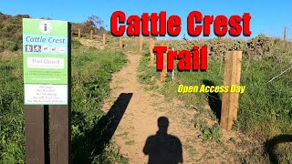

more stats
1.0 mile
Distance
196 ft
Climb
-452 ft
Descent
00:10:20
Avg time
-256 ft
Altitude change
357 ft
Altitude min
756 ft
Altitude max
661 ft
Altitude start
405 ft
Altitude end
-4.72%
Grade
-36.121%
Grade max
22.701%
Grade min
1,830 ft
Distance climb
3,254 ft
Distance down
339 ft
Distance flat
00:10:20
Avg time

Cattle Crest Details

  • Activities
    • Mountain Bike
    • Hike
    • Trail Running
  • Riding Area
    Irvine Open Space
    Irvine, California
  • Difficulty Rating
  • Voted Difficulty
    Blue (1 vote)
  • Local Popularity
    70 in Mountain Biking [+]
    • 75 in Trail Running
    • 75 in Hiking
  • Global Ranking
    #72731 in Mountain Biking [+]
    • #125938 in Trail Running
    • #130189 in Hiking
  • State Ranking
    #2,322 in Mountain Biking · California [+]
    • #6,211 in Trail Running
    • #7,315 in Hiking
  • Trail Type
    Singletrack
  • Dogs Allowed
    Yes

"Self-guided" trail access is limited to the date and hours posted on the gates and at letsgooutside.com.

When gates are closed, you will be subject to citation if you are found to be on the Irvine “scheduled program only” trails.

Restricted Access
Disclaimer

"Self-guided" trail access is limited. Check the Wilderness Access link here for upcoming dates.

Tags

Trail Supporters

Local Trail Association

Traditionally Indigenous Territory

Recent Activity on Trail

Past Week
  • 0 rides
  •  
6 Months
  • 5 rides
  • 17 miles avg distance
All
  • 34 rides
  • Last: Oct 17, 2026
c1c2c3c4
January
February
March
April
May
June
July
August
September
October
November
December
update trails status or condition

Cattle Crest Trail Reports

statusdatedescription
May 10, 2024 @ 2:07pm
May 10, 2024
Ridden on 5/10 and just like the last post trail has been nicely cleared!
Apr 20, 2024 @ 1:25am
Apr 20, 2024
recently cut back. Running really nice on Open access day
Mar 22, 2024 @ 4:15pm
Mar 22, 2024
Starting to get overgrown I would say it has another 2 weeks left until it will be fully covered by growth. Ridden on March 22.
Dec 15, 2023 @ 11:55pm
Dec 15, 2023
Real loose chunky
Oct 13, 2023 @ 12:14pm
Oct 13, 2023
Plants cut back well, lots of small loose rocks makes for low traction.
more »
Status:
on May 10, 2024
Dry
Avg: 4.21 (3 votes)
Your vote: 0

view (438)
close
      Directions to cattle-crest trailhead (33.633040, -117.770040)

      Photos

      1 more »
      mtb
      155 |
      Aug 5, 2020 @ 7:58pm
      Aug 5, 2020

      Videos

      1 more »
      youtuber Cattle Crest MTB Trail | Irvine CA 2022
      mtb
      12:08 | 566 | Feb 19, 2022 , Irvine

      Routes with this trail

      8 miles • 1,465 ft • 3 •
      Quail trail loop ----------
      4.7 ★★★★★
      3 Ratings
      5 ★ 67%
      4 ★ 33%
      3 ★
      2 ★
      1 ★

      2 Reviews & Comments

      Bschiazzano
      MTB Mor, I watched your video before riding it today and you made it look easier then it is. Super fun trail, little bit of everything and the shady oaks single track is no bargain either, some tech in that one
      MTBMOR MTBMOR
      This is a legit trail. There are a few rocky sections and people go up and down it.

      We hope you've been enjoying Trailforks!

      Create a FREE account to view all trail reviews and much more.

      Frequently Asked Questions

      ▼ Where is Cattle Crest located?
      Cattle Crest is located in Irvine Open Space, Irvine, California, United States. It is part of the Irvine Open Space trail network. The trailhead is located at coordinates 33.63304, -117.77004.
      ▼ How hard is Cattle Crest?
      Cattle Crest is rated as Blue difficulty. The average grade is 4.72%.
      ▼ What is the elevation gain for Cattle Crest?
      Cattle Crest has 196 ft of elevation gain. The trail has 452 ft of elevation descent. The elevation ranges from 357 ft to 756 ft.
      ▼ How long is Cattle Crest?
      Cattle Crest is 1.0 mile long. The trail type is singletrack.
      ▼ Are dogs allowed on Cattle Crest?
      Yes, dogs are allowed on Cattle Crest. Please keep dogs on a leash where required and clean up after them.
      ▼ How do I access Cattle Crest? Where is the closest parking trailhead?
      The closest parking and trailhead locations to Cattle Crest are: View all parking locations in the area.
      ▼ How long does it take to ride Cattle Crest?
      Based on recorded activities, it takes an average of 10 minutes to ride Cattle Crest. The trail is 1.0 mile long. Actual times will vary based on fitness level, conditions, and pace. View recent activity logs for more details.
      ▼ How busy is Cattle Crest?
      Cattle Crest is a very popular trail. There have been 442 recorded activities on this trail. The trail has received 438 check-ins. View recent activity on this trail.

      Hit the Trail

      Open in App

      Get this trail on your phone instantly.

      open trail in app

      Download Trail

      Save to wishlist, Garmin & download.
      save the trail

      Find Related Routes

      Find routes and users activities that include this trail.
      find routes for this trail

      You must enter a description before submitting.