
more stats
3.0 miles
Distance
142 ft
Climb
-109 ft
Descent
00:33:16
Avg time
31 ft
Altitude change
2,556 ft
Altitude min
2,646 ft
Altitude max
2,558 ft
Altitude start
2,589 ft
Altitude end
0.2%
Grade
-10.6%
Grade max
9.3%
Grade min
4,849 ft
Distance climb
3,668 ft
Distance down
1 mile
Distance flat
00:33:16
Avg time

C-B Details

  • Activities
    • Mountain Bike
    • E-Bike
    • Gravel Bike
    • Winter Fat Bike
    • Hike
    • Trail Running
  • Riding Area
    Twin Peaks
    Wickenburg, Arizona
  • Difficulty Rating
  • Voted Difficulty
    Blue (1 vote)
  • Local Popularity
    55 in Mountain Biking heatmap [+]
    • 75 in E-Biking
    • 5 in Trail Running
    • 5 in Hiking
    • 5 in Winter Fat Biking
    • 5 in Gravel Biking
  • Global Ranking
    #30144 in Mountain Biking [+]
    • #157274 in E-Biking
    • #431933 in Trail Running
    • #435863 in Hiking
    • #19645 in Winter Fat Biking
    • #27367 in Gravel Biking
  • State Ranking
    #423 in Mountain Biking · Arizona [+]
    • #1,064 in E-Biking
    • #5,268 in Trail Running
    • #5,394 in Hiking
    • #44 in Winter Fat Biking
    • #257 in Gravel Biking
  • Trail Type
    Singletrack
  • Bike Type
    AM, XC, Fat, Gravel
  • Direction
    Both Directions
  • Climb Difficulty
    Blue
  • Physical Rating
    Moderate
  • Trail Visibility
    Sometimes hard to follow
  • eBike Allowed
    Yes up to Class 1

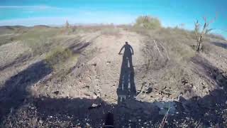
A single track trail which meanders south of the old abandoned Hwy 60. Can be ridden in both directions with ease. If a rider is looking they can see remnants of the original California Road. Part of the east end is on the remnants of that old road. Look for pieces of metal and thrown out cans from old vehicles along the way.

Access Info

Trail can be accessed at both the east and west end via the abandoned Hwy 60 or in the middle by Oasis Trail.

Disclaimer

Trail is located on State Trust Land. A person must purchase a permit to have access to State Trust land.

Tags
Faint trail

Recent Activity on Trail

Past Week
  • 0 rides
  •  
6 Months
  • 0 rides
  •  
All
  • 14 rides
  • Last: Apr 11, 2026
c1c2c3c4
January
February
March
April
May
June
July
August
September
October
November
December
update trails status or condition

C-B Trail Reports

Status:
on Apr 12, 2026
Very Dry
Avg: 3.84 (2 votes)
Your vote: 0

view (27)
close
      Directions to cb-679187 trailhead (33.948590, -112.845140)

      Photos

      2 more »
      mtb
      C-B
      53 |
      Dec 12, 2023 @ 11:55am
      Dec 12, 2023
      mtb
      C-B
      55 |
      Dec 7, 2023 @ 4:54pm
      Dec 7, 2023

      Videos

      1 more »
      Twin Peaks - C-B (Wickenburg, AZ) - Full Trail
      mtb
      23:03 | 117 | Jan 16, 2024 , Wickenburg
      3.0 ★★★★★
      2 Ratings
      5 ★
      4 ★
      3 ★ 100%
      2 ★
      1 ★

      2 Reviews & Comments

      cloneranger
      Yeah, border line cow trail in parts but for a non exciting spin in the desert it's ok. The camping here is outstanding. Bring music and peyote cause chances are you will be alone in the glory of the desert.
      Ampfrog Ampfrog
      So many corners! The cans, boneyard, etc were nice touches. Easier end of intermediate with lots of pedaling. Starts up a very short steep-ish hill by a power line pole just west of the bridge.

      We hope you've been enjoying Trailforks!

      Create a FREE account to view all trail reviews and much more.

      Nearby Trails

      • By bdalleyTF Pro & contributors
      • #679187 - 544 views

      Frequently Asked Questions

      ▼ Where is C-B located?
      C-B is located in Twin Peaks, Wickenburg, Arizona, United States. It is part of the Twin Peaks trail network. The trailhead is located at coordinates 33.94859, -112.84514.
      ▼ How hard is C-B?
      C-B is rated as Blue difficulty. The physical rating is Moderate. The average grade is 0.2%. The climb difficulty is rated Blue.
      ▼ What is the elevation gain for C-B?
      C-B has 142 ft of elevation gain. The trail has 109 ft of elevation descent. The elevation ranges from 2,556 ft to 2,646 ft.
      ▼ Is C-B a point to point trail?
      C-B is not a point to point trail. The direction is Both Directions. The trail type is singletrack.
      ▼ How long is C-B?
      C-B is 3.0 miles long. The trail type is singletrack.
      ▼ Are dogs allowed on C-B?
      There is no information about dogs being allowed on C-B. Check with local trail managers or the trail page for the latest access rules.
      ▼ When is the best time of year to ride C-B?
      Based on activity log data, the most popular months to ride C-B are:
      • November (4 activities)
      • February (3 activities)
      • April (2 activities)
      Check the reports page for current trail conditions.
      ▼ How do I access C-B? Where is the closest parking trailhead?
      The closest parking and trailhead locations to C-B are: View all parking locations in the area.
      ▼ How long does it take to ride C-B?
      Based on recorded activities, it takes an average of 33 minutes to ride C-B. The trail is 3.0 miles long. Actual times will vary based on fitness level, conditions, and pace. View recent activity logs for more details.
      ▼ How busy is C-B?
      C-B is a moderately popular trail. There have been 25 recorded activities on this trail. The trail has received 27 check-ins. View recent activity on this trail.

      Hit the Trail

      Open in App

      Get this trail on your phone instantly.

      open trail in app

      Download Trail

      Save to wishlist, Garmin & download.
      save the trail

      Find Related Routes

      Find routes and users activities that include this trail.
      find routes for this trail

      You must enter a description before submitting.

