Supporters, Builders, Maintainers & Land Managers of CDNST (MacDonald Pass to Switchback Ridge) Trail
CDNSTSponsor
Montana CDTSponsor
USFSLand Manager
Montana Bicycle GuildMaintainer
Details
-
Activities
- Mountain Bike
- Horse
- Hike
- Trail Running
- Snowshoe
- Backcountry Ski
- Nordic Ski
-
Riding AreaMacDonald Pass
Helena, Montana -
Ref Number#337
-
AKAMac Pass
-
Difficulty Rating
-
Hiking SAC ScaleT1 Hiking
-
Trail TypeSingletrack
-
Bike TypeAM, XC, Fat
-
DirectionBoth DirectionsPopular direction shown
-
Climb DifficultyBlack Diamond
-
Physical RatingModerate
-
Trail VisibilityAlways easy to follow
-
SeasonJune-October
-
Dogs AllowedYes
-
eBike Allowed
-
TTFs on TrailRock Face, Rock Garden
-
Global Ranking
-
Local Popularity45 in Mountain Biking [+]
- 5 in Trail Running
- 70 in Hiking
- 5 in Horseback
- 5 in Snowshoeing
- 5 in Skiing
- 5 in Skiing
-
Land OwnerUSFS
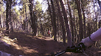
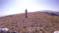
Four miles of the Continental Divide Trail lead to a locals' favorite downhill on the Switchback Ridge Trail. The CDT portion doesn't climb very much, but it is strewn with very challenging rock gardens. Several of them provide very difficult climbs. Get ready to session them, or to carry your bike. The rocks are the trail's defining feature, and Helenans love testing themselves on them.
Access Info
Exit Highway 12 at the Cromwell-Dixon Campground, and drive up the hill to the Continental Divide overlook. The trail starts at the stairs. There is a gate shortly after entering the forest; be sure to close it behind you. As the CDT rises into an open meadow, the Switchback Ridge Trail is to the left towards the trees. This provides the downhill connection to Tenmile Creek and Rimini Road.
Local Trail Association
-
-
Please consider joining or donating to the local trail association to supportdonate to earn trail karma!
trail development & maintenance.
Traditionally Indigenous Territory
More Stats for CDNST (MacDonald Pass to Switchback Ridge) multi-use trail trail
-
Altitude change291 ft
-
Altitude min6,217 ft
-
Altitude max6,706 ft
-
Altitude start6,415 ft
-
Altitude end6,706 ft
-
Grade1.7%
-
Grade max-34.1%
-
Grade min44.8%
-
Distance climb2 miles
-
Distance down1 mile
-
Distance flat1,004 ft
-
Avg time01:13:02
-
Avg reverse time00:37:56
- view trail stats
-
Layers w
- Map Content
- More Layers
- Pro
- Pro
- Pro
- Pro
- Pro
- Pro
- Pro
- Pro
-
Upgrade to

- Unknown
- Snow Groomed
- Snow Packed
- Snow Covered
- Snow Cover Partial
- Freeze/thaw Cycle
- Icy
- Prevalent Mud
- Wet
- Variable
- Ideal
- Dry
- Very Dry
The colour categories are based on what percentage of riders are riding a trail in its intended direction.
- > 96%
- > 90%
- > 80%
- > 70%
- > 50%
- < 50%
- bi-directional trail
- no data
- < 2 days
- < 1 week
- < 2 weeks
- < 1 month
- < 6 months
- > 6 months
- Downhill Only
- Downhill Primary
- Both Directions
- Uphill Primary
- Uphill Only
- One Direction
- Description
- Photos
- Description & Photos
- Videos
- most popular
- popular
- less popular
- not popular

- mountain biking recent
- mountain biking (>6 month)
- hiking (1 year)
- moto (1 year)
- Downhill Ski
- Backcountry Ski
- Nordic Ski
- Snowmobile
Save the current map location and zoom level as your default home location whenever this page is loaded.
SaveCDNST (MacDonald... Trail Reports
Recent Ridelog Activity on Trail
- 0 rides
- 0 rides
- 255 rides
- Last: Jul 15, 2023
 Bridge


Photos
Trail Lists
-
 Continental Divide Trail20 trailsNational Scenic Trail or Official Route
Routes with this trail
Trail Events
We hope you've been enjoying Trailforks!
Create a FREE account to view trail comments and much more.
Videos

Nearby Trails
- Cdnst Macdonald Pass 2,113 ft
- Parking Area Branch 2,365 ft
- Cdnst Connector 3,730 ft
- Fs 1897 1 mile
- Switchback Ridge Trail 4 miles
- By evasive
 MBG & contributors
 - #18000 - 4,341 views
- follow/subscribe
- login to download gpx or kml files.
You must enter a description before submitting.