




Open in App
Get this trail on your phone instantly.

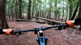
The blue XC trail begins at the top of the Green XC trail just above switchback 4 on Schweitzer Mountain Road and climbs through a dark, mossy forest with several stream crossings, dipping in and out of US Forest Service property, taking riders to the top of the black DH trail just east of switchback 6 on Schweitzer Mountain road.
The Lower Basin XC blue trail is two-directional and is rated blue for some steep climbing pitches, off-camber rooted sections of steep singletrack that can be challenging to beginner riders. The trail is predominantly hand-built and user-created below switchback 6 and to the top of the Green XC trail, which was machine-built and opened in fall of 2022.

| c1 | c2 | c3 | c4 |
|---|---|---|---|
January | February | March | April |
May | June | July | August |
September | October | November | December |

Service Road Atlas is a free to use, community-driven service for viewing and creating reports on the numerous back-country service roads around B.C. and Alberta.
Save the current map location and zoom level as your default home location whenever this page is loaded.
SaveWe hope you've been enjoying Trailforks!
Create a FREE account to view all trail reviews and much more.
 POP & contributors
You must enter a description before submitting.

