more stats
2.9 miles
Distance
864 ft
Climb
-915 ft
Descent
00:39:34
Avg time
-51 ft
Altitude change
4,780 ft
Altitude min
5,216 ft
Altitude max
4,833 ft
Altitude start
4,783 ft
Altitude end
-0.3%
Grade
-48.4%
Grade max
88.3%
Grade min
1 mile
Distance climb
2 miles
Distance down
709 ft
Distance flat
00:39:34
Avg time

Cloudline Details

  • Activities
    • Mountain Bike
    • E-Bike
    • Hike
    • Trail Running
  • Riding Area
  • Difficulty Rating
  • Local Popularity
    95 in Mountain Biking [+]
    • 100 in E-Biking
    • 95 in Trail Running
    • 90 in Hiking
  • Global Ranking
    #266 in Mountain Biking [+]
    • #305 in Trail Running
    • #1425 in Hiking
  • Trail Type
    Singletrack
  • Bike Type
    AM, XC, Fat
  • Direction
    Both Directions
    Popular Direction Shown
  • Dogs Allowed
    Yes
  • eBike Allowed
    Yes up to Class 1
  • Land Owner

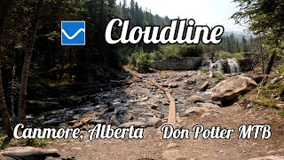
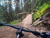
A cross-country style trail, machine built with flow, that runs between Three Sisters Creek and Stewart Creek, with some incredible viewpoints in between.

Cloudline was finished in 2023 by Alberta Parks, with help from the Friends of Kananaskis Country, and the Canmore & Area Mountain Bike Association.

Local Trail Association

Recent Activity on Trail

Past Week
  • 24 rides
  • 20.2 km average
6 Months
  • 105 rides
  • 22.1 km avg distance
All
  • 825 rides
  • Last: Jun 24, 2026
c1c2c3c4
January
February
March
April
May
June
July
August
September
October
November
December
update trails status or condition

Cloudline Trail Reports

statusdatedescription
Jun 24, 2026 @ 2:09pm (America/Edmonton)
10 hours
Jun 21, 2026 @ 5:38pm (America/Edmonton)
Jun 21, 2026
Excellent conditions. No mud, tacky. No downed trees, clear. Lots of flow!
May 25, 2026 @ 6:09pm (America/Creston)
May 25, 2026
May 11, 2026 @ 7:13pm (America/Edmonton)
May 11, 2026
Oct 25, 2025 @ 9:12pm (America/Edmonton)
Oct 25, 2025
Three trees down on cloud line there are all pretty close together
more »
Status:
on Jun 24, 2026
Ideal
Avg: 4.56 (19 votes)
Your vote: 0

view (5,173)
close
3D
Trail Conditions
  • Unknown
  • Snow Groomed
  • Snow Packed
  • Snow Covered
  • Snow Cover Partial
  • Freeze/thaw Cycle
  • Icy
  • Prevalent Mud
  • Wet
  • Variable
  • Ideal
  • Dry
  • Very Dry
Trail Flow (Ridden Direction)
Trailforks scans users ridelogs to determine the most popular direction each trail is ridden. A good flowing trail network will have most trails flowing in a single direction according to their intension.
The colour categories are based on what percentage of riders are riding a trail in its intended direction.
  • > 96%
  • > 90%
  • > 80%
  • > 70%
  • > 50%
  • < 50%
  • bi-directional trail
  • no data
Trail Last Ridden
Trailforks scans ridelogs to determine the last time a trail was ridden.
  • < 2 days
  • < 1 week
  • < 2 weeks
  • < 1 month
  • < 6 months
  • > 6 months
Trail Ridden Direction
The intended direction a trail should be ridden.
  • Downhill Only
  • Downhill Primary
  • Both Directions
  • Uphill Primary
  • Uphill Only
  • One Direction
Contribute Details
Colors indicate trail is missing specified detail.
  • Description
  • Photos
  • Description & Photos
  • Videos
Trail Popularity ?
Trailforks scans ridelogs to determine which trails are ridden the most in the last 9 months. Trails are compared with nearby trails in the same city region with a possible 25 colour shades. Think of this as a heatmap, more rides = more kinetic energy = warmer colors.
  • most popular
  • popular
  • less popular
  • not popular
ATV/ORV/OHV Filter
Max Vehicle Width
inches
US Cell Coverage
Legend
cell carrier legend

Radar Time
Activity Recordings
Trailforks uses anonymized public activity data. ?
Activity Recordings
Trailforks uses anonymized public activity data. ?
Personal Heatmap
Activity Types
all / none
Options
2
Date range month
Winter Trails
Warning A routing network for winter maps does not exist. Selecting trails using the winter trails layer has been disabled.
Missing Trails
Most Popular
Least Popular
Trails are colored based on popularity. The more popular a trail is, the more red. Less popular trails trend towards green.
Jump Magnitude Heatmap
Heatmap of where riders jump on trails. Zoom in to see individual jumps, click circles to view jump details.
BC Backroad Status

Service Road Atlas is a free to use, community-driven service for viewing and creating reports on the numerous back-country service roads around B.C. and Alberta.

map legend
Slope Aspect
Direction the slope faces
Flat N NE E SE S SW W NW
Trails Deemphasized
Trails are shown in grey.
disable
Only show trails with no bike usage.
Enable
Suggested Layers
Based on selected activity type

    Save the current map location and zoom level as your default home location whenever this page is loaded.

    Save
        Directions to cloudline trailhead (51.049030, -115.337390)

        Photos

        13 more »
        330 |
        Jul 18, 2023 @ 3:36pm
        Jul 18, 2023
        433 |
        Jul 9, 2023 @ 6:27pm
        Jul 9, 2023
        91 |
        Jul 29, 2024 @ 8:18am
        Jul 29, 2024
        82 |
        Oct 6, 2023 @ 2:33pm
        Oct 6, 2023

        Videos

        5 more »
        Cloudline in Canmore, Alberta
        27:35 | 79 | Nov 15, 2025 , Canmore
        Biking the Cloudline Trail 'In Reverse' - June...
        9:17 | 80 | Jun 21, 2025 , Canmore
        Riding Through the Clouds | Exploring...
        99 | Jun 20, 2025 , Canmore
        Fat Biking End-of-Season April 2025
        21:10 | 83 | Apr 16, 2025 , Canmore

        Routes with this trail

        5.0 14 miles 2,864 ft 8
        The newest Pedal for Pints loop, starting at Quarry Lake parking lot, going up Highline for a full west to...
        10 miles 2,082 ft 5 Point to Point
        its the party lap of cloudline to guylafluer but with a bit of suffering tossed in by highline to make...

        16 Reviews & Comments


        We hope you've been enjoying Trailforks!

        Create a FREE account to view trail comments and much more.

        • By jdeoliveTF Pro & contributors
        • #610542 - 13,729 views

        Frequently Asked Questions About Cloudline

        Where is Cloudline located?
        Cloudline is located in Bow Valley Wildland Provincial Park, Canmore, Alberta, Canada. It is part of the Bow Valley Wildland Provincial Park trail network. The trailhead is located at coordinates 51.04903, -115.33739.
        How hard is Cloudline?
        Cloudline is rated as Blue difficulty. The average grade is 0.3%.
        What is the elevation gain for Cloudline?
        Cloudline has 263 m of elevation gain. The trail has 279 m of elevation descent. The elevation ranges from 1,457 m to 1,590 m.
        Is Cloudline a point to point trail?
        Cloudline is not a point to point trail. The direction is Both Directions. The trail type is singletrack.

        Hit the Trail

        Open in App

        Get this trail on your phone instantly.
        open trail in app

        Download Trail

        Save to wishlist, Garmin & download.
        save the trail

        Find Related Routes

        Find routes and users activities that include this trail.
        find routes for this trail

        You must enter a description before submitting.