
more stats
2,411 ft
Distance
43 ft
Climb
-115 ft
Descent
00:05:20
Avg time
-72 ft
Altitude change
32 ft
Altitude min
135 ft
Altitude max
135 ft
Altitude start
62 ft
Altitude end
-3%
Grade
-15%
Grade max
23.3%
Grade min
410 ft
Distance climb
1,365 ft
Distance down
607 ft
Distance flat
00:05:20
Avg time

Coke Details

  • Activities
    • Mountain Bike
    • Hike
    • Trail Running
  • Riding Area
    Allaire State Park
    Howell, New Jersey
  • Difficulty Rating
  • Voted Difficulty
    Blue (3 votes)
  • Local Popularity
    85 in Mountain Biking [+]
    • 5 in Trail Running
    • 5 in Hiking
  • Global Ranking
    #51486 in Mountain Biking [+]
    • #343167 in Trail Running
    • #332541 in Hiking
  • State Ranking
    #283 in Mountain Biking · New Jersey [+]
    • #3,016 in Trail Running
    • #3,528 in Hiking
  • Trail Type
    Singletrack
  • Direction
    Downhill Primary
  • Climb Difficulty
    Black Diamond
  • Physical Rating
    Hard
  • Trail Visibility
    Always easy to follow

Located along the Manasquan river, this trail is an out and back that includes a lot of fun trail features. Please do not cross over the golf course. The Coke trail requires good bike handling skills if one does not want to fall into the river.

This trail is unsanctioned.

Tags

Traditionally Indigenous Territory

Recent Activity on Trail

Past Week
  • 2 rides
  • 13 miles average
6 Months
  • 81 rides
  • 12 miles avg distance
All
  • 835 rides
  • Last: Oct 31, 2026
c1c2c3c4
January
February
March
April
May
June
July
August
September
October
November
December
update trails status or condition

Coke Trail Reports

statusdatedescription
May 9, 2024 @ 7:04am
May 9, 2024
Apr 15, 2024 @ 7:08am
Apr 15, 2024
Nov 7, 2021 @ 10:06am
Nov 7, 2021
Aug 8, 2021 @ 9:59am
Aug 8, 2021
It was raining - obviously the trails would be wet... this place drains/dries really well and needed the rain to pack in all the loose sand.
Apr 2, 2021 @ 5:18am
Apr 2, 2021
more »
Status:
on May 9, 2024
Ideal
Avg: 4.06 (9 votes)
Your vote: 0

view (4,588)
close
      Directions to coke trailhead (40.152080, -74.140190)

      Photos

      3 more »
      mtb
      96 |
      Mar 11, 2025 @ 7:16am
      Mar 11, 2025
      mtb
      93 |
      Mar 11, 2025 @ 7:16am
      Mar 11, 2025
      mtb
      420 |
      Apr 23, 2019 @ 1:58pm
      Apr 23, 2019

      Videos

      1 more »
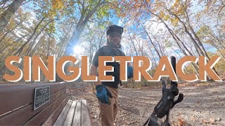
      Singletrack Through the Pines | Allaire State...
      mtb
      9:40 | 129 | Nov 4, 2025 , Howell

      Routes with this trail

      14 miles • 675 ft • 16 • Loop •
      This route covers all ends of the entire park and loops back near the start around mile 8 if you want to...
      4.1 ★★★★★
      9 Ratings
      5 ★ 44%
      4 ★ 22%
      3 ★ 33%
      2 ★
      1 ★

      1 Review & Comments

      LiamU5272
      One of the best technical trails in the park, especially when combined with Outer Limits. Has quite a nasty climb right at the end of the descent.

      We hope you've been enjoying Trailforks!

      Create a FREE account to view all trail reviews and much more.

      • #17105 - 5,310 views

      Frequently Asked Questions

      ▼ Where is Coke located?
      Coke is located in Allaire State Park, Howell, New Jersey, United States. It is part of the Allaire State Park trail network. The trailhead is located at coordinates 40.15208, -74.14019.
      ▼ How hard is Coke?
      Coke is rated as Black Diamond difficulty. The physical rating is Hard. The average grade is 3%. The climb difficulty is rated Black Diamond.
      ▼ What is the elevation gain for Coke?
      Coke has 43 ft of elevation gain. The trail has 115 ft of elevation descent. The elevation ranges from 32 ft to 135 ft.
      ▼ Is Coke a point to point trail?
      Coke is not a point to point trail. The direction is Downhill Primary. The trail type is singletrack.
      ▼ How long is Coke?
      Coke is 2,411 ft long. The trail type is singletrack.
      ▼ Are dogs allowed on Coke?
      There is no information about dogs being allowed on Coke. Check with local trail managers or the trail page for the latest access rules.
      ▼ How do I access Coke? Where is the closest parking trailhead?
      The closest parking and trailhead locations to Coke are: View all parking locations in the area.
      ▼ How long does it take to ride Coke?
      Based on recorded activities, it takes an average of 5 minutes to ride Coke. The trail is 2,411 ft long. Actual times will vary based on fitness level, conditions, and pace. View recent activity logs for more details.
      ▼ How busy is Coke?
      Coke is a very popular trail. There have been 3,841 recorded activities on this trail. The trail has received 4,588 check-ins. View recent activity on this trail.

      Hit the Trail

      Open in App

      Get this trail on your phone instantly.

      open trail in app

      Download Trail

      Save to wishlist, Garmin & download.
      save the trail

      Find Related Routes

      Find routes and users activities that include this trail.
      find routes for this trail

      You must enter a description before submitting.

