close
-
Layers w
- Weather Layers
- Pro
- Pro
- Pro
- Pro
- Pro
- Pro
- More Layers
- Pro
- Pro
- Pro
- Pro
-
Upgrade to

3D
Trail Conditions
- Unknown
- Snow Groomed
- Snow Packed
- Snow Covered
- Snow Cover Partial
- Freeze/thaw Cycle
- Icy
- Prevalent Mud
- Wet
- Variable
- Ideal
- Dry
- Very Dry
Trail Flow (Ridden Direction)
Trailforks scans users activity logs to determine the most popular direction each trail is ridden. A good flowing trail network will have most trails flowing in a single direction according to their intension.
The colour categories are based on what percentage of users are riding a trail in its intended direction.
The colour categories are based on what percentage of users are riding a trail in its intended direction.
- > 96%
- > 90%
- > 80%
- > 70%
- > 50%
- < 50%
- bi-directional trail
- no data
Trail Last Ridden
Trailforks scans activity logs to determine the last time a trail was ridden.
- < 2 days
- < 1 week
- < 2 weeks
- < 1 month
- < 6 months
- > 6 months
Trail Ridden Direction
The intended direction a trail should be ridden.
- Downhill Only
- Downhill Primary
- Both Directions
- Uphill Primary
- Uphill Only
- One Direction
Contribute Details
Colors indicate trail is missing specified detail.
- Description
- Photos
- Description & Photos
- Videos
Trail Popularity ?
Trailforks scans activity logs to determine which trails are ridden the most in the last 9 months.
Trails are compared with nearby trails in the same city region with a possible 25 colour shades.
Think of this as a heatmap, more activities = more kinetic energy = warmer colors.
- most popular
- popular
- less popular
- not popular
ATV/ORV/OHV Filter
Max Vehicle Width
inches
US Cell Coverage
Legend

Radar Time
Activity Recordings
Trailforks uses anonymized public activity data.
?
Activity Recordings
Trailforks uses anonymized public activity data.
?
Personal Heatmap
▶
Activity Types
all
/
none
▶
Options
2
Date range
month
–
Winter Trails
Warning
A routing network for winter maps does not exist. Selecting trails using the winter trails layer has been disabled.
Missing Trails
Most Popular
Least Popular
Trails are colored based on popularity. The more popular a trail is, the more red. Less popular trails trend towards green.
Jump Magnitude Heatmap
Heatmap of where users jump on trails. Zoom in to see individual jumps, click circles to view jump details.
BC Backroad Status
![map legend]()
Service Road Atlas is a free to use, community-driven service for viewing and creating reports on the numerous back-country service roads around B.C. and Alberta.

Slope Aspect
Direction the slope faces
Trails Deemphasized
Trails are shown in grey.
Only show trails with no bike usage.
Suggested Layers
Based on selected activity type
Save the current map location and zoom level as your default home location whenever this page is loaded.
Save
No description for Howell has been added yet!
Login or register to submit one.
Activities Click to view
- Mountain Bike
270 trails
- E-Bike
55 trails
- Gravel Bike
9 trails
- Adaptive Bike
0 trails
- Winter Fat Bike
5 trails
- Horse
62 trails
- Hike
275 trails
- Trail Running
274 trails
- Dirtbike/Moto
16 trails
- ATV/ORV/OHV
20 trails
Region Details
- 15
- 5
- 115
- 120
- 7
- 1
Region Status
Open as of 1 dayLocal Trail Association
Stats
- Avg Trail Rating
- Trails (view details)
- 269
- Trails Mountain Bike
- 271
- Trails E-Bike
- 55
- Trails Gravel Bike
- 9
- Trails Winter Fat Bike
- 5
- Trails Horse
- 62
- Trails Hike
- 275
- Trails Trail Running
- 274
- Trails Dirtbike/Moto
- 16
- Trails ATV/ORV/OHV
- 20
- Trails Snowshoe
- 7
- Trails Nordic Ski
- 9
- Total Distance
- 79 miles
- Total Descent
- 4,028 ft
- Total Vertical
- 151 ft
- Highest Trailhead
- 156 ft
- Reports
- 2,486
- Photos
- 315
- Completed Counter
- 106,378
Sub Regions
-
Allaire State Park
- 3
- 118
- 101
- 14
- 1
- 1
-
Manasquan Reservoir
- 1
- 5
- 3
Popular Howell Mountain Biking Trails
• 100 ★ 3.7 • 2,736 ft • 44 ft • 1,737 •
It's the first trail you ride heading south east from the lot. It parallels Road and is named because there was an old hunters there years ago. It is a fun little trail with it's twists and turns and will lead you up to the gravel road...
• 100 ★ 4.0 • 2,290 ft • 61 ft • 1,454 •
Popular blue difficulty singletrack. This mountain bike primary trail and has a easy overall physical rating with a 61 ft green climb. On average it takes 5 minutes to complete this trail.
• 100 ★ 4.0 • 413 ft • 10 ft • 1,343 •
Popular blue difficulty singletrack. This mountain bike primary trail can be used both directions. On average it takes 1 minutes to complete this trail.
• 90 ★ 4.0 • 1,962 ft • 3 ft • 1,304 •
Twisty single track that parallels road from the main parking lot .
• 75 ★ 4.0 • 2,562 ft • 42 ft • 1,289 •
Easy to Moderate Sand trail in State Park near .
Howell Mountain Bike Routes
★ 2.0 • 7 miles • 428 ft • 14 • Out & Back •
A great trail ride for beginner to intermediate riders. Plenty of descents and climbs that wrap around all...
★ 2.4 • 9 miles • 392 ft • 9 •
2 downhill runs, Galss and into some tight singletrack alongside the and into Sherwood then back to the lot.
★ 4.0 • 6 miles • 185 ft • 28 • Loop •
Nice Leg burner to get the legs ready for the backside of the Allaire
14 miles • 675 ft • 16 • Loop •
This route covers all ends of the entire park and loops back near the start around mile 8 if you want to...
11 miles • 664 ft • 10 • Loop •
The first half of the route takes most of the right hand turns at intersections, keeping this in mind may...
14 miles • 811 ft • 6 •
Ride around the wild area where no too many riders go. Then, crossing over to the main Allaire section....
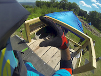
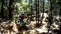
Photos of Howell Mountain Bike
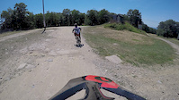
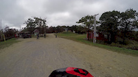
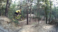
Videos of Howell Mountain Bike

trail: Sketch
0:06 |
39 |
Jul 12, 2025
trail: Blue
3:08 |
300 |
Aug 1, 2018
trail: Blue
4:58 |
196 |
Jul 12, 2018
trail: Blue
6:11 |
99 |
Oct 18, 2017
trail: White Blue Road
0:10 |
903 |
Aug 28, 2015
trail: White Blue Road
0:27 |
393 |
Jul 26, 2015

trail: Operation
3:42 |
124 |
Dec 24, 2014

trail: Coke
9:40 |
93 |
Nov 4, 2025 , Howell
Current Trail Warnings
| status | trail | date | condition | user | info |
|---|---|---|---|---|---|
| Roller Coaster | Jul 13, 2026 @ 3:03pm (America/New_York) Jul 13, 2026 | Unknown | JuggernautMTB JORBA 6MR | Large tree down across trail, blocking trail | |
| Alt. Blind | Jul 13, 2026 @ 2:00pm (America/New_York) Jul 13, 2026 | Unknown | JuggernautMTB JORBA 6MR | Large tree removed | |
| Glass | Jul 5, 2026 @ 8:14pm (America/New_York) Jul 5, 2026 | Ideal | TimBrick |
Recent Trail Reports
| status | trail | date | condition | info | user |
|---|---|---|---|---|---|
| Snake | Jul 24, 2026 @ 7:30pm (America/New_York) 1 day | Ideal | TimBrick | ||
| Connector | Jul 24, 2026 @ 7:29pm (America/New_York) 1 day | Ideal | TimBrick | ||
| Unbreakable | Jul 24, 2026 @ 7:29pm (America/New_York) 1 day | Dry | TimBrick | ||
| River Trail | Jul 24, 2026 @ 7:29pm (America/New_York) 1 day | Ideal | TimBrick | ||
| Crossing Guard | Jul 24, 2026 @ 7:28pm (America/New_York) 1 day | Ideal | TimBrick | ||
| Slippery When Wet | Jul 24, 2026 @ 11:38am (America/New_York) 2 days | Dry | TimBrick | ||
| Get Some | Jul 19, 2026 @ 6:40pm (America/New_York) Jul 19, 2026 | Unknown | Moshe2GBBcv | ||
| Back up 1 | Jul 19, 2026 @ 6:37pm (America/New_York) Jul 19, 2026 | Ideal | TimBrick | ||
| White Blue Road | Jul 19, 2026 @ 6:37pm (America/New_York) Jul 19, 2026 | Ideal | TimBrick | ||
| Side Step | Jul 19, 2026 @ 6:37pm (America/New_York) Jul 19, 2026 | Ideal | TimBrick |
Activity Feed
| username | action | type | title | date |
|---|---|---|---|---|
| RobincbDBfi | wishlist | route | activity #100015204 | Jul 25, 2026 @ 4:45pm 7 hours |
| Tyler-onthe-Peaks | wishlist | trail | activity #99963561 | Jul 25, 2026 @ 7:14am 16 hours |
| TimBrick | add | report | activity #99924893 and 4 more | Jul 24, 2026 @ 4:28pm 1 day |
| TimBrick | add | report | activity #99893549 | Jul 24, 2026 @ 8:38am 2 days |
| Stuartq2OKS8 | wishlist | route | activity #99818304 | Jul 23, 2026 @ 7:37am 3 days |
Recent Comments
| username | type | title | comment | date |
|---|---|---|---|---|
| report | Cleared | Jul 13, 2026 @ 11:01am Jul 13, 2026 | ||
| report | Tree down from storm on Friday night. You can... | Jul 5, 2026 @ 5:15pm Jul 5, 2026 | ||
| trail | Kick ass trail | Apr 27, 2026 @ 6:11pm Apr 27, 2026 | ||
| trail | One of the best | Apr 6, 2026 @ 6:03pm Apr 6, 2026 | ||
| trail | The actual name for this trail is: “Root... | Nov 30, 2025 @ 2:47pm Nov 30, 2025 |
Local Badges
-

10 Green Trails1,101 awarded -

Epic Ride Climb 2k2 awarded -

Climbing 10k Badge114 awarded -

Climbing 100k Badge1 awarded -

Epic Ride Descent 2k2 awarded -

Descent 10k Badge114 awarded
Activity Type Stats
| activitytype | trails | distance | descent | descent distance | total vertical | rating | global rank | state rank | photos | reports | routes | activity logs |
|---|---|---|---|---|---|---|---|---|---|---|---|---|
| Mountain Bike | 270 | 78 miles | 4,026 ft | 22 miles | 151 ft | #107 | #42 | 305 | 2,486 | 16 | 39,302 | |
| E-Bike | 55 | 9 miles | 420 ft | 2 miles | 151 ft | #4,003 | #1,330 | 2,385 | 5 | 2,217 | ||
| Gravel Bike | 9 | #721 | #1,116 | 11 | 1 | 111 | ||||||
| Winter Fat Bike | 5 | #480 | #1,152 | 1 | 1 | 3 | ||||||
| Horse | 62 | 19 miles | 561 ft | 5 miles | 141 ft | #1,640 | #939 | 514 | 1 | 1 | ||
| Hike | 275 | 78 miles | 4,003 ft | 22 miles | 151 ft | #1,237 | #573 | 12 | 2,476 | 4 | 398 | |
| Trail Running | 274 | 78 miles | 3,996 ft | 22 miles | 151 ft | #1,418 | #508 | 1 | 2,476 | 2 | 1,096 | |
| Dirtbike/Moto | 16 | 1 mile | 108 ft | 3,051 ft | 121 ft | #1,216 | #490 | 510 | 7 | |||
| ATV/ORV/OHV | 20 | 2 miles | 115 ft | 3,219 ft | 121 ft | #921 | #423 | 1 | 511 | 7 | ||
| Snowshoe | 7 | 1 | 2 | |||||||||
| Nordic Ski | 9 | 1 |
Frequently Asked Questions About Howell
▼
What are the best places to ride in Howell?
Howell has 2 areas to explore for mountain biking. The top rated areas are:
▼
What are the highest rated mountain biking trails in Howell?
The highest rated mountain biking trails in Howell are:
- Manasquan Reservoir Perimeter Trail (4.2/5)
- Outer Limits (4.1/5)
- Jaime (4.1/5)
- Roller Coaster (4.1/5)
- Ignacio (4.1/5)
▼
What is the best time of the year to ride in Howell?
Based on activity log data, the most popular months to ride in Howell are:
- November (557 activities)
- July (545 activities)
- May (506 activities)
▼
Where can I park to ride in Howell?
There are 18 parking locations listed in Howell. The most popular parking spots are: View all parking and trailhead locations on the map to plan your visit.
Activities
Trails
- By brenthillier
 NSMBA TRAILFORKS & contributors
 - Admins: JORBA, JARJORBA
- #3615 - 7,403 views
- howell activity log | embed map of Howell mountain bike trails | howell mountain biking points of interest
Downloading of trail gps tracks in kml & gpx formats is enabled for Howell.
You must login to download files.