


Open in App
Get this trail on your phone instantly.

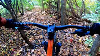
The Rouge Park Trail is a beginner to intermediate singletrack trail in the City of Detroit's Rouge Park in the Warrendale neighborhood. Close to Dearborn, Redford, Hines Drive, the Rouge Gateway Trail, Eliza Howell Park, and more. The singletrack is short but has plenty of character and challenge. It basically travels along the banks of the Rouge River from Tireman north to Joy Road, crosses the river, and heads south back to the corner of Spinoza and Tireman. The natural beauty in the middle of an urban area makes this a special place.
Starting at the trailhead, the trail proceeds clockwise: heading north parallel to Outer Drive with some switchbacks. Near the corner where Outer Drive crosses over Joy Rd, the trail swoops down and heads east towards the river. It exits the forest onto the sidewalk on Joy Rd. Take Joy Rd. east on the bridge over the river, and then jump back into the woods. The trail winds through the forest some more before briefly jumping out into some open space across from the aero-modelers' field. The trail then winds south following the ridgeline before exiting onto the sidewalk where Spinoza meets Tireman. Follow the sidewalk west on Tireman and jump back into the trail after crossing the bridge over the river. Finish the loop and exit back to trailhead.
| c1 | c2 | c3 | c4 |
|---|---|---|---|
January | February | March | April |
May | June | July | August |
September | October | November | December |

Service Road Atlas is a free to use, community-driven service for viewing and creating reports on the numerous back-country service roads around B.C. and Alberta.
Save the current map location and zoom level as your default home location whenever this page is loaded.
SaveWe hope you've been enjoying Trailforks!
Create a FREE account to view trail comments and much more.
You must enter a description before submitting.

