

more stats
2.2 miles
Distance
26 ft
Climb
-2,018 ft
Descent
01:59:43
Avg time
-1,993 ft
Altitude change
116 ft
Altitude min
2,109 ft
Altitude max
2,109 ft
Altitude start
116 ft
Altitude end
-17.109%
Grade
-48.657%
Grade max
18.387%
Grade min
558 ft
Distance climb
2 miles
Distance down
608 ft
Distance flat
01:59:43
Avg time

Coppermine DH Details

  • Activities
    • Hike
    • Mountain Bike
    • Trail Running
  • Riding Area
    Corner Brook
    , Newfoundland
  • Difficulty Rating
  • Local Popularity
    50 in Mountain Biking [+]
    • 60 in Trail Running
    • 100 in Hiking
  • Global Ranking
    #160454 in Mountain Biking [+]
    • #31484 in Trail Running
    • #1460 in Hiking
  • Provincial Ranking
    #190 in Mountain Biking · Newfoundland and Labrador [+]
    • #103 in Trail Running
    • #3 in Hiking
  • Hiking SAC Scale
    T1 Hiking
  • Trail Type
    Singletrack
  • Bike Type
    DH
  • Direction
    Downhill Only
  • Climb Difficulty
    Double Black Diamond
  • Physical Rating
    Hard
  • Season
    June - November
  • Dogs Allowed
    Yes
  • eBike Allowed
  • TTFs on Trail
    Drop, Rock Face, Rock Garden
  • Land Owner
    Outer Bay of Islands Development Committee

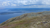
Coppermine DH is a hiking trail located in the outer Bay of Islands. It is maintained by the Outer Bay of Islands Development Committee. It is a hiking-preferred trail and has some awesome steep shoots and technical features. It's about a 2 hour hike-a-bike to get to the top, with some pretty incredible views of the Bay of Islands. The ride down is about 20 to 30 minutes, stopping for breaks throughout.

Access Info

Access from the Parking Lot before you get to York Harbour, on the left side of the highway. In the corner of the parking lot, there is a set of stairs where the trail begins.

Disclaimer

Trail has some very technical descents and is hiking-preferred. Please give right of way to hikers!

Local Trail Association

Traditionally Indigenous Territory

Recent Activity on Trail

Past Week
  • 0 rides
  •  
6 Months
  • 1 rides
  • 5 miles avg distance
All
  • 2 rides
  • Last: Sep 20, 2026
c1c2c3c4
January
February
March
April
May
June
July
August
September
October
November
December
update trails status or condition

Coppermine DH Trail Reports

statusdatedescription
Jun 26, 2023 @ 1:26pm
Jun 26, 2023
Mixed conditions, some dry sections others with streams running down it. only a couple unrideable sections for an experienced rider, where erosion...
Oct 18, 2019 @ 6:31pm
Oct 18, 2019
Hiked the Cape Blow Me Down Trail (aka Copper Mine) Oct. 12, 2019. A huge shout out and thanks to Mr. Swift and Wally (a friendly mountain biker...
Oct 12, 2019 @ 12:47pm
Oct 12, 2019
Minor erosion (trail braiding, small ruts developing, brake bumps)
Jul 15, 2019 @ 3:23am
Jul 15, 2019
Jun 3, 2019 @ 11:35am
Jun 3, 2019
Trail is mostly ridable, but has two sections that could use snow shoes. Dismount required.
more »
Status:
on Jun 26, 2023
Variable
Avg: 4.09 (4 votes)
Your vote: 0

view (170)
close
      Directions to coppermine-dh trailhead (49.062030, -58.273290)

      Photos

      31 more »
      mtb
      850 |
      Apr 19, 2018 @ 10:17am
      Apr 19, 2018
      mtb
      134 |
      Jun 26, 2023 @ 12:29pm
      Jun 26, 2023
      mtb
      188 |
      Jan 27, 2021 @ 3:05pm
      Jan 27, 2021
      mtb
      154 |
      Feb 25, 2019 @ 3:27pm
      Feb 25, 2019

      Videos

      2 more »
      Coppermine DH
      mtb
      9:44 | 1271 | Jul 3, 2018 , Corner Brook
      Coppermine Views from the Top
      mtb
      0:18 | 73 | Jun 7, 2022 , Corner Brook
      4.3 ★★★★★
      4 Ratings
      5 ★ 50%
      4 ★ 25%
      3 ★ 25%
      2 ★
      1 ★

      7 Reviews & Comments

      j-t-g j-t-g
      Drove all the way from BC, and let me say if this trail isn't on your MTB bucket list you'd better give your head a shake.
      hodder709 hodder709
      So access wise is it a direct hike up the trail,then back down the way you came up?
      adrianricketts adrianricketts
      Best DH trail on the West Coast - worth the gruelling hike-a-bike!

      We hope you've been enjoying Trailforks!

      Create a FREE account to view all trail reviews and much more.

      • By adrianrickettsTF Pro & contributors
      • #65026 - 5,164 views

      Frequently Asked Questions

      ▼ Where is Coppermine DH located?
      Coppermine DH is located in Corner Brook, Newfoundland, Canada. It is part of the Corner Brook trail network. The trailhead is located at coordinates 49.06203, -58.27329.
      ▼ How hard is Coppermine DH?
      Coppermine DH is rated as Double Black Diamond difficulty. The physical rating is Hard. The average grade is 17.109%. The climb difficulty is rated Double Black Diamond.
      ▼ What is the elevation gain for Coppermine DH?
      Coppermine DH has 26 ft of elevation gain. The trail has 2,018 ft of elevation descent. The elevation ranges from 116 ft to 2,109 ft.
      ▼ Is Coppermine DH a point to point trail?
      Yes, Coppermine DH is a point to point trail. The direction is Downhill Only. The trail type is singletrack.
      ▼ How long is Coppermine DH?
      Coppermine DH is 2.2 miles long. The trail type is singletrack.
      ▼ Are dogs allowed on Coppermine DH?
      Yes, dogs are allowed on Coppermine DH. Please keep dogs on a leash where required and clean up after them.
      ▼ When is the best time of year to ride Coppermine DH?
      Coppermine DH is best visited during: June - November.
      ▼ How do I access Coppermine DH? Where is the closest parking trailhead?
      The closest parking and trailhead locations to Coppermine DH are: View all parking locations in the area.
      ▼ How long does it take to ride Coppermine DH?
      Based on recorded activities, it takes an average of 1 hour 60 minutes to ride Coppermine DH. The trail is 2.2 miles long. Actual times will vary based on fitness level, conditions, and pace. View recent activity logs for more details.
      ▼ How busy is Coppermine DH?
      Coppermine DH is a moderately popular trail. There have been 107 recorded activities on this trail. The trail has received 170 check-ins. View recent activity on this trail.

      Hit the Trail

      Open in App

      Get this trail on your phone instantly.

      open trail in app

      Download Trail

      Save to wishlist, Garmin & download.
      save the trail

      Find Related Routes

      Find routes and users activities that include this trail.
      find routes for this trail

      You must enter a description before submitting.