Supporters, Builders, Maintainers & Land Managers of CRC Trail
BC ParksLand Manager
CRC Details
-
Activities
- Mountain Bike
- Hike
- Trail Running
-
Riding AreaBurke Mountain
Coquitlam, British Columbia -
AKATrail down to river, coquitlam river connector
-
Difficulty Rating
-
Voted DifficultyBlack Diamond (4 votes)
-
Hiking SAC ScaleT1 Hiking
-
Trail TypeSingletrack
-
Bike TypeDH, AM
-
DirectionDownhill OnlyPopular direction shown
-
Climb DifficultyGreen
-
Physical RatingEasy
-
Trail VisibilityAlways easy to follow
-
SeasonApr - Oct
-
Dogs AllowedYes
-
TTFs on TrailBerm, Drop, Jump, Skinny
-
Global Ranking
-
Local Popularity75 in Mountain Biking [+]
- 80 in Trail Running
- 35 in Hiking
Seasonal trail: April to October.
During winter months, the water crossing at Crystal Falls can be impassable. The only exit will be to push back up the trail so choose carefully.
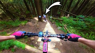
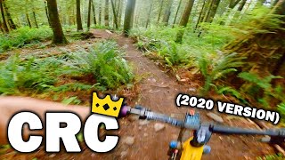
This trail traverses down from Woodland Walk to Coquitlam River Trail (CRT) upstream from Crystal falls. In the wet, the bottom section is clay and has low traction. In the summer and late spring, the lower section can get overgrown.
This trail is unsanctioned.
Disclaimer
River crossing at Crystal Falls can be impassable in the late fall and winter months.
Traditionally Indigenous Territory
More Stats for CRC mountain bike trail trail
-
Altitude change-921 ft
-
Altitude min346 ft
-
Altitude max1,267 ft
-
Altitude start1,267 ft
-
Altitude end344 ft
-
Grade-16%
-
Grade max-38%
-
Grade min-0.2%
-
Distance down1 mile
-
Distance flat138 ft
-
Avg time00:12:20
-
Avg reverse time00:19:40
- view trail stats
- Unknown
- Snow Groomed
- Snow Packed
- Snow Covered
- Snow Cover Partial
- Freeze/thaw Cycle
- Icy
- Prevalent Mud
- Wet
- Variable
- Ideal
- Dry
- Very Dry
The colour categories are based on what percentage of riders are riding a trail in its intended direction.
- > 96%
- > 90%
- > 80%
- > 70%
- > 50%
- < 50%
- bi-directional trail
- no data
- < 2 days
- < 1 week
- < 2 weeks
- < 1 month
- < 6 months
- > 6 months
- Downhill Only
- Downhill Primary
- Both Directions
- Uphill Primary
- Uphill Only
- One Direction
- Description
- Photos
- Description & Photos
- Videos
- most popular
- popular
- less popular
- not popular
- mountain biking recent
- mountain biking (>6 month)
- hiking (1 year)
- moto (1 year)
- Downhill Ski
- Backcountry Ski
- Nordic Ski
- Snowmobile
Save the current map location and zoom level as your default home location whenever this page is loaded.
SaveCRC Trail Reports
Recent Ridelog Activity on Trail
- 0 rides
- 6 rides
- 12 miles avg distance
- 212 rides
- Last: Jan 19, 2025
Photos
Trail Products
11 Reviews & Comments
We hope you've been enjoying Trailforks!
Create a FREE account to view trail comments and much more.
Videos
Nearby Trails
- Pylon Access 3,504 ft
- Lower Vic's 4,400 ft
- Eco Mode 4,541 ft
- Nescafe 4,593 ft
- The Hammer 4,987 ft
You must enter a description before submitting.