more stats
321 ft
Distance
6 ft
Climb
-43 ft
Descent
00:01:02
Avg time
-37 ft
Altitude change
677 ft
Altitude min
722 ft
Altitude max
720 ft
Altitude start
683 ft
Altitude end
-11.563%
Grade
-31.767%
Grade max
14.239%
Grade min
53 ft
Distance climb
234 ft
Distance down
34 ft
Distance flat
00:01:02
Avg time

Damnation Details

  • Activities
    • Mountain Bike
    • E-Bike
    • Winter Fat Bike
  • Riding Area
    Summit Ridge
    Maple Valley, Washington
  • Difficulty Rating
  • Voted Difficulty
    Black Diamond (1 vote)
  • Local Popularity
    20 in Mountain Biking [+]
    • 65 in E-Biking
    • 5 in Winter Fat Biking
  • Global Ranking
    #124455 in Mountain Biking [+]
    • #152385 in E-Biking
  • Trail Type
    Singletrack
  • Bike Type
    DH, AM, XC, Fat
  • Direction
    Downhill Only
    Popular Direction Shown
  • Dogs Allowed
    Yes
  • eBike Allowed
    Yes up to Class 1
  • TTFs on Trail
    Drop
  • Year Opened
    2019

Short spur off of Salvation with two steep downhill sections, rollable but safer to just send it. This trail will shoot you right out onto the Agitator uphill section, which gives you the option of hitting the tabletop jump line or finishing on Agitator beginner down-hill.

Local Trail Association
Traditionally Indigenous Territory

Recent Activity on Trail

Past Week
  • 0 rides
  •  
6 Months
  • 3 rides
  • 6 miles avg distance
All
  • 365 rides
  • Last: May 12, 2026
c1c2c3c4
January
February
March
April
May
June
July
August
September
October
November
December
update trails status or condition

Damnation Trail Reports

statusdatedescription
Aug 10, 2026 @ 7:23am (America/Los_Angeles)
Aug 10, 2026
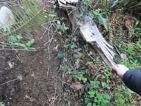
Overgrown and unridable
Oct 14, 2025 @ 5:04pm (America/Los_Angeles)
Oct 14, 2025
overgrown and in need of rebuild.
Oct 6, 2024 @ 3:29pm
Oct 6, 2024
looked grown over and unused, the entrance sign was no longer there so I just took salvation
Apr 19, 2023 @ 2:00pm
Apr 19, 2023
The line gets confusing with some blow downs, but it goes start to finish no problem.
Jan 30, 2023 @ 5:58pm
Jan 30, 2023
big trees over the trail, not rideable Saturday 1/28
more »
Status:
on Aug 10, 2026
Avg: 3.88 (3 votes)
Your vote: 0

view (1,479)
close
      Directions to damnation trailhead (47.333030, -122.011110)

      Photos

      No photos have been added for Damnation yet, add a photo.

      Videos

      1 more »
      Damnation
      mtb
      5:03 | 211 | Apr 28, 2025 , Maple Valley

      Routes with this trail

      2.0 24 miles 1,242 ft 50
      this site is annoying how do i use it
      3.7
      3 Ratings
      5 67%
      4
      3
      2
      1 33%

      4 Reviews & Comments

      enumclaw
      I scouted out Damnation first and then decided at 82 I am a little old for riding this one.
      bopple
      Can’t even be considered a trail anymore tried to ride it last January-March timeframe and after realizing what it really was my buddys and I had a hard time even walking it down I can’t imagine how bad condition it’s in now with almost a year of time passing
      bopple
      Do NOT ride this it is in major need of repair with two downed trees across it and it’s extremely rutted out in the condition it is in right now I would consider it a high level double black DH trail even waking it is

      We hope you've been enjoying Trailforks!

      Create a FREE account to view all trail reviews and much more.

      • By nocoastTF Pro & contributors
      • #189620 - 1,706 views

      Frequently Asked Questions

      Where is Damnation located?
      Damnation is located in Summit Ridge, Maple Valley, Washington, United States. It is part of the Summit Ridge trail network. The trailhead is located at coordinates 47.33303, -122.01111.
      How hard is Damnation?
      Damnation is rated as Black Diamond difficulty. The average grade is 11.563%.
      What is the elevation gain for Damnation?
      Damnation has 6 ft of elevation gain. The trail has 43 ft of elevation descent. The elevation ranges from 677 ft to 722 ft.
      Is Damnation a point to point trail?
      Yes, Damnation is a point to point trail. The direction is Downhill Only. The trail type is singletrack.
      How long is Damnation?
      Damnation is 321 ft long. The trail type is singletrack.
      Are dogs allowed on Damnation?
      Yes, dogs are allowed on Damnation. Please keep dogs on a leash where required and clean up after them.
      When is the best time of year to ride Damnation?
      Based on activity log data, the most popular months to ride Damnation are:
      • March (2 activities)
      • February (1 activities)
      • April (1 activities)
      Check the reports page for current trail conditions.
      How do I access Damnation? Where is the closest parking trailhead?
      The closest parking and trailhead locations to Damnation are: View all parking locations in the area.
      How long does it take to ride Damnation?
      Based on recorded activities, it takes an average of 1 minute to ride Damnation. The trail is 321 ft long. Actual times will vary based on fitness level, conditions, and pace. View recent activity logs for more details.
      How busy is Damnation?
      Damnation is a less popular trail with lighter traffic. There have been 256 recorded activities on this trail. The trail has received 1,479 check-ins. View recent activity on this trail.

      Hit the Trail

      Open in App

      Get this trail on your phone instantly.

      open trail in app

      Download Trail

      Save to wishlist, Garmin & download.
      save the trail

      Find Related Routes

      Find routes and users activities that include this trail.
      find routes for this trail

      You must enter a description before submitting.