more stats
6.1 miles
Distance
223 ft
Climb
-2,585 ft
Descent
00:40:23
Avg time
-2,362 ft
Altitude change
1,339 ft
Altitude min
3,742 ft
Altitude max
3,700 ft
Altitude start
1,339 ft
Altitude end
-7.4%
Grade
-53.8%
Grade max
19%
Grade min
1 mile
Distance climb
5 miles
Distance down
1,831 ft
Distance flat
00:40:23
Avg time

Dead Mountain Details

  • Activities
    • Mountain Bike
    • E-Bike
    • Hike
    • Trail Running
  • Riding Area
    Dead Mountain
    Oakridge, Oregon
  • Ref Number
    #3566
  • Difficulty Rating
  • Local Popularity
    100 in Mountain Biking [+]
    • 95 in E-Biking
    • 5 in Trail Running
    • 5 in Hiking
  • Global Ranking
    #7912 in Mountain Biking [+]
    • #13166 in E-Biking
    • #111030 in Trail Running
    • #107066 in Hiking
  • Trail Type
    Singletrack
  • Direction
    Downhill Primary
    Popular Direction Shown
  • Climb Difficulty
    Black Diamond
  • Dogs Allowed
    Yes
  • eBike Allowed
    Yes up to Class 1
  • TTFs on Trail
    Berm, Drop, Gap Jump, Roller Coaster

Overview
Catch a morning shuttle to warm up on one of the area’s newer trails, Dead Mountain, and then catch an afternoon shuttle to Larison Rock. You can ride back into town from the bottom of either trail and by the end of the day you’ll have notched over 6K’ of descending.

Route Details
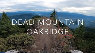
Dead Mountain is a great introduction to the riding in Oakridge. It isn’t as deep into the backcountry as some of the other trails but to compensate it bumps up the fun factor. Once the shuttle rig drops you off you can add a quick bonus loop by pedaling up the remaining quarter mile on a doubletrack road to get to the summit, which then loops you back down on singletrack to the official start of the Upper Dead Mountain Trail.

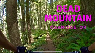
The upper part of the trail is flowy with lots of rollers to pump for speed but plenty of sidehill to keep you honest. The lower section opens up with faster, straighter segments, the trees flying by in a blur of emerald green in your peripheral vision. The corners come up fast when you’re moving at speed so get ready to haul on the brakes so you don’t overshoot the turns. After five glorious miles of descending you’ll end at the lower trailhead off Salmon Creek Road. If your vehicle isn’t here and you need to head into Oakridge, you can keep heading downhill and hop on the Salmon Creek Trail for a pleasant creek-side spin back into downtown.

This ride is good when paired with the nearby Larison Rock shuttle (https://www.trailforks.com/trails/larison-rock/).

Riding Season
Spring through fall.

Important navigational note:
There is a confusing trail sign on this trail. The trail that mountain bikers call lower Dead Mountain is signed by the official forest service trail name "Flat Creek Trail #3566". Continue straight at the Flat Creek sign at the road crossing, you are still on the correct route.

Trail Supporters
Local Trail Association

Recent Activity on Trail

Past Week
  • 11 rides
  • 12 miles average
6 Months
  • 62 rides
  • 13 miles avg distance
All
  • 593 rides
  • Last: Jul 1, 2026
c1c2c3c4
January
February
March
April
May
June
July
August
September
October
November
December
update trails status or condition

Dead Mountain Trail Reports

statusdatedescription
Jun 14, 2026 @ 3:54pm (America/Los_Angeles)
Jun 14, 2026
Upper section has some hero dirt, but the lower section is dry.
May 23, 2026 @ 9:54pm (America/Los_Angeles)
May 23, 2026
May 5, 2026 @ 1:18pm (America/Los_Angeles)
May 5, 2026
reporter prescribed burn notice
Apr 26, 2026 @ 10:02pm (America/Los_Angeles)
Apr 26, 2026
Hero dirt get it while it’s good
Jan 17, 2026 @ 5:11pm (America/Los_Angeles)
Jan 17, 2026
Some debris but running great otherwise.
more »
Status:
on Jun 14, 2026
Dry
Avg: 4.21 (37 votes)
Your vote: 0

view (3,088)
close
3D
Trail Conditions
  • Unknown
  • Snow Groomed
  • Snow Packed
  • Snow Covered
  • Snow Cover Partial
  • Freeze/thaw Cycle
  • Icy
  • Prevalent Mud
  • Wet
  • Variable
  • Ideal
  • Dry
  • Very Dry
Trail Flow (Ridden Direction)
Trailforks scans users ridelogs to determine the most popular direction each trail is ridden. A good flowing trail network will have most trails flowing in a single direction according to their intension.
The colour categories are based on what percentage of riders are riding a trail in its intended direction.
  • > 96%
  • > 90%
  • > 80%
  • > 70%
  • > 50%
  • < 50%
  • bi-directional trail
  • no data
Trail Last Ridden
Trailforks scans ridelogs to determine the last time a trail was ridden.
  • < 2 days
  • < 1 week
  • < 2 weeks
  • < 1 month
  • < 6 months
  • > 6 months
Trail Ridden Direction
The intended direction a trail should be ridden.
  • Downhill Only
  • Downhill Primary
  • Both Directions
  • Uphill Primary
  • Uphill Only
  • One Direction
Contribute Details
Colors indicate trail is missing specified detail.
  • Description
  • Photos
  • Description & Photos
  • Videos
Trail Popularity ?
Trailforks scans ridelogs to determine which trails are ridden the most in the last 9 months. Trails are compared with nearby trails in the same city region with a possible 25 colour shades. Think of this as a heatmap, more rides = more kinetic energy = warmer colors.
  • most popular
  • popular
  • less popular
  • not popular
ATV/ORV/OHV Filter
Max Vehicle Width
inches
US Cell Coverage
Legend
cell carrier legend

Radar Time
Activity Recordings
Trailforks uses anonymized public activity data. ?
Activity Recordings
Trailforks uses anonymized public activity data. ?
Personal Heatmap
Activity Types
all / none
Options
2
Date range month
Winter Trails
Warning A routing network for winter maps does not exist. Selecting trails using the winter trails layer has been disabled.
Missing Trails
Most Popular
Least Popular
Trails are colored based on popularity. The more popular a trail is, the more red. Less popular trails trend towards green.
Jump Magnitude Heatmap
Heatmap of where riders jump on trails. Zoom in to see individual jumps, click circles to view jump details.
BC Backroad Status

Service Road Atlas is a free to use, community-driven service for viewing and creating reports on the numerous back-country service roads around B.C. and Alberta.

map legend
Slope Aspect
Direction the slope faces
Flat N NE E SE S SW W NW
Trails Deemphasized
Trails are shown in grey.
disable
Only show trails with no bike usage.
Enable
Suggested Layers
Based on selected activity type

    Save the current map location and zoom level as your default home location whenever this page is loaded.

    Save
        Directions to dead-mountain trailhead (43.778420, -122.402030)

        Photos

        53 more »
        48 |
        Apr 7, 2026 @ 1:13pm
        Apr 7, 2026
        73 |
        Dec 29, 2025 @ 1:24pm
        Dec 29, 2025
        80 |
        Nov 26, 2025 @ 8:51pm
        Nov 26, 2025
        71 |
        Nov 26, 2025 @ 8:51pm
        Nov 26, 2025

        Videos

        3 more »
        Dead Mountain - Oakridge, Oregon
        18:10 | 1007 | Apr 2, 2022 , Oakridge
        Dead Mountain | Oakridge, OR
        9:21 | 413 | Nov 8, 2021 , Oakridge
        Dead Mountain: First Rides in Oakridge Pt. 2
        8:09 | 883 | Aug 8, 2019 , Oakridge

        Trail Lists

        Routes with this trail

        6 miles 207 ft 1
        Overview Catch a morning shuttle to warm up on one of the area’s newer trails, , and then catch an...

        Trail Products

        23 Reviews & Comments


        We hope you've been enjoying Trailforks!

        Create a FREE account to view trail comments and much more.

        Frequently Asked Questions About Dead Mountain

        Where is Dead Mountain located?
        Dead Mountain is located in Dead Mountain, Oakridge, Oregon, United States. It is part of the Dead Mountain trail network. The trailhead is located at coordinates 43.77842, -122.40203.
        How hard is Dead Mountain?
        Dead Mountain is rated as Blue difficulty. The average grade is 7.4%. The climb difficulty is rated Black Diamond.
        What is the elevation gain for Dead Mountain?
        Dead Mountain has 223 ft of elevation gain. The trail has 2,585 ft of elevation descent. The elevation ranges from 1,339 ft to 3,742 ft.
        Is Dead Mountain a point to point trail?
        Dead Mountain is not a point to point trail. The direction is Downhill Primary. The trail type is singletrack.

        Hit the Trail

        Open in App

        Get this trail on your phone instantly.
        open trail in app

        Download Trail

        Save to wishlist, Garmin & download.
        save the trail

        Find Related Routes

        Find routes and users activities that include this trail.
        find routes for this trail

        You must enter a description before submitting.