

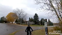
more stats
4.3 miles
Distance
284 ft
Climb
-119 ft
Descent
00:34:22
Avg time
167 ft
Altitude change
2,136 ft
Altitude min
2,303 ft
Altitude max
2,136 ft
Altitude start
2,303 ft
Altitude end
0.7%
Grade
-22.9%
Grade max
20.8%
Grade min
2 miles
Distance climb
1 mile
Distance down
2 miles
Distance flat
00:34:22
Avg time

Devonian Trail Details

  • Activities
    • Mountain Bike
    • Gravel Bike
    • Adaptive Bike
    • Winter Fat Bike
    • Hike
    • Trail Running
  • Riding Area
    Devon River Valley
    Devon, Alberta
  • AKA
    Prospector's Point Trail
  • Difficulty Rating
  • Local Popularity
    50 in Mountain Biking heatmap [+]
    • 35 in Trail Running
    • 5 in Hiking
    • 5 in Winter Fat Biking
    • 5 in Adaptive Biking
    • 85 in Gravel Biking
  • Global Ranking
    #100128 in Mountain Biking [+]
    • #156255 in Trail Running
    • #313014 in Hiking
    • #4978 in Winter Fat Biking
    • #1753 in Adaptive Biking
    • #2497 in Gravel Biking
  • Provincial Ranking
    #1,442 in Mountain Biking · Alberta [+]
    • #3,100 in Trail Running
    • #4,252 in Hiking
    • #229 in Winter Fat Biking
    • #40 in Adaptive Biking
    • #75 in Gravel Biking
  • Trail Type
    Gravel Path
  • Bike Type
    XC, Fat, Adaptive MTB, Gravel
  • Direction
    Both Directions
  • Climb Difficulty
    Blue
  • Physical Rating
    Moderate
  • Season
    All-Season
  • Dogs Allowed
    Yes
  • Ride in Rain
    Yes
  • Year Opened
    2016
  • Land Owner

The 7km granular/gravel trail spans from Prospectors' Point to the Botanical Gardens. The trail roams through a varying range of biodiversity and terrain; from wetlands, to river valley, to dense forest, and boardwalks. Keep a keen eye out for owls, eagles, rabbits, deer, and coyotes - there is an abundance of wildlife to be seen. For an added bonus, stop in at the Botanical Gardens for a tour or a quick snack/coffee.

Access Info

Trail-heads start at either the Botanical Gardens or at Prospector's Point parking lots.

Disclaimer

Multi-Use Trail - watch out for hikers/walkers - especially when close to Prospector's Point (Near the Devon bridge).

Tags
BoardwalkCafe nearby

Local Trail Association

Recent Activity on Trail

Past Week
  • 0 rides
  •  
6 Months
  • 8 rides
  • 13 miles avg distance
All
  • 32 rides
  • Last: Oct 25, 2026
c1c2c3c4
January
February
March
April
May
June
July
August
September
October
November
December
update trails status or condition

Devonian Trail Trail Reports

statusdatedescription
Aug 29, 2026 @ 5:40pm (America/Edmonton)
Aug 29, 2026
The gravel can be deep in some parts making it difficult to climb hills. Ruts in the trail from water run off and some overgrowth of branches in...
Dec 17, 2025 @ 10:18am (America/Edmonton)
Dec 17, 2025
Large tree down across trail, blocking trail
Jun 20, 2022 @ 8:24am
Jun 20, 2022
Large tree down across trail, blocking trail
Dec 8, 2020 @ 7:51pm
Dec 8, 2020
A covering of snow makes this trail pretty easy to ride on (compared to the “loose gravel” reviews prior). Good to go from Voyageur Park until...
Jun 20, 2020 @ 5:12pm
Jun 20, 2020
Trail is still like previous reports, loose gravel and blind corners after Range Road 262 towards Prospectors point. Great views off trail but not...
more »
Status:
on Aug 29, 2026
Snow Covered
Avg: 4.11 (2 votes)
Your vote: 0

view (219)
close
      Directions to devonian-trail-104336 trailhead (53.371960, -113.753440)

      Photos

      7 more »
      mtb
      170 |
      Jun 20, 2020 @ 5:02pm
      Jun 20, 2020
      mtb
      122 |
      Jun 20, 2020 @ 5:02pm
      Jun 20, 2020
      mtb
      251 |
      Feb 24, 2018 @ 5:18pm
      Feb 24, 2018
      mtb
      308 |
      Sep 28, 2017 @ 6:06pm
      Sep 28, 2017

      Videos

      6 more »
      devon flow nov 2019
      mtb
      2:27 | 441 | Nov 18, 2019 , Devon
      Oct. 8, 2020: MTB Ride Devon, The Wifey & the...
      mtb
      3:48 | 113 | Oct 11, 2020 , Devon
      Oct. 8, 2020: MTB Ride Devon, The Wifey & the...
      mtb
      3:55 | 43 | Oct 11, 2020 , Devon
      Oct. 8, 2020: MTB Ride Devon, The Wifey & the...
      mtb
      2:37 | 42 | Oct 11, 2020 , Devon

      Routes with this trail

      more »
      65 miles • 3,093 ft • 47 •
      Route from Fort Saskatchewan to Devon
      57 miles • 2,060 ft • 97 •
      Route from Fort Saskatchewan to Devon
      4.5 ★★★★★
      2 Ratings
      5 ★ 50%
      4 ★ 50%
      3 ★
      2 ★
      1 ★

      2 Reviews & Comments

      Drfargo
      Trailhead from Prospector’s point to Range Road 262 is heavy, loose gravel. Watch the down hill sections especially towards the river, tight, blind corners with loose gravel. Be nice and ring your bell in those sections. The climb up in loose gravel can be challenging.
      wheelsdan
      this trail has been covered with marble sized rocks that is difficult to peddle or walk on

      We hope you've been enjoying Trailforks!

      Create a FREE account to view all trail reviews and much more.

      • By Wronks & contributors
      • #104336 - 7,411 views

      Frequently Asked Questions

      ▼ Where is Devonian Trail located?
      Devonian Trail is located in Devon River Valley, Devon, Alberta, Canada. It is part of the Devon River Valley trail network. The trailhead is located at coordinates 53.37196, -113.75344.
      ▼ How hard is Devonian Trail?
      Devonian Trail is rated as Green difficulty. The physical rating is Moderate. The average grade is 0.7%. The climb difficulty is rated Blue.
      ▼ What is the elevation gain for Devonian Trail?
      Devonian Trail has 284 ft of elevation gain. The trail has 119 ft of elevation descent. The elevation ranges from 2,136 ft to 2,303 ft.
      ▼ Is Devonian Trail a point to point trail?
      Devonian Trail is not a point to point trail. The direction is Both Directions. The trail type is gravel path.
      ▼ How long is Devonian Trail?
      Devonian Trail is 4.3 miles long. The trail type is gravel path.
      ▼ Are dogs allowed on Devonian Trail?
      Yes, dogs are allowed on Devonian Trail. Please keep dogs on a leash where required and clean up after them.
      ▼ When is the best time of year to ride Devonian Trail?
      Devonian Trail is best visited during: All-Season.
      ▼ How do I access Devonian Trail? Where is the closest parking trailhead?
      The closest parking and trailhead locations to Devonian Trail are: View all parking locations in the area.
      ▼ How long does it take to ride Devonian Trail?
      Based on recorded activities, it takes an average of 34 minutes to ride Devonian Trail. The trail is 4.3 miles long. Actual times will vary based on fitness level, conditions, and pace. View recent activity logs for more details.
      ▼ How busy is Devonian Trail?
      Devonian Trail is a moderately popular trail. There have been 201 recorded activities on this trail. The trail has received 219 check-ins. View recent activity on this trail.

      Hit the Trail

      Open in App

      Get this trail on your phone instantly.

      open trail in app

      Download Trail

      Save to wishlist, Garmin & download.
      save the trail

      Find Related Routes

      Find routes and users activities that include this trail.
      find routes for this trail

      You must enter a description before submitting.