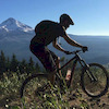

more stats
2.4 miles
Distance
201 ft
Climb
-132 ft
Descent
00:36:30
Avg time
72 ft
Altitude change
2,914 ft
Altitude min
3,021 ft
Altitude max
2,914 ft
Altitude start
2,986 ft
Altitude end
0.6%
Grade
-22.3%
Grade max
16.3%
Grade min
1 mile
Distance climb
4,751 ft
Distance down
2,408 ft
Distance flat
00:36:30
Avg time

Dick's Trail Details

  • Activities
    • Mountain Bike
    • E-Bike
    • Hike
    • Trail Running
  • Riding Area
    South Side
    Williams Lake, British Columbia
  • Difficulty Rating
  • Local Popularity
    70 in Mountain Biking heatmap [+]
    • 60 in E-Biking
    • 85 in Trail Running
    • 90 in Hiking
  • Global Ranking
    #85845 in Mountain Biking [+]
    • #46861 in E-Biking
    • #105144 in Trail Running
    • #84141 in Hiking
  • Provincial Ranking
    #4,308 in Mountain Biking · British Columbia [+]
    • #3,227 in E-Biking
    • #6,012 in Trail Running
    • #4,431 in Hiking
  • Trail Type
    Singletrack
  • Bike Type
    AM
  • Dogs Allowed
    Yes
  • eBike Allowed
    Yes up to Class 1

• Popular X-C trail always ridden one way from the Twizzler end. Fairly flat elevation profile and fairly easy x-c pedalling except for a 300 metre long rocky section along a boulder-strewn canyon edge which provides a short section of technical challenge. This part can easily be walked, though, and is well worth it to experience the unique landscape.
• If you're shuttling from the top of Twizzler, this is a popular side detour if you don't mind doing some pedalling to extend the ride down.
• To locate the turnoff from upper Twizzler, use the wire fence as a landmark. Going up, look for the wire fence on your left; when it ends, turn left onto Dick’s. Coming down from Dog Creek Rd, as soon as there is a fence on your right, back up slightly for the turnoff. There is a trail sign a short way in on Dick’s Trail.
• Rim Job is the natural continuation of Dick's Trail. As you near Rim Job, you'll come out into the open and there will be a wire fence on your right, then look for an opening on the left with a well-used singletrack.

Tags
Rocky

Local Trail Association

Traditionally Indigenous Territory

Recent Activity on Trail

Past Week
  • 0 rides
  •  
6 Months
  • 4 rides
  • 11 miles avg distance
All
  • 90 rides
  • Last: Nov 7, 2026
c1c2c3c4
January
February
March
April
May
June
July
August
September
October
November
December
update trails status or condition

Dick's Trail Trail Reports

statusdatedescription
Apr 2, 2026 @ 2:40pm (America/Vancouver)
Apr 2, 2026
reporter cleared trail good to go
Aug 20, 2025 @ 6:19pm
Aug 20, 2025
reporter
Jun 30, 2025 @ 1:34pm
Jun 30, 2025
reporter tree cleared
May 8, 2025 @ 1:50pm
May 8, 2025
reporter
Mar 16, 2025 @ 5:10pm
Mar 16, 2025
Tree down before rock garden. Chainsaw needed
more »
Status:
on Apr 2, 2026
Avg: 3.98 (1 votes)
Your vote: 0

view (414)
close
      Directions to dick-s-trail trailhead (52.083410, -122.098310)

      Photos

      8 more »
      mtb
      268 |
      Aug 5, 2016 @ 8:23pm
      Aug 5, 2016
      mtb
      580 |
      Jul 21, 2015 @ 5:55pm
      Jul 21, 2015
      mtb
      402 |
      Jul 21, 2015 @ 5:55pm
      Jul 21, 2015
      report
      mtb
      97 |
      May 10, 2021 @ 8:53pm
      May 10, 2021

      Videos

      no videos have been added for Dick's Trail yet, add a video.

      Routes with this trail

      more »
      10 miles • 1,572 ft • 20 •
      A classic Southside loop featuring Dick's trail and Jaden. Relatively long but rideable climb to begin,...
      4.0 ★★★★★
      1 Ratings
      5 ★
      4 ★ 100%
      3 ★
      2 ★
      1 ★

      3 Reviews & Comments

      TrevorSowersXc2
      This is such a fun trail to ride! The rock garden section is challenging but not scary and much of the trail is just as fun in reverse. This is a must ride in WL IMO
      gbeaks33 gbeaks33
      Not sure if they've updated the trail this year but there is a very clear continuation of the trail past nerdee that connects directly to Rim Job. The other post that said there isn't a trail is incorrect.
      biking1985 biking1985
      Just a heads up, this trail is great up to Nerdee (green rd access trail). No trail, and very difficult to locate continuation towards Rim/Job connector.

      We hope you've been enjoying Trailforks!

      Create a FREE account to view all trail reviews and much more.

      Nearby Trails

      • By Ivor-McTF Pro & contributors
      • #38777 - 3,013 views

      Frequently Asked Questions

      ▼ Where is Dick's Trail located?
      Dick's Trail is located in South Side, Williams Lake, British Columbia, Canada. It is part of the South Side trail network. The trailhead is located at coordinates 52.08341, -122.09831.
      ▼ How hard is Dick's Trail?
      Dick's Trail is rated as Blue difficulty. The average grade is 0.6%.
      ▼ What is the elevation gain for Dick's Trail?
      Dick's Trail has 201 ft of elevation gain. The trail has 132 ft of elevation descent. The elevation ranges from 2,914 ft to 3,021 ft.
      ▼ How long is Dick's Trail?
      Dick's Trail is 2.4 miles long. The trail type is singletrack.
      ▼ Are dogs allowed on Dick's Trail?
      Yes, dogs are allowed on Dick's Trail. Please keep dogs on a leash where required and clean up after them.
      ▼ When is the best time of year to ride Dick's Trail?
      Based on activity log data, the most popular months to ride Dick's Trail are:
      • July (5 activities)
      • September (5 activities)
      • August (4 activities)
      Check the reports page for current trail conditions.
      ▼ How do I access Dick's Trail? Where is the closest parking trailhead?
      The closest parking and trailhead locations to Dick's Trail are: View all parking locations in the area.
      ▼ How long does it take to ride Dick's Trail?
      Based on recorded activities, it takes an average of 37 minutes to ride Dick's Trail. The trail is 2.4 miles long. Actual times will vary based on fitness level, conditions, and pace. View recent activity logs for more details.
      ▼ How busy is Dick's Trail?
      Dick's Trail is a very popular trail. There have been 427 recorded activities on this trail. The trail has received 414 check-ins. View recent activity on this trail.

      Hit the Trail

      Open in App

      Get this trail on your phone instantly.

      open trail in app

      Download Trail

      Save to wishlist, Garmin & download.
      save the trail

      Find Related Routes

      Find routes and users activities that include this trail.
      find routes for this trail

      You must enter a description before submitting.