more stats
3,054 ft
Distance
-753 ft
Descent
00:07:06
Avg time
-753 ft
Altitude change
9,309 ft
Altitude min
10,063 ft
Altitude max
10,063 ft
Altitude start
9,311 ft
Altitude end
-24.6%
Grade
-67.3%
Grade max
-3.9%
Grade min
3,054 ft
Distance down
00:07:06
Avg time

Dogpatch Details

  • Activities
    • Mountain Bike
  • Riding Area
    Pajarito Bike Park
    Los Alamos, New Mexico
  • Difficulty Rating
  • Local Popularity
    95 in Mountain Biking
  • Global Ranking
    #64553 in Mountain Biking
  • Trail Type
    Singletrack
  • Bike Type
    DH
  • Season
    May - Nov
  • Dogs Allowed
    Yes
  • TTFs on Trail
    Berm, Drop
  • Year Opened
    2025
  • Land Owner

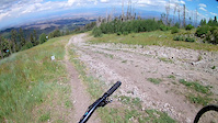
Considered to be a more intermediate downhill run, but still really fun for more advanced riders.
At times it's very steep and tight, but there are no mandatory jumps or drops.

Drop in left and do a fun rock roll, or go right and avoid it.
Ride for a while in steep tight corners and loose sections.

Once you hit the road, you cross and set up for a few jumps/drops.
Go arounds for both, but the drop is really fun and mellow, just be ready for a small second drop after.
Hit the next jump and if you can stay left around the corner, there's another as you go back into the woods.

More woods down to a road, follow that straight down to the base.

Bike Park

Local Trail Association
Traditionally Indigenous Territory

Recent Activity on Trail

Past Week
  • 0 rides
  •  
6 Months
  • 3 rides
  • 13 miles avg distance
All
  • 145 rides
  • Last: Jun 11, 2026
c1c2c3c4
January
February
March
April
May
June
July
August
September
October
November
December
update trails status or condition

Dogpatch Trail Reports

Status:
on May 9, 2026
Avg: 4.07 (6 votes)
Your vote: 0

view (786)
close
3D
Trail Conditions
  • Unknown
  • Snow Groomed
  • Snow Packed
  • Snow Covered
  • Snow Cover Partial
  • Freeze/thaw Cycle
  • Icy
  • Prevalent Mud
  • Wet
  • Variable
  • Ideal
  • Dry
  • Very Dry
Trail Flow (Ridden Direction)
Trailforks scans users ridelogs to determine the most popular direction each trail is ridden. A good flowing trail network will have most trails flowing in a single direction according to their intension.
The colour categories are based on what percentage of riders are riding a trail in its intended direction.
  • > 96%
  • > 90%
  • > 80%
  • > 70%
  • > 50%
  • < 50%
  • bi-directional trail
  • no data
Trail Last Ridden
Trailforks scans ridelogs to determine the last time a trail was ridden.
  • < 2 days
  • < 1 week
  • < 2 weeks
  • < 1 month
  • < 6 months
  • > 6 months
Trail Ridden Direction
The intended direction a trail should be ridden.
  • Downhill Only
  • Downhill Primary
  • Both Directions
  • Uphill Primary
  • Uphill Only
  • One Direction
Contribute Details
Colors indicate trail is missing specified detail.
  • Description
  • Photos
  • Description & Photos
  • Videos
Trail Popularity ?
Trailforks scans ridelogs to determine which trails are ridden the most in the last 9 months. Trails are compared with nearby trails in the same city region with a possible 25 colour shades. Think of this as a heatmap, more rides = more kinetic energy = warmer colors.
  • most popular
  • popular
  • less popular
  • not popular
ATV/ORV/OHV Filter
Max Vehicle Width
inches
US Cell Coverage
Legend
cell carrier legend

Radar Time
Activity Recordings
Trailforks uses anonymized public activity data. ?
Activity Recordings
Trailforks uses anonymized public activity data. ?
Personal Heatmap
Activity Types
all / none
Options
2
Date range month
Winter Trails
Warning A routing network for winter maps does not exist. Selecting trails using the winter trails layer has been disabled.
Missing Trails
Most Popular
Least Popular
Trails are colored based on popularity. The more popular a trail is, the more red. Less popular trails trend towards green.
Jump Magnitude Heatmap
Heatmap of where riders jump on trails. Zoom in to see individual jumps, click circles to view jump details.
BC Backroad Status

Service Road Atlas is a free to use, community-driven service for viewing and creating reports on the numerous back-country service roads around B.C. and Alberta.

map legend
Slope Aspect
Direction the slope faces
Flat N NE E SE S SW W NW
Trails Deemphasized
Trails are shown in grey.
disable
Only show trails with no bike usage.
Enable
Suggested Layers
Based on selected activity type

    Save the current map location and zoom level as your default home location whenever this page is loaded.

    Save
        Directions to dogpatch trailhead (35.886390, -106.389610)

        Photos

        No photos have been added for Dogpatch yet, add a photo.

        Videos

        2 more »
        Mountain Biking Dogpatch at Pajarito Bike...
        10:01 | 423 | Oct 13, 2021 , Los Alamos
        Dogpatch (with gimbal stabilizer)
        3:34 | 202 | Jul 18, 2017 , Los Alamos

        Reviews / Comments

        No reviews yet, be the first to write a review or ask a question.
        Use trail reports to comment on trail conditions.


        We hope you've been enjoying Trailforks!

        Create a FREE account to view trail comments and much more.

        • By lyophilizationTF Pro & contributors
        • #62667 - 1,616 views

        Frequently Asked Questions About Dogpatch

        Where is Dogpatch located?
        Dogpatch is located in Pajarito Bike Park, Los Alamos, New Mexico, United States. It is part of the Pajarito Bike Park trail network. The trailhead is located at coordinates 35.88639, -106.38961.
        How hard is Dogpatch?
        Dogpatch is rated as Black Diamond difficulty. The average grade is 24.6%.
        What is the elevation gain for Dogpatch?
        The trail has 753 ft of elevation descent. The elevation ranges from 9,309 ft to 10,063 ft.
        How long is Dogpatch?
        Dogpatch is 3,054 ft long. The trail type is singletrack.

        Hit the Trail

        Open in App

        Get this trail on your phone instantly.
        open trail in app

        Download Trail

        Save to wishlist, Garmin & download.
        save the trail

        Find Related Routes

        Find routes and users activities that include this trail.
        find routes for this trail

        You must enter a description before submitting.