
more stats
4,314 ft
Distance
134 ft
Climb
-74 ft
Descent
00:10:28
Avg time
60 ft
Altitude change
289 ft
Altitude min
370 ft
Altitude max
289 ft
Altitude start
348 ft
Altitude end
1.4%
Grade
-14%
Grade max
23.6%
Grade min
1,765 ft
Distance climb
2,054 ft
Distance down
492 ft
Distance flat
00:10:28
Avg time

Donaconda Details

  • Activities
    • Mountain Bike
    • E-Bike
    • Hike
    • Trail Running
    • Snowshoe
  • Riding Area
    Don Valley
    Toronto, Ontario
  • Difficulty Rating
  • Voted Difficulty
    Double Black Diamond (8 votes)
  • Local Popularity
    90 in Mountain Biking heatmap [+]
    • 95 in E-Biking
    • 90 in Trail Running
    • 80 in Hiking
    • 5 in Snowshoeing
  • Global Ranking
    #10093 in Mountain Biking [+]
    • #1745 in E-Biking
    • #65101 in Trail Running
    • #73668 in Hiking
    • #2953 in Snowshoeing
  • Provincial Ranking
    #307 in Mountain Biking · Ontario [+]
    • #9 in E-Biking
    • #1,337 in Trail Running
    • #2,243 in Hiking
    • #735 in Snowshoeing
  • Hiking SAC Scale
    T1 Hiking
  • Trail Type
    Singletrack
  • Bike Type
    AM, XC
  • Climb Difficulty
    Black Diamond
  • Physical Rating
    Hard
  • Trail Visibility
    Always easy to follow
  • eBike Allowed
    Yes up to Class 1
  • TTFs on Trail
    A-Frame, Berm, Drop, Jump, Gap Jump, Rock Garden, Other
  • Land Owner
    City of Toronto / Toronto Region Conservation Authority

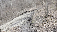
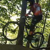
Likely the most technical trail in the Don. Scope all drops before hitting. Trail starts with a steady climb up. At the first switchback you have a choice of not climbing further to avoid the mandatory gap jump and subsequent down line (there is a sign). Once the trails converge expect a steady technical ride that snakes along a ridge line with a couple of rock skinnies and other delights before climbing back up for the second descent. The first drop on the descent is a mandatory gap of about 2'. The second larger gap has a ride around. Remainder of the trail is the easiest section of the trail that passes a dilapidated cabin before a steep climb out to Beechwood. Watch for cars before merging.

This trail is unsanctioned.

Recent Activity on Trail

Past Week
  • 4 rides
  • 34.7 km average
6 Months
  • 105 rides
  • 25.5 km avg distance
All
  • 726 rides
  • Last: Nov 15, 2026
c1c2c3c4
January
February
March
April
May
June
July
August
September
October
November
December
update trails status or condition

Donaconda Trail Reports

statusdatedescription
Nov 15, 2026 @ 8:43am (America/Toronto)
2 days
Lovely. Will be dry for sure this week for biking.
Nov 10, 2026 @ 8:58pm (America/Toronto)
Nov 10, 2026
Trail is blown. Mostly by another guy I ran into while I was going through.
Nov 9, 2026 @ 6:06pm (America/Toronto)
Nov 9, 2026
Could use another blow
Oct 30, 2026 @ 6:47pm (America/Toronto)
Oct 30, 2026
Blown by a rodent
Oct 28, 2026 @ 2:09pm (America/Toronto)
Oct 28, 2026
Dry and super leafy, but awesome.
more »
Status:
on Nov 15, 2026
Ideal
Avg: 4.41 (18 votes)
Your vote: 0

view (3,722)
close
      Directions to donaconda trailhead (43.686840, -79.360360)

      Photos

      41 more »
      mtb
      688 |
      Aug 21, 2020 @ 12:37pm
      Aug 21, 2020
      mtb
      68 |
      Jun 30, 2026 @ 7:34am
      Jun 30, 2026
      mtb
      450 |
      Oct 22, 2022 @ 1:23pm
      Oct 22, 2022
      mtb
      430 |
      Oct 22, 2022 @ 1:23pm
      Oct 22, 2022

      Videos

      5 more »
      youtuber Don Valley Trails | DONACONDA | Mountain Biking
      mtb
      2:22 | 2649 | Aug 2, 2020 , Toronto
      youtuber Don Valley Bike Trails: Donaconda POV (Double...
      mtb
      5:49 | 1729 | Jul 9, 2020 , Toronto
      youtuber Donaconda, The Don, Toronto
      mtb
      6:53 | 1877 | Jan 20, 2020 , Toronto
      Donaconda Washout
      mtb
      0:22 | 54 | Apr 19, 2026 , Toronto

      Routes with this trail

      more »
      ★ 5.0 • 59 miles • 5,018 ft • 111 • Loop •
      100k loop through the greater Don Valley, the route has almost no repeat sections. Consists mostly of...
      ★ 4.0 • 24 miles • 2,002 ft • 50 • Loop •
      A route linking together the all the hardest trails throughout the Don Valley. This is a physically...
      ★ 5.0 • 24 miles • 2,515 ft • 41 •
      40 km of the best trails in the Don! Not for the timid :P
      4.6 ★★★★★
      18 Ratings
      5 ★ 67%
      4 ★ 28%
      3 ★
      2 ★ 6%
      1 ★

      26 Reviews & Comments

      artvandelay33 artvandelay33
      The technical rock features on this trail are truly something else. Feels like something you'd see in a bike park, except it's made out of old cinder blocks.
      StevendvJ51P StevendvJ51P
      Nice little adventure that you should probably do a dry run on. This trail can hurt you.
      ldp1
      Thank you for the tidy up and shopping cart repairs, builders!

      We hope you've been enjoying Trailforks!

      Create a FREE account to view all trail reviews and much more.

      • #218048 - 13,229 views

      Frequently Asked Questions

      ▼ Where is Donaconda located?
      Donaconda is located in Don Valley, Toronto, Ontario, Canada. It is part of the Don Valley trail network. The trailhead is located at coordinates 43.68684, -79.36036.
      ▼ How hard is Donaconda?
      Donaconda is rated as Double Black Diamond difficulty. The physical rating is Hard. The average grade is 1.4%. The climb difficulty is rated Black Diamond.
      ▼ What is the elevation gain for Donaconda?
      Donaconda has 41 m of elevation gain. The trail has 23 m of elevation descent. The elevation ranges from 88 m to 113 m.
      ▼ How long is Donaconda?
      Donaconda is 1.3 km long. The trail type is singletrack.
      ▼ Are dogs allowed on Donaconda?
      There is no information about dogs being allowed on Donaconda. Check with local trail managers or the trail page for the latest access rules.
      ▼ When is the best time of year to ride Donaconda?
      Based on activity log data, the most popular months to ride Donaconda are:
      • September (49 activities)
      • October (47 activities)
      • June (42 activities)
      Check the reports page for current trail conditions.
      ▼ How do I access Donaconda? Where is the closest parking trailhead?
      The closest parking and trailhead locations to Donaconda are: View all parking locations in the area.
      ▼ How long does it take to ride Donaconda?
      Based on recorded activities, it takes an average of 10 minutes to ride Donaconda. The trail is 1.3 km long. Actual times will vary based on fitness level, conditions, and pace. View recent activity logs for more details.
      ▼ How busy is Donaconda?
      Donaconda is a very popular trail. There have been 3,651 recorded activities on this trail. The trail has received 3,722 check-ins. View recent activity on this trail.

      Hit the Trail

      Open in App

      Get this trail on your phone instantly.

      open trail in app

      Download Trail

      Save to wishlist, Garmin & download.
      save the trail

      Find Related Routes

      Find routes and users activities that include this trail.
      find routes for this trail

      You must enter a description before submitting.

