
more stats
2.4 miles
Distance
96 ft
Climb
-244 ft
Descent
00:19:21
Avg time
-149 ft
Altitude change
932 ft
Altitude min
1,082 ft
Altitude max
1,082 ft
Altitude start
935 ft
Altitude end
-1.2%
Grade
-14.1%
Grade max
10.9%
Grade min
2,654 ft
Distance climb
4,895 ft
Distance down
4,921 ft
Distance flat
00:19:21
Avg time

Eagle Details

  • Activities
    • Mountain Bike
    • E-Bike
    • Hike
    • Trail Running
  • Riding Area
    Allegrippis Trails
    Hesston, Pennsylvania
  • Difficulty Rating
  • Voted Difficulty
    Green (1 vote)
  • Local Popularity
    85 in Mountain Biking heatmap [+]
    • 85 in E-Biking
    • 5 in Trail Running
    • 75 in Hiking
  • Global Ranking
    #59311 in Mountain Biking [+]
    • #111969 in E-Biking
    • #347937 in Trail Running
    • #135735 in Hiking
  • State Ranking
    #781 in Mountain Biking · Pennsylvania [+]
    • #571 in E-Biking
    • #5,521 in Trail Running
    • #2,526 in Hiking
  • Trail Type
    Singletrack
  • Bike Type
    XC
  • Direction
    Both Directions
    Popular Direction Shown
  • Climb Difficulty
    Blue
  • Physical Rating
    Moderate
  • Trail Visibility
    Always easy to follow
  • Dogs Allowed
    Yes
  • eBike Allowed
  • Land Owner
    USACE - Baltimore District

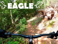
Easy, mellow contoured climbing trail. This trail is the preferred climbing trail out from the Hydro Loop trailhead over Osprey. Also can be used as a more beginner-friendly downhill alternative to Osprey.

Tags

Local Trail Association

Traditionally Indigenous Territory

Recent Activity on Trail

Past Week
  • 2 rides
  • 29.8 km average
6 Months
  • 250 rides
  • 26.6 km avg distance
All
  • 1,444 rides
  • Last: Nov 9, 2026
c1c2c3c4
January
February
March
April
May
June
July
August
September
October
November
December
Status:
on Oct 24, 2026
Ideal
Avg: 4.05 (12 votes)
Your vote: 0

view (6,076)
close
      Directions to eagle-16563 trailhead (40.402980, -78.053060)

      Photos

      50 more »
      mtb
      353 |
      Jun 16, 2016 @ 1:51pm
      Jun 16, 2016
      report
      mtb
      72 |
      Sep 4, 2026 @ 7:01am
      Sep 4, 2026
      report
      mtb
      77 |
      Sep 4, 2026 @ 4:40am
      Sep 4, 2026
      report
      mtb
      56 |
      Aug 23, 2026 @ 5:32am
      Aug 23, 2026

      Videos

      1 more »
      Eagle - Allegrippis Trails | Huntingdon, PA
      mtb
      457 | Oct 8, 2021 , Hesston

      Routes with this trail

      more »
      Go For A Dip Featured
      ★ 5.0 • 9 miles • 793 ft • 6 • Loop •
      A classic loop on a hot day where you want to stop at the Hydro Swim Spot, lake lookout, and go for a...
      ★ 5.0 • 23 miles • 1,875 ft • 16 •
      This is a point-to-point route, so either park a car at the beach for the end or be prepared to climb back...
      ★ 5.0 • 11 miles • 932 ft • 6 • Loop •
      Buck > Fawn > Osprey > Hydro Loop > Eagle > Switch > Buck
      4.1 ★★★★★
      12 Ratings
      5 ★ 33%
      4 ★ 42%
      3 ★ 25%
      2 ★
      1 ★

      4 Reviews & Comments

      Pssva058
      A great flowy / fun trail on the way down toward Hydroloop. My preferred option for climbing up from Hydro also… one of my go-to trails when I’m trying to maximize miles and XC flow
      abradley77
      Easy but monotonous climbing trail. Kinda boring but definitely beats climbing up Osprey.
      CodyFishel CodyFishel
      My preferred route to climbing out from Hydro. Definitely better than taking Osprey, especially on a weekend.

      “EAGLE OUT!”

      We hope you've been enjoying Trailforks!

      Create a FREE account to view all trail reviews and much more.

      Nearby Trails

      • By schillingsworthTF Pro TRAILFORKS HTA & contributors
      • #16563 - 3,063 views

      Frequently Asked Questions

      ▼ Where is Eagle located?
      Eagle is located in Allegrippis Trails, Hesston, Pennsylvania, United States. It is part of the Allegrippis Trails trail network. The trailhead is located at coordinates 40.40298, -78.05306.
      ▼ How hard is Eagle?
      Eagle is rated as Blue difficulty. The physical rating is Moderate. The average grade is 1.2%. The climb difficulty is rated Blue.
      ▼ What is the elevation gain for Eagle?
      Eagle has 96 ft of elevation gain. The trail has 244 ft of elevation descent. The elevation ranges from 932 ft to 1,082 ft.
      ▼ Is Eagle a point to point trail?
      Eagle is not a point to point trail. The direction is Both Directions. The trail type is singletrack.
      ▼ How long is Eagle?
      Eagle is 2.4 miles long. The trail type is singletrack.
      ▼ Are dogs allowed on Eagle?
      Yes, dogs are allowed on Eagle. Please keep dogs on a leash where required and clean up after them.
      ▼ How do I access Eagle? Where is the closest parking trailhead?
      The closest parking and trailhead locations to Eagle are: View all parking locations in the area.
      ▼ How long does it take to ride Eagle?
      Based on recorded activities, it takes an average of 19 minutes to ride Eagle. The trail is 2.4 miles long. Actual times will vary based on fitness level, conditions, and pace. View recent activity logs for more details.
      ▼ How busy is Eagle?
      Eagle is a very popular trail. There have been 6,097 recorded activities on this trail. The trail has received 6,076 check-ins. View recent activity on this trail.

      Hit the Trail

      Open in App

      Get this trail on your phone instantly.

      open trail in app

      Download Trail

      Save to wishlist, Garmin & download.
      save the trail

      Find Related Routes

      Find routes and users activities that include this trail.
      find routes for this trail

      You must enter a description before submitting.