more stats
1.1 miles
Distance
28 ft
Climb
-320 ft
Descent
00:06:44
Avg time
-294 ft
Altitude change
932 ft
Altitude min
1,226 ft
Altitude max
1,226 ft
Altitude start
932 ft
Altitude end
-5.3%
Grade
-22.8%
Grade max
10.1%
Grade min
558 ft
Distance climb
4,232 ft
Distance down
745 ft
Distance flat
00:06:44
Avg time

Osprey Details

  • Activities
    • Mountain Bike
    • E-Bike
    • Hike
    • Trail Running
  • Riding Area
    Allegrippis Trails
    Hesston, Pennsylvania
  • Difficulty Rating
  • Voted Difficulty
    Blue (2 votes)
  • Local Popularity
    80 in Mountain Biking [+]
    • 90 in E-Biking
    • 80 in Trail Running
    • 5 in Hiking
  • Global Ranking
    #34548 in Mountain Biking [+]
    • #62305 in Trail Running
    • #123566 in Hiking
  • Hiking SAC Scale
    T1 Hiking
  • Trail Type
    Singletrack
  • Bike Type
    AM, XC
  • Direction
    Downhill Primary
    Popular Direction Shown
  • Climb Difficulty
    Blue
  • Physical Rating
    Moderate
  • Dogs Allowed
    Yes
  • eBike Allowed
  • TTFs on Trail
    Berm
  • Land Owner
    USACE - Baltimore District

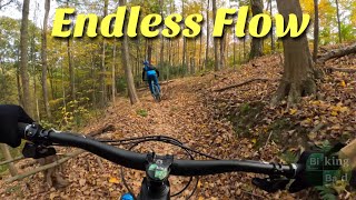
This trail has been voted one of the best free flow trails in the US. It is very fast and fun, and you hardly need to ever pedal. Watch out for climbing riders and hikers when bombing down though.

Local Trail Association
Traditionally Indigenous Territory

Recent Activity on Trail

Past Week
  • 10 rides
  • 17.5 km average
6 Months
  • 115 rides
  • 20.9 km avg distance
All
  • 899 rides
  • Last: Jul 4, 2026
c1c2c3c4
January
February
March
April
May
June
July
August
September
October
November
December
update trails status or condition

Osprey Trail Reports

Status:
on Jun 13, 2026
Ideal
Avg: 4.69 (30 votes)
Your vote: 0

view (3,999)
close
3D
Trail Conditions
  • Unknown
  • Snow Groomed
  • Snow Packed
  • Snow Covered
  • Snow Cover Partial
  • Freeze/thaw Cycle
  • Icy
  • Prevalent Mud
  • Wet
  • Variable
  • Ideal
  • Dry
  • Very Dry
Trail Flow (Ridden Direction)
Trailforks scans users ridelogs to determine the most popular direction each trail is ridden. A good flowing trail network will have most trails flowing in a single direction according to their intension.
The colour categories are based on what percentage of riders are riding a trail in its intended direction.
  • > 96%
  • > 90%
  • > 80%
  • > 70%
  • > 50%
  • < 50%
  • bi-directional trail
  • no data
Trail Last Ridden
Trailforks scans ridelogs to determine the last time a trail was ridden.
  • < 2 days
  • < 1 week
  • < 2 weeks
  • < 1 month
  • < 6 months
  • > 6 months
Trail Ridden Direction
The intended direction a trail should be ridden.
  • Downhill Only
  • Downhill Primary
  • Both Directions
  • Uphill Primary
  • Uphill Only
  • One Direction
Contribute Details
Colors indicate trail is missing specified detail.
  • Description
  • Photos
  • Description & Photos
  • Videos
Trail Popularity ?
Trailforks scans ridelogs to determine which trails are ridden the most in the last 9 months. Trails are compared with nearby trails in the same city region with a possible 25 colour shades. Think of this as a heatmap, more rides = more kinetic energy = warmer colors.
  • most popular
  • popular
  • less popular
  • not popular
ATV/ORV/OHV Filter
Max Vehicle Width
inches
US Cell Coverage
Legend
cell carrier legend

Radar Time
Activity Recordings
Trailforks uses anonymized public activity data. ?
Activity Recordings
Trailforks uses anonymized public activity data. ?
Personal Heatmap
Activity Types
all / none
Options
2
Date range month
Winter Trails
Warning A routing network for winter maps does not exist. Selecting trails using the winter trails layer has been disabled.
Missing Trails
Most Popular
Least Popular
Trails are colored based on popularity. The more popular a trail is, the more red. Less popular trails trend towards green.
Jump Magnitude Heatmap
Heatmap of where riders jump on trails. Zoom in to see individual jumps, click circles to view jump details.
BC Backroad Status

Service Road Atlas is a free to use, community-driven service for viewing and creating reports on the numerous back-country service roads around B.C. and Alberta.

map legend
Slope Aspect
Direction the slope faces
Flat N NE E SE S SW W NW
Trails Deemphasized
Trails are shown in grey.
disable
Only show trails with no bike usage.
Enable
Suggested Layers
Based on selected activity type

    Save the current map location and zoom level as your default home location whenever this page is loaded.

    Save
        Directions to osprey trailhead (40.405900, -78.055320)

        Photos

        27 more »
        160 |
        Aug 11, 2017 @ 3:15pm
        Aug 11, 2017
        334 |
        Jun 16, 2016 @ 1:55pm
        Jun 16, 2016
        379 |
        Jun 16, 2016 @ 1:51pm
        Jun 16, 2016
        303 |
        Jun 16, 2016 @ 1:51pm
        Jun 16, 2016

        Videos

        10 more »
        Biking Bad - Do Yourself a Favor, Checkout the...
        26:44 | 157 | Oct 20, 2024 , Hesston
        Osprey Downhill // Allegrippis Trails at...
        4:09 | 426 | Aug 17, 2022 , Hesston
        Osprey - Allegrippis Trails | Huntingdon, PA
        236 | Sep 5, 2021 , Hesston
        Allegrippis Trails - Osprey 5June21
        4:35 | 298 | Jun 9, 2021 , Hesston

        Routes with this trail

        Go For A Dip Featured
        5.0 9 miles 793 ft 6 Loop
        A classic loop on a hot day where you want to stop at the Hydro Swim Spot, lake lookout, and go for a...
        5.0 13 miles 1,245 ft 8
        This route brings you through some of the greatest hits of Allegrippis, like and , and then rides out to...
        5.0 15 miles 1,424 ft 9
        This route features the three highest-rated trails in the Allegrippis trail system: , , and , with an...

        5 Reviews & Comments


        We hope you've been enjoying Trailforks!

        Create a FREE account to view trail comments and much more.

        Nearby Trails

        • By schillingsworthTF Pro TRAILFORKS HTA & contributors
        • #16561 - 6,429 views

        Frequently Asked Questions About Osprey

        Where is Osprey located?
        Osprey is located in Allegrippis Trails, Hesston, Pennsylvania, United States. It is part of the Allegrippis Trails trail network. The trailhead is located at coordinates 40.4059, -78.05532.
        How hard is Osprey?
        Osprey is rated as Blue difficulty. The physical rating is Moderate. The average grade is 5.3%. The climb difficulty is rated Blue.
        What is the elevation gain for Osprey?
        Osprey has 28 ft of elevation gain. The trail has 320 ft of elevation descent. The elevation ranges from 932 ft to 1,226 ft.
        Is Osprey a point to point trail?
        Osprey is not a point to point trail. The direction is Downhill Primary. The trail type is singletrack.

        Hit the Trail

        Open in App

        Get this trail on your phone instantly.
        open trail in app

        Download Trail

        Save to wishlist, Garmin & download.
        save the trail

        Find Related Routes

        Find routes and users activities that include this trail.
        find routes for this trail

        You must enter a description before submitting.