more stats
4,275 ft
Distance
195 ft
Climb
-260 ft
Descent
00:12:44
Avg time
-65 ft
Altitude change
3,818 ft
Altitude min
4,078 ft
Altitude max
3,883 ft
Altitude start
3,819 ft
Altitude end
-1.5%
Grade
-42.4%
Grade max
34.6%
Grade min
1,870 ft
Distance climb
2,103 ft
Distance down
299 ft
Distance flat
00:12:44
Avg time

Eddie J (upper) Details

  • Activities
    • Mountain Bike
    • E-Bike
    • Winter Fat Bike
    • Hike
    • Trail Running
  • Riding Area
    Monte Christo
    Rossland, British Columbia
  • Difficulty Rating
  • Local Popularity
    95 in Mountain Biking heatmap [+]
    • 95 in E-Biking
    • 95 in Trail Running
    • 95 in Hiking
    • 5 in Winter Fat Biking
  • Global Ranking
    #60071 in Mountain Biking [+]
    • #7156 in E-Biking
    • #82797 in Trail Running
    • #98252 in Hiking
    • #5069 in Winter Fat Biking
  • Provincial Ranking
    #2,935 in Mountain Biking · British Columbia [+]
    • #578 in E-Biking
    • #4,820 in Trail Running
    • #5,199 in Hiking
    • #348 in Winter Fat Biking
  • Trail Type
    Singletrack
  • Bike Type
    AM, XC, Fat
  • Climb Difficulty
    Blue
  • Physical Rating
    Moderate
  • Trail Visibility
    Always easy to follow
  • Family Friendly
    Yes
  • Dogs Allowed
    Yes
  • eBike Allowed
  • TTFs on Trail
    Berm, Rock Face
  • Ride in Rain
    Yes
  • Year Opened
    2015
  • OSM Way

Built by the Church of Dirt volunteer build crew, this trail has quickly become a year round favourite. It is a great progressive trail from beginner to intermediate. It rides well in both directions and provides loop options on Monte Christo Mountain. Slightly more challenging than lower Eddie J.

Access Info

A common Monte Christo Loop starts from Centennial Gate or Parking Lot : Drifter - Lower Eddie J - Upper Eddie J - Kootenay Columbia Trail back to Centennial Parking. Loops which link other trails in the Monte Christo area can be made by turning left on Kootenay Columbia Trail after completing Eddie J

Tags
BermsFamily friendlyRock slabs

Local Trail Association

Recent Activity on Trail

Past Week
  • 2 rides
  • 9 miles average
6 Months
  • 122 rides
  • 8 miles avg distance
All
  • 839 rides
  • Last: Nov 13, 2026
c1c2c3c4
January
February
March
April
May
June
July
August
September
October
November
December
update trails status or condition

Eddie J (upper) Trail Reports

statusdatedescription
Oct 17, 2026 @ 9:32am (America/Vancouver)
Oct 17, 2026
good
Sep 22, 2026 @ 4:27pm (America/Vancouver)
Sep 22, 2026
reporter Cleared.
Sep 20, 2026 @ 7:46pm (America/Vancouver)
Sep 20, 2026
Large tree down across trail, blocking trail
May 14, 2026 @ 2:23pm (America/Vancouver)
May 14, 2026
reporter The KCTS trail crew completed seasonal inspection and maintenance. All of the major root-ball damage has been dealt with.
Apr 12, 2026 @ 5:00pm (America/Vancouver)
Apr 12, 2026
Many more trees came down this winter by the look of it, but they have been bucked. the trail tread is in generally good shape, but there a couple...
more »
Status:
on Oct 17, 2026
Ideal
Avg: 3.82 (7 votes)
Your vote: 0

view (7,009)
close
      Directions to eddie-j-upper trailhead (49.088200, -117.802390)

      Photos

      13 more »
      mtb
      75 |
      Jul 11, 2024 @ 10:32am
      Jul 11, 2024
      mtb
      108 |
      Jul 7, 2021 @ 8:32am
      Jul 7, 2021
      report
      mtb
      71 |
      Sep 28, 2024 @ 6:57pm
      Sep 28, 2024
      report
      mtb
      58 |
      Sep 28, 2024 @ 6:57pm
      Sep 28, 2024

      Videos

      1 more »
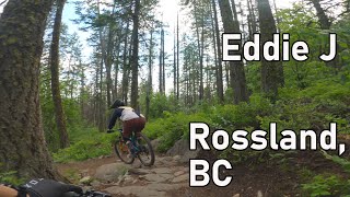
      youtuber Eddie J - Rossland, BC
      mtb
      10:30 | 313 | Jul 12, 2024 , Rossland

      Routes with this trail

      more »
      ★ 5.0 • 38 miles • 7,280 ft • 28 • Loop •
      A long ride, almost all singletrack. Redtop up and down, Caldera, Eddie J, lower Mongoose, KC, Techno...
      10 miles • 2,046 ft • 7 • Loop •
      A ride from Centennial Parking lot that includes a variety of trail types with a good mix of climbing and...
      8 miles • 1,622 ft • 12 • Loop •
      This route from town showcases the best trails in the KC area. Riding is all intermediate, except for KC...
      3.7 ★★★★★
      7 Ratings
      5 ★
      4 ★ 71%
      3 ★ 29%
      2 ★
      1 ★

      3 Reviews & Comments

      Fourpointeight
      Trail all clear again! Great shape for fat!

      We hope you've been enjoying Trailforks!

      Create a FREE account to view all trail reviews and much more.

      • By barry-mclaneTF Pro & contributors
      • #28998 - 5,700 views

      Frequently Asked Questions

      ▼ Where is Eddie J (upper) located?
      Eddie J (upper) is located in Monte Christo, Rossland, British Columbia, Canada. It is part of the Monte Christo trail network. The trailhead is located at coordinates 49.0882, -117.80239.
      ▼ How hard is Eddie J (upper)?
      Eddie J (upper) is rated as Blue difficulty. The physical rating is Moderate. The average grade is 1.5%. The climb difficulty is rated Blue.
      ▼ What is the elevation gain for Eddie J (upper)?
      Eddie J (upper) has 195 ft of elevation gain. The trail has 260 ft of elevation descent. The elevation ranges from 3,818 ft to 4,078 ft.
      ▼ How long is Eddie J (upper)?
      Eddie J (upper) is 4,275 ft long. The trail type is singletrack.
      ▼ Are dogs allowed on Eddie J (upper)?
      Yes, dogs are allowed on Eddie J (upper). Please keep dogs on a leash where required and clean up after them.
      ▼ How do I access Eddie J (upper)? Where is the closest parking trailhead?
      The closest parking and trailhead locations to Eddie J (upper) are: View all parking locations in the area.
      ▼ How long does it take to ride Eddie J (upper)?
      Based on recorded activities, it takes an average of 13 minutes to ride Eddie J (upper). The trail is 4,275 ft long. Actual times will vary based on fitness level, conditions, and pace. View recent activity logs for more details.
      ▼ How busy is Eddie J (upper)?
      Eddie J (upper) is a very popular trail. There have been 6,722 recorded activities on this trail. The trail has received 7,009 check-ins. View recent activity on this trail.

      Hit the Trail

      Open in App

      Get this trail on your phone instantly.

      open trail in app

      Download Trail

      Save to wishlist, Garmin & download.
      save the trail

      Find Related Routes

      Find routes and users activities that include this trail.
      find routes for this trail

      You must enter a description before submitting.