37.5 miles
Distance
7,280 ft
Climb
-7,371 ft
Descent
5,218 ft
High Point

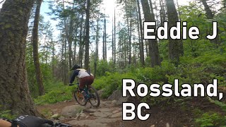
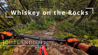
A long ride, almost all singletrack. Redtop up and down, Caldera, Eddie J, lower Mongoose, KC, Techno Grind, Full Monte, Milky Way, Green Door, Rogers, Cemetery, Happy Valley, through Rossland, Drakes Doukhobor, Tamarack, SMD(A), up Doukhobor, Tamarac, Whiskey on the Rocks.

"Trails in Route" section can be a little confusing since the ride touches small sections of a number of trails. Also goes both ways on the same trail at different points in the ride, but these show as just one trail entry.

Detailed Description
4 Points is a 38 mile popular expert route located near Rossland British Columbia. This mountain bike only route and has a hard overall physical rating. This route includes 28 trails. This route climbs 7,280 ft with a max elevation of 5,218 ft then descends -7,371 ft.
Local Trail Association
Local trail association
Kootenay Columbia Trails Society (www.kcts.ca)
Please consider joining or donating to the local riding association to support trail development & maintenance.
donate to earn trail karma!

43 Reviews & Comments


We hope you've been enjoying Trailforks!

Create a FREE account to view route comments and much more.

Details

  • Riding area
  • Primary Activity
    Mountain Bike
  • Difficulty rating
    Black Diamond
  • Route Type
    Loop
  • Bike type
    AM
  • Physical rating
    Hard
More Stats for 4 Points mountain bike route
  • Avg time
    10 hr 0 min
  • Altitude min
    2,250 ft
  • Altitude start
    3,401 ft
  • Altitude end
    3,301 ft
  • Grade
    -0.1%
  • Grade max
    -67.9%
  • Grade min
    51.9%
  • Distance climb
    19 miles
  • Distance down
    16 miles
  • Distance flat
    3 miles
Avg: 5 (1 votes)
close
3D
Trail Conditions
  • Unknown
  • Snow Groomed
  • Snow Packed
  • Snow Covered
  • Snow Cover Partial
  • Freeze/thaw Cycle
  • Icy
  • Prevalent Mud
  • Wet
  • Variable
  • Ideal
  • Dry
  • Very Dry
Trail Flow (Ridden Direction)
Trailforks scans users ridelogs to determine the most popular direction each trail is ridden. A good flowing trail network will have most trails flowing in a single direction according to their intension.
The colour categories are based on what percentage of riders are riding a trail in its intended direction.
  • > 96%
  • > 90%
  • > 80%
  • > 70%
  • > 50%
  • < 50%
  • bi-directional trail
  • no data
Trail Last Ridden
Trailforks scans ridelogs to determine the last time a trail was ridden.
  • < 2 days
  • < 1 week
  • < 2 weeks
  • < 1 month
  • < 6 months
  • > 6 months
Trail Ridden Direction
The intended direction a trail should be ridden.
  • Downhill Only
  • Downhill Primary
  • Both Directions
  • Uphill Primary
  • Uphill Only
  • One Direction
Contribute Details
Colors indicate trail is missing specified detail.
  • Description
  • Photos
  • Description & Photos
  • Videos
Trail Popularity ?
Trailforks scans ridelogs to determine which trails are ridden the most in the last 9 months. Trails are compared with nearby trails in the same city region with a possible 25 colour shades. Think of this as a heatmap, more rides = more kinetic energy = warmer colors.
  • most popular
  • popular
  • less popular
  • not popular
ATV/ORV/OHV Filter
Max Vehicle Width
inches
US Cell Coverage
Legend
cell carrier legend

Radar Time
x Activity Recordings
Trailforks users anonymized public ridelogs from the past 6 months.
  • mountain biking recent
  • mountain biking (>6 month)
  • hiking (1 year)
  • moto (1 year)
Activity Recordings
Trailforks users anonymized public skilogs from the past 12 months.
  • Downhill Ski
  • Backcountry Ski
  • Nordic Ski
  • Snowmobile
Winter Trails
Warning A routing network for winter maps does not exist. Selecting trails using the winter trails layer has been disabled.
x Missing Trails
Most Popular
Least Popular
Trails are colored based on popularity. The more popular a trail is, the more red. Less popular trails trend towards green.
Jump Magnitude Heatmap
Heatmap of where riders jump on trails. Zoom in to see individual jumps, click circles to view jump details.
Trails Deemphasized
Trails are shown in grey.
disable
Only show trails with NO bikes.
enable

Save the current map location and zoom level as your default home location whenever this page is loaded.

Save
Trail transparency
20
467
422
390
youtuber Eddie J - Rossland, BC
Eddie J - Rossland, BC
10:30 | 66 | comments: 0 | favs:
Jul 12, 2024
what a great trail to start on. Super fun!
4:18 | 75 | comments: 0 | favs:
Nov 4, 2024

Recent Trail Reports Along Route

statustraildateconditiondescription
Doukhobor
Jul 3, 2025 @ 6:56pm
Jul 3, 2025
2 medium trees down early in single track after Drakes access road.
Full Monte
Jul 3, 2025 @ 11:26am
Jul 3, 2025
2 small trees leaning over trail just past Ziggy. Not particularly dangerous but will be down soon.
Awesome
Jul 1, 2025 @ 3:28pm
Jul 1, 2025
Green Door
Jul 1, 2025 @ 3:28pm
Jul 1, 2025
SMD
Jul 1, 2025 @ 3:28pm
Jul 1, 2025
Tree down across the trail on Death.
more reports »
  • By freerideposerTF Pro KCTS & contributors
  • #865 - 3,246 views