4,121 ft
Distance
-283 ft
Descent
00:04:41
Avg time
Supporters, Builders, Maintainers & Land Managers of Enticer Trail
  • BLM
    BLM
    Land Manager

Enticer Details

  • Activities
    • Mountain Bike
    • Hike
    • Trail Running
  • Riding Area
  • Difficulty Rating
  • Voted Difficulty
    Black Diamond (1 vote)
  • Trail Type
    Machine Groomed
  • Bike Type
    DH, AM, XC, DJ
  • Direction
    Downhill Primary
    Popular direction shown
  • Dogs Allowed
    Yes
  • TTFs on Trail
    Berm, Drop, Jump, Gap Jump, Other
  • Global Ranking
    #4825 in Mountain Biking [+]
    • #23392 in Trail Running
    • #31944 in Hiking
  • Local Popularity
    95 in Mountain Biking [+]
    • 70 in Trail Running
    • 65 in Hiking
  • Year Opened
    2017
  • Land Owner
    blm

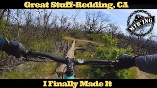
This jump trail was created in the Spring of 2017 by Redding Trail Alliance. It is a mile long jump trail featuring berms, jumps and drops. It is like something you would see at a bike park

Access Info

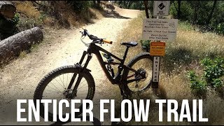
Pedal up the newly created Owen's run for a mellow climb right to the top of the Enticer.

Disclaimer

Large jumps, look before you leap!

Local Trail Association
Traditionally Indigenous Territory
More Stats for Enticer mountain bike trail trail
  • Altitude change
    -283 ft
  • Altitude min
    999 ft
  • Altitude max
    1,282 ft
  • Altitude start
    1,282 ft
  • Altitude end
    997 ft
  • Grade
    -6.9%
  • Grade max
    -20.8%
  • Grade min
    -1.1%
  • Distance down
    4,035 ft
  • Distance flat
    82 ft
  • Avg time
    00:04:41
  • Avg reverse time
    00:04:17
  • view trail stats
Status:
on Oct 7, 2023
Very Dry
Avg: 4.55 (14 votes)
Your vote: 0

view (4,925)
close
3D
Trail Conditions
  • Unknown
  • Snow Groomed
  • Snow Packed
  • Snow Covered
  • Snow Cover Inadequate
  • Freeze/thaw Cycle
  • Icy
  • Prevalent Mud
  • Wet
  • Variable
  • Ideal
  • Dry
  • Very Dry
Trail Flow (Ridden Direction)
Trailforks scans users ridelogs to determine the most popular direction each trail is ridden. A good flowing trail network will have most trails flowing in a single direction according to their intension.
The colour categories are based on what percentage of riders are riding a trail in its intended direction.
  • > 96%
  • > 90%
  • > 80%
  • > 70%
  • > 50%
  • < 50%
  • bi-directional trail
  • no data
Trail Last Ridden
Trailforks scans ridelogs to determine the last time a trail was ridden.
  • < 2 days
  • < 1 week
  • < 2 weeks
  • < 1 month
  • < 6 months
  • > 6 months
Trail Ridden Direction
The intended direction a trail should be ridden.
  • Downhill Only
  • Downhill Primary
  • Both Directions
  • Uphill Primary
  • Uphill Only
  • One Direction
Contribute Details
Colors indicate trail is missing specified detail.
  • Description
  • Photos
  • Description & Photos
  • Videos
Trail Popularity ?
Trailforks scans ridelogs to determine which trails are ridden the most in the last 9 months. Trails are compared with nearby trails in the same city region with a possible 25 colour shades. Think of this as a heatmap, more rides = more kinetic energy = warmer colors.
  • most popular
  • popular
  • less popular
  • not popular
ATV/ORV/OHV Filter
Max Vehicle Width
inches

Radar Time
x Activity Recordings
Trailforks users anonymized public ridelogs from the past 6 months.
  • mountain biking recent
  • mountain biking (>6 month)
  • hiking (1 year)
  • moto (1 year)
Activity Recordings
Trailforks users anonymized public skilogs from the past 12 months.
  • Downhill Ski
  • Backcountry Ski
  • Nordic Ski
  • Snowmobile
Winter Trails
Warning A routing network for winter maps does not exist. Selecting trails using the winter trails layer has been disabled.
x Missing Trails
Most Popular
Least Popular
Trails are colored based on popularity. The more popular a trail is, the more red. Less popular trails trend towards green.
Jump Magnitude Heatmap
Heatmap of where riders jump on trails. Zoom in to see individual jumps, click circles to view jump details.
Trails Deemphasized
Trails are shown in grey.
disable
Only show trails with NO bikes.
enable

Save the current map location and zoom level as your default home location whenever this page is loaded.

Save
      Directions to enticer trailhead (40.560450, -122.485260)
      update trails status or condition

      Enticer Trail Reports

      statusdatedescription
      Oct 7, 2023 @ 2:02am
      Oct 7, 2023
      Lots and lots of twigs leaves and debris to roll through not really avoidable
      May 29, 2023 @ 3:05am
      May 29, 2023
      May 15, 2023 @ 8:45am
      May 15, 2023
      Feb 18, 2023 @ 7:14pm
      Feb 18, 2023
      Jan 1, 2023 @ 3:09am
      Jan 1, 2023
      Perfection
      view all reports »

      Recent Ridelog Activity on Trail

      Past Week
      • 15 rides
      • 12 miles avg distance
      6 Months
      • 209 rides
      • 11 miles avg distance
      All
      • 4,212 rides
      • Last: Nov 27, 2023

      Photos

      more »
      47 |
      Apr 25, 2023 @ 7:50pm
      Apr 25, 2023
      49 |
      Apr 25, 2023 @ 7:50pm
      Apr 25, 2023
      36 |
      Apr 25, 2023 @ 7:50pm
      Apr 25, 2023
      131 |
      Apr 19, 2022 @ 3:26pm
      Apr 19, 2022

      8 Reviews & Comments


      We hope you've been enjoying Trailforks!

      Create a FREE account to view trail comments and much more.

      Videos

      more »
      youtuber Enticer Jump Line, Mt Shasta Mine Trail, &...
      23:32 | 539 | Apr 19, 2021 , Redding
      youtuber Enticer - New Flow Trail in Redding California...
      10:19 | 1048 | Jul 19, 2018 , Redding
      youtuber Can She Send it? Attempting Her Biggest Gap...
      15:51 | 313 | Jan 6, 2022 , Redding
      youtuber The Best Jump/Flow Line In Northern...
      2:35 | 1187 | Mar 12, 2020 , Redding
      • By cannonball RR & contributors
      • #104130 - 19,970 views