
more stats
1.0 mile
Distance
61 ft
Climb
-401 ft
Descent
00:08:34
Avg time
-341 ft
Altitude change
2,933 ft
Altitude min
3,274 ft
Altitude max
3,274 ft
Altitude start
2,933 ft
Altitude end
-6.2%
Grade
-33.1%
Grade max
21.4%
Grade min
830 ft
Distance climb
3,002 ft
Distance down
1,614 ft
Distance flat
00:08:34
Avg time

Espresso Details

  • Activities
    • Mountain Bike
    • E-Bike
    • Hike
    • Trail Running
  • Riding Area
    Cranbrook Community Forest
    Cranbrook, British Columbia
  • Ref Number
    #047
  • Difficulty Rating
  • Voted Difficulty
    Blue (3 votes)
  • Local Popularity
    100 in Mountain Biking heatmap [+]
    • 95 in E-Biking
    • 5 in Trail Running
    • 5 in Hiking
  • Global Ranking
    #24864 in Mountain Biking [+]
    • #2842 in E-Biking
    • #213942 in Trail Running
    • #205070 in Hiking
  • Provincial Ranking
    #1,196 in Mountain Biking · British Columbia [+]
    • #274 in E-Biking
    • #11,735 in Trail Running
    • #11,480 in Hiking
  • Trail Type
    Singletrack
  • Bike Type
    AM, XC
  • Climb Difficulty
    Blue
  • Physical Rating
    Moderate
  • Trail Visibility
    Always easy to follow
  • Dogs Allowed
    Yes
  • eBike Allowed
    Yes up to Class 1
  • TTFs on Trail
    Berm, Drop, Jump, Rock Face, Roller Coaster
  • Year Opened
    2019
  • Land Owner
    FLNROD

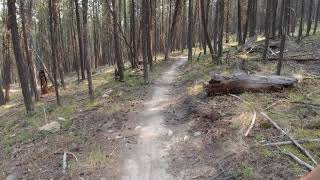
Great variety as you start on rocky ridges then flow downhill with berms and rock rolls. The grand finale is a machine built flow section that moves into a gully with 14 crossings with natural berms and jumps. Climb back up on Coffee Grinder or exit to Chief Isadore for a rail-grade return to the parking areas.

Special thanks to Columbia Basin Trust for funding part of this trail project.

Local Trail Association

Traditionally Indigenous Territory

Recent Activity on Trail

Past Week
  • 3 rides
  • 9 miles average
6 Months
  • 132 rides
  • 10 miles avg distance
All
  • 907 rides
  • Last: Nov 15, 2026
c1c2c3c4
January
February
March
April
May
June
July
August
September
October
November
December
update trails status or condition

Espresso Trail Reports

statusdatedescription
Oct 24, 2026 @ 1:14pm (America/Creston)
Oct 24, 2026
Jul 26, 2026 @ 10:05am (America/Creston)
Jul 26, 2026
May 2, 2026 @ 12:44pm (America/Creston)
May 2, 2026
Apr 8, 2026 @ 5:25pm (America/Edmonton)
Apr 8, 2026
Vsmall tree across trail near migor. Forgot Hand saw or I would have cleared it.
Apr 7, 2026 @ 5:01pm (America/Edmonton)
Apr 7, 2026
reporter CRANBROOK COMMUNITY FOREST OFFICIAL: We are now fully open. Beware of early season hazards as our trail crew continues to remove winter debris.
more »
Status:
on Oct 24, 2026
Ideal
Avg: 4.34 (24 votes)
Your vote: 0

view (2,678)
close
      Directions to espresso-52882 trailhead (49.548970, -115.712720)

      Photos

      5 more »
      mtb
      49 |
      Apr 8, 2026 @ 4:23pm
      Apr 8, 2026
      mtb
      244 |
      Nov 8, 2019 @ 9:04pm
      Nov 8, 2019
      mtb
      243 |
      Nov 8, 2019 @ 9:04pm
      Nov 8, 2019
      report
      mtb
      40 |
      Apr 8, 2026 @ 4:25pm
      Apr 8, 2026

      Videos

      2 more »
      espresso (1440p60)
      mtb
      6:34 | 562 | Jul 25, 2021 , Cranbrook
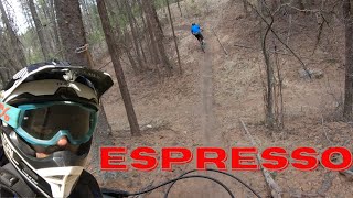
      The Best trail in Cranbrook | Espresso
      mtb
      5:31 | 619 | Apr 29, 2021 , Cranbrook

      Routes with this trail

      more »
      ★ 3.5 • 12 miles • 1,955 ft • 9 • Loop •
      Route showcasing some of the best descents in the forest
      ★ 3.0 • 18 miles • 2,763 ft • 13 • Loop •
      This route takes in some of the best riding in the CCF
      4.4 ★★★★★
      24 Ratings
      5 ★ 58%
      4 ★ 33%
      3 ★ 4%
      2 ★
      1 ★ 4%

      6 Reviews & Comments

      clandrock clandrock
      Mostly traversing easy (green/blue) XC until you get to the big gully and thats where it gets really fun. Worth it for the final gulley descent - if you ride it well it feels like rollercoaster and you wont loose your momentum, I never had to pedal anywhere in that section. Definitely not a black, easy blue imo.
      tombraumandl
      can't wait for a tkroz built trail so we can finally have fun
      tkroz tkroz
      If you just finished double shot and are hoping that this trail will deliver more of the same fun, you will be a little disappointed. The first 1/3 is much like double shot, but then the middle third is a flat pedally traverse the skirts around a local topographical high point. After this, it descends into the gully that is mentioned in the trail description. Personally I think the builders took the path of least resistance when building in this gully and the end product is less fun than it could be. The trail rides down into the gulley via the fall line and then back up the other side until you have burned the majority of your momentum, then it makes a 120 degree turn and repeats the process several times leading you to the bottom. The description mentions a machine built element to this trail however I did not experience any machine built features.

      We hope you've been enjoying Trailforks!

      Create a FREE account to view all trail reviews and much more.

      • By Prez2900TF Pro WCC CCFS & contributors
      • #52882 - 3,462 views

      Frequently Asked Questions

      ▼ Where is Espresso located?
      Espresso is located in Cranbrook Community Forest, Cranbrook, British Columbia, Canada. It is part of the Cranbrook Community Forest trail network. The trailhead is located at coordinates 49.54897, -115.71272.
      ▼ How hard is Espresso?
      Espresso is rated as Black Diamond difficulty. The physical rating is Moderate. The average grade is 6.2%. The climb difficulty is rated Blue.
      ▼ What is the elevation gain for Espresso?
      Espresso has 61 ft of elevation gain. The trail has 401 ft of elevation descent. The elevation ranges from 2,933 ft to 3,274 ft.
      ▼ How long is Espresso?
      Espresso is 1.0 mile long. The trail type is singletrack.
      ▼ Are dogs allowed on Espresso?
      Yes, dogs are allowed on Espresso. Please keep dogs on a leash where required and clean up after them.
      ▼ When is the best time of year to ride Espresso?
      Based on activity log data, the most popular months to ride Espresso are:
      • April (109 activities)
      • May (81 activities)
      • June (67 activities)
      Check the reports page for current trail conditions.
      ▼ How do I access Espresso? Where is the closest parking trailhead?
      The closest parking and trailhead locations to Espresso are: View all parking locations in the area.
      ▼ How long does it take to ride Espresso?
      Based on recorded activities, it takes an average of 9 minutes to ride Espresso. The trail is 1.0 mile long. Actual times will vary based on fitness level, conditions, and pace. View recent activity logs for more details.
      ▼ How busy is Espresso?
      Espresso is a very popular trail. There have been 2,676 recorded activities on this trail. The trail has received 2,678 check-ins. View recent activity on this trail.

      Hit the Trail

      Open in App

      Get this trail on your phone instantly.

      open trail in app

      Download Trail

      Save to wishlist, Garmin & download.
      save the trail

      Find Related Routes

      Find routes and users activities that include this trail.
      find routes for this trail

      You must enter a description before submitting.