more stats
1.6 miles
Distance
86 ft
Climb
-291 ft
Descent
00:10:55
Avg time
-205 ft
Altitude change
296 ft
Altitude min
529 ft
Altitude max
512 ft
Altitude start
308 ft
Altitude end
-2.4%
Grade
-16.8%
Grade max
10.9%
Grade min
2,244 ft
Distance climb
1 mile
Distance down
1,037 ft
Distance flat
00:10:55
Avg time

Explosions Details

  • Activities
    • Mountain Bike
    • E-Bike
  • Riding Area
  • Ref Number
    #20
  • Difficulty Rating
  • Local Popularity
    95 in Mountain Biking [+]
    • 95 in E-Biking
  • Global Ranking
    #19022 in Mountain Biking [+]
    • #3847 in E-Biking
  • Trail Type
    Singletrack
  • Bike Type
    XC
  • Direction
    Both Directions
    Popular Direction Shown
  • Climb Difficulty
    Blue
  • Physical Rating
    Moderate
  • Trail Visibility
    Always easy to follow
  • eBike Allowed
    Yes up to Class 1
  • Land Owner
  • OSM Way

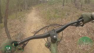
The name Explosions was originally given to the section running down past the quarry. The trail head is situated approximately where Apiary break would intersect the trail if extended. It has been called this for some years until in July 2019 a large section of Never Ending Story was listed on Trailforks as Explosions. Many riders will still consider the quarry part to be Explosions and the lead in track to be Never Ending Story. The original Explosions has been a real buzz to ride with it's switchbacks and small berms. It is characterized with some rooty and rocky roughness that riders in Nerang will be familiar with.

Local Trail Association
Traditionally Indigenous Territory

Recent Activity on Trail

Past Week
  • 3 rides
  • 12 miles average
6 Months
  • 77 rides
  • 12 miles avg distance
All
  • 1,973 rides
  • Last: Jun 12, 2026
c1c2c3c4
January
February
March
April
May
June
July
August
September
October
November
December
Status:
on May 30, 2026
Variable
Avg: 3.99 (7 votes)
Your vote: 0

view (11,171)
close
3D
Trail Conditions
  • Unknown
  • Snow Groomed
  • Snow Packed
  • Snow Covered
  • Snow Cover Partial
  • Freeze/thaw Cycle
  • Icy
  • Prevalent Mud
  • Wet
  • Variable
  • Ideal
  • Dry
  • Very Dry
Trail Flow (Ridden Direction)
Trailforks scans users ridelogs to determine the most popular direction each trail is ridden. A good flowing trail network will have most trails flowing in a single direction according to their intension.
The colour categories are based on what percentage of riders are riding a trail in its intended direction.
  • > 96%
  • > 90%
  • > 80%
  • > 70%
  • > 50%
  • < 50%
  • bi-directional trail
  • no data
Trail Last Ridden
Trailforks scans ridelogs to determine the last time a trail was ridden.
  • < 2 days
  • < 1 week
  • < 2 weeks
  • < 1 month
  • < 6 months
  • > 6 months
Trail Ridden Direction
The intended direction a trail should be ridden.
  • Downhill Only
  • Downhill Primary
  • Both Directions
  • Uphill Primary
  • Uphill Only
  • One Direction
Contribute Details
Colors indicate trail is missing specified detail.
  • Description
  • Photos
  • Description & Photos
  • Videos
Trail Popularity ?
Trailforks scans ridelogs to determine which trails are ridden the most in the last 9 months. Trails are compared with nearby trails in the same city region with a possible 25 colour shades. Think of this as a heatmap, more rides = more kinetic energy = warmer colors.
  • most popular
  • popular
  • less popular
  • not popular
ATV/ORV/OHV Filter
Max Vehicle Width
inches
US Cell Coverage
Legend
cell carrier legend

Radar Time
Activity Recordings
Trailforks uses anonymized public activity data. ?
Activity Recordings
Trailforks uses anonymized public activity data. ?
Personal Heatmap
Activity Types
all / none
Options
2
Date range month
Winter Trails
Warning A routing network for winter maps does not exist. Selecting trails using the winter trails layer has been disabled.
Missing Trails
Most Popular
Least Popular
Trails are colored based on popularity. The more popular a trail is, the more red. Less popular trails trend towards green.
Jump Magnitude Heatmap
Heatmap of where riders jump on trails. Zoom in to see individual jumps, click circles to view jump details.
BC Backroad Status

Service Road Atlas is a free to use, community-driven service for viewing and creating reports on the numerous back-country service roads around B.C. and Alberta.

map legend
Slope Aspect
Direction the slope faces
Flat N NE E SE S SW W NW
Trails Deemphasized
Trails are shown in grey.
disable
Only show trails with no bike usage.
Enable
Suggested Layers
Based on selected activity type

    Save the current map location and zoom level as your default home location whenever this page is loaded.

    Save
        Directions to explosions trailhead (-27.973560, 153.310720)

        Photos

        18 more »
        228 |
        May 17, 2018 @ 5:50pm
        May 17, 2018
        57 |
        May 27, 2020 @ 3:49pm
        May 27, 2020
        72 |
        Feb 16, 2019 @ 5:17pm
        Feb 16, 2019
        68 |
        Feb 16, 2019 @ 5:17pm
        Feb 16, 2019

        Videos

        2 more »
        NERANG | Riding blind TRACK 20: Explosions ????
        4:56 | 519 | Dec 22, 2020 , Gold Coast
        Explosions (Eastbound) - Nerang National Park...
        9:28 | 488 | Aug 10, 2020 , Gold Coast

        Routes with this trail

        4.0 14 miles 1,734 ft 10 Loop
        This particular loop takes you out to the back of Nerang State Forest to the beautiful Lost World single...
        1.0 10 miles 1,302 ft 26 Loop
        Good loop for beginners looking to ride some blue trails as well. A few narrow climbing trails that can be...
        5.0 6 miles 844 ft 14 Out & Back
        Testing out the route planner function

        4 Reviews & Comments


        We hope you've been enjoying Trailforks!

        Create a FREE account to view trail comments and much more.

        • By aaroncobTF Pro & contributors
        • #49823 - 2,909 views

        Frequently Asked Questions About Explosions

        Where is Explosions located?
        Explosions is located in Nerang National Park, Gold Coast, Australia. It is part of the Nerang National Park trail network. The trailhead is located at coordinates -27.97356, 153.31072.
        How hard is Explosions?
        Explosions is rated as Blue difficulty. The physical rating is Moderate. The average grade is 2.4%. The climb difficulty is rated Blue.
        What is the elevation gain for Explosions?
        Explosions has 86 ft of elevation gain. The trail has 291 ft of elevation descent. The elevation ranges from 296 ft to 529 ft.
        Is Explosions a point to point trail?
        Explosions is not a point to point trail. The direction is Both Directions. The trail type is singletrack.

        Hit the Trail

        Open in App

        Get this trail on your phone instantly.
        open trail in app

        Download Trail

        Save to wishlist, Garmin & download.
        save the trail

        Find Related Routes

        Find routes and users activities that include this trail.
        find routes for this trail

        You must enter a description before submitting.