
This trail is permanently closed/decommissioned
more stats
427 ft
Distance
-102 ft
Descent
00:01:06
Avg time
-102 ft
Altitude change
1,253 ft
Altitude min
1,355 ft
Altitude max
1,355 ft
Altitude start
1,253 ft
Altitude end
-23.8%
Grade
-44.4%
Grade max
-4.4%
Grade min
427 ft
Distance down
00:01:06
Avg time

FarnFarm Details

  • Activities
    • Mountain Bike
    • E-Bike
  • Riding Area
  • Difficulty Rating
  • Local Popularity
    45 in Mountain Biking [+]
    • 50 in E-Biking
  • Trail Type
    Singletrack
  • Bike Type
    DH, AM, XC
  • Trail Visibility
    Always easy to follow
  • Family Friendly
    Yes
  • Dogs Allowed
    Yes
  • eBike Allowed
  • TTFs on Trail
    Berm, Other
  • Ride in Rain
    Yes

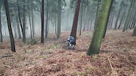
Mit Liebe gefräste Anlieger im weichen nadligen Boden des Dossenheim-Forst

Access Info

Haltet Ausschau nach dem Baum mit den "DO 2" Markierungen, kurz bevor der Forstweg rechts ab zum Hohen Nistler geht.

Tags
BermsFamily friendly

Trail Supporters

  • orampe
    Builder

Recent Activity on Trail

Past Week
  • 0 rides
  •  
6 Months
  • 4 rides
  • 14 miles avg distance
All
  • 23 rides
  • Last: Oct 25, 2026
c1c2c3c4
January
February
March
April
May
June
July
August
September
October
November
December
update trails status or condition

FarnFarm Trail Reports

statusdatedescription
Apr 27, 2026 @ 7:17pm (Europe/Berlin)
Apr 27, 2026
reporter leider nicht mehr zu sehen daher auch nicht mehr fahrbar
Dec 27, 2025 @ 6:41am (Pacific/Midway)
Dec 27, 2025
Dec 26, 2023 @ 9:52am
Dec 26, 2023
reporter Der Winter hat die Farne geschrumpft, so konnte ich die Linie wieder finden. Ich hab den Einstieg mal etwas freigeräumt
Jun 15, 2023 @ 2:29pm
Jun 15, 2023
reporter Uuuund der Einstieg ist wieder komplett unsichtbar
Sep 28, 2022 @ 1:29pm
Sep 28, 2022
reporter Hurra, ich hab den Trail gefunden! ^.^ Die Linie ist etwas zugewachsen und relativ schwer erkennbar, ich hab versucht, ein paar Spuren...
more »
Status:
on Apr 27, 2026
no votes yet
Your vote: 0

view (148)
close
      Directions to farnfarm trailhead (49.446730, 8.695300)

      Photos

      3 more »
      mtb
      162 |
      Feb 2, 2020 @ 9:46am
      Feb 2, 2020
      mtb
      161 |
      Feb 2, 2020 @ 9:46am
      Feb 2, 2020
      mtb
      153 |
      Feb 2, 2020 @ 9:45am
      Feb 2, 2020

      Videos

      1 more »
      FarnFarmTrail
      mtb
      0:13 | 142 | Apr 21, 2020 , Dossenheim

      2 Reviews & Comments


      We hope you've been enjoying Trailforks!

      Create a FREE account to view all trail reviews and much more.

      • By orampe & contributors
      • #250689 - 1,324 views

      Frequently Asked Questions

      ▼ Where is FarnFarm located?
      FarnFarm is located in Dossenheim, Germany. It is part of the Dossenheim trail network. The trailhead is located at coordinates 49.44673, 8.6953.
      ▼ How hard is FarnFarm?
      FarnFarm is rated as Blue difficulty. The average grade is 23.8%.
      ▼ What is the elevation gain for FarnFarm?
      The trail has 102 ft of elevation descent. The elevation ranges from 1,253 ft to 1,355 ft.
      ▼ How long is FarnFarm?
      FarnFarm is 427 ft long. The trail type is singletrack.
      ▼ Are dogs allowed on FarnFarm?
      Yes, dogs are allowed on FarnFarm. Please keep dogs on a leash where required and clean up after them.
      ▼ How do I access FarnFarm? Where is the closest parking trailhead?
      The closest parking and trailhead locations to FarnFarm are: View all parking locations in the area.
      ▼ How long does it take to ride FarnFarm?
      Based on recorded activities, it takes an average of 1 minute to ride FarnFarm. The trail is 427 ft long. Actual times will vary based on fitness level, conditions, and pace. View recent activity logs for more details.
      ▼ How busy is FarnFarm?
      FarnFarm is a moderately popular trail. There have been 160 recorded activities on this trail. The trail has received 148 check-ins. View recent activity on this trail.

      Hit the Trail

      Open in App

      Get this trail on your phone instantly.

      open trail in app

      Download Trail

      Save to wishlist, Garmin & download.
      save the trail

      Find Related Routes

      Find routes and users activities that include this trail.
      find routes for this trail

      You must enter a description before submitting.

