more stats
1.7 miles
Distance
351 ft
Climb
-123 ft
Descent
00:14:02
Avg time
229 ft
Altitude change
529 ft
Altitude min
758 ft
Altitude max
529 ft
Altitude start
758 ft
Altitude end
2.514%
Grade
-14.676%
Grade max
16.196%
Grade min
1 mile
Distance climb
2,031 ft
Distance down
1,570 ft
Distance flat
00:14:02
Avg time

FB (Lower) Details

  • Activities
    • Mountain Bike
    • Hike
    • Trail Running
  • Riding Area
    Keswick
    Redding, California
  • Difficulty Rating
  • Local Popularity
    90 in Mountain Biking [+]
    • 85 in Trail Running
    • 5 in Hiking
  • Global Ranking
    #60645 in Mountain Biking [+]
    • #61389 in Trail Running
    • #131250 in Hiking
  • Trail Type
    Machine Groomed
  • Bike Type
    DH, AM, XC
  • Direction
    Both Directions
  • Climb Difficulty
    Green
  • Physical Rating
    Easy
  • Season
    All seasons
  • Dogs Allowed
    Yes
  • TTFs on Trail
    Bridge
  • Ride in Rain
    Yes

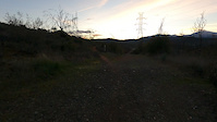
Mellow fun trail that leads from Keswick Dam Blvd down to the Sacramento River Trail. Many other trails can be linked from there.

Access Info

Park in the FB parking lot on Keswick Damn Blvd. Trail starts on the other side of the road from the parking lot.

Trail Supporters
  • BLM
    BLM
    Land Manager
Local Trail Association
Traditionally Indigenous Territory

Recent Activity on Trail

Past Week
  • 3 rides
  • 14 miles average
6 Months
  • 71 rides
  • 17 miles avg distance
All
  • 373 rides
  • Last: Jun 30, 2026
c1c2c3c4
January
February
March
April
May
June
July
August
September
October
November
December
update trails status or condition

FB (Lower) Trail Reports

statusdatedescription
Jul 24, 2025 @ 5:49pm
Jul 24, 2025
Jul 20, 2025 @ 3:01pm
Jul 20, 2025
Jul 8, 2025 @ 7:00pm
Jul 8, 2025
Trail in great condition, tall grasses must have been recently cut. Very dry and loose rocks all along trial. Lots of fun as always.
Aug 15, 2024 @ 4:09pm
Aug 15, 2024
Wide open - no issues. Just dry and a little loose here and there.
Jun 7, 2024 @ 1:21am
Jun 7, 2024
more »
Status:
on Jul 24, 2025
Very Dry
Avg: 4.21 (3 votes)
Your vote: 0

view (3,951)
close
3D
Trail Conditions
  • Unknown
  • Snow Groomed
  • Snow Packed
  • Snow Covered
  • Snow Cover Partial
  • Freeze/thaw Cycle
  • Icy
  • Prevalent Mud
  • Wet
  • Variable
  • Ideal
  • Dry
  • Very Dry
Trail Flow (Ridden Direction)
Trailforks scans users ridelogs to determine the most popular direction each trail is ridden. A good flowing trail network will have most trails flowing in a single direction according to their intension.
The colour categories are based on what percentage of riders are riding a trail in its intended direction.
  • > 96%
  • > 90%
  • > 80%
  • > 70%
  • > 50%
  • < 50%
  • bi-directional trail
  • no data
Trail Last Ridden
Trailforks scans ridelogs to determine the last time a trail was ridden.
  • < 2 days
  • < 1 week
  • < 2 weeks
  • < 1 month
  • < 6 months
  • > 6 months
Trail Ridden Direction
The intended direction a trail should be ridden.
  • Downhill Only
  • Downhill Primary
  • Both Directions
  • Uphill Primary
  • Uphill Only
  • One Direction
Contribute Details
Colors indicate trail is missing specified detail.
  • Description
  • Photos
  • Description & Photos
  • Videos
Trail Popularity ?
Trailforks scans ridelogs to determine which trails are ridden the most in the last 9 months. Trails are compared with nearby trails in the same city region with a possible 25 colour shades. Think of this as a heatmap, more rides = more kinetic energy = warmer colors.
  • most popular
  • popular
  • less popular
  • not popular
ATV/ORV/OHV Filter
Max Vehicle Width
inches
US Cell Coverage
Legend
cell carrier legend

Radar Time
Activity Recordings
Trailforks uses anonymized public activity data. ?
Activity Recordings
Trailforks uses anonymized public activity data. ?
Personal Heatmap
Activity Types
all / none
Options
2
Date range month
Winter Trails
Warning A routing network for winter maps does not exist. Selecting trails using the winter trails layer has been disabled.
Missing Trails
Most Popular
Least Popular
Trails are colored based on popularity. The more popular a trail is, the more red. Less popular trails trend towards green.
Jump Magnitude Heatmap
Heatmap of where riders jump on trails. Zoom in to see individual jumps, click circles to view jump details.
BC Backroad Status

Service Road Atlas is a free to use, community-driven service for viewing and creating reports on the numerous back-country service roads around B.C. and Alberta.

map legend
Slope Aspect
Direction the slope faces
Flat N NE E SE S SW W NW
Trails Deemphasized
Trails are shown in grey.
disable
Only show trails with no bike usage.
Enable
Suggested Layers
Based on selected activity type

    Save the current map location and zoom level as your default home location whenever this page is loaded.

    Save
        Directions to fb-lower trailhead (40.601730, -122.442980)

        Photos

        8 more »
        87 |
        May 11, 2019 @ 9:10pm
        May 11, 2019
        74 |
        May 11, 2019 @ 9:10pm
        May 11, 2019
        87 |
        May 11, 2019 @ 9:10pm
        May 11, 2019
        71 |
        May 11, 2019 @ 9:10pm
        May 11, 2019

        Videos

        2 more »
        FB Lower MTB Redding California
        9:51 | 115 | Oct 29, 2024 , Redding
        Lower FB to Suspension Bridge
        6:05 | 13 | Jan 7, 2024 , Redding

        Routes with this trail

        4.0 7 miles 637 ft 2 Out & Back
        This Bigfoot Adventure Challenge Route includes some fun paved and dirt trails along the Sacramento River...
        18 miles 924 ft 4 Loop
        This Bigfoot urban gravel is designed to explore North Redding on your drop bar gravel bike with a...
        15 miles 1,363 ft 7 Loop
        This route is the classic rugged French Fry trail along with some other fun regional trails in the...

        2 Reviews & Comments


        We hope you've been enjoying Trailforks!

        Create a FREE account to view trail comments and much more.

        • By cannonballTF Pro RR & contributors
        • #47823 - 2,130 views

        Frequently Asked Questions About FB (Lower)

        Where is FB (Lower) located?
        FB (Lower) is located in Keswick, Redding, California, United States. It is part of the Keswick trail network. The trailhead is located at coordinates 40.60173, -122.44298.
        How hard is FB (Lower)?
        FB (Lower) is rated as Green difficulty. The physical rating is Easy. The average grade is 2.514%. The climb difficulty is rated Green.
        What is the elevation gain for FB (Lower)?
        FB (Lower) has 351 ft of elevation gain. The trail has 123 ft of elevation descent. The elevation ranges from 529 ft to 758 ft.
        Is FB (Lower) a point to point trail?
        FB (Lower) is not a point to point trail. The direction is Both Directions. The trail type is machine groomed.

        Hit the Trail

        Open in App

        Get this trail on your phone instantly.
        open trail in app

        Download Trail

        Save to wishlist, Garmin & download.
        save the trail

        Find Related Routes

        Find routes and users activities that include this trail.
        find routes for this trail

        You must enter a description before submitting.